![](/images/other/stat-length.png)
![Randonnée Marche Mirmande - Balcon-du-Rhône 11km. - Photo](https://media.geolcdn.com/t/1900/400/ext.pjpeg?maxdim=2&url=https%3A%2F%2Fmedia.geolcdn.com%2Ff%2F65f7d0c4-9656-42ca-beca-cf82cff2d6f9.jpg)
Balcon-du-Rhône 11km.
chancha
Utilisateur
![Longueur](/images/other/stat-length.png)
Longueur
11,3 km
![Altitude max](https://static1.geolcdn.com/siteimages/upload/files/1508320355ic_sort_altitude_max_24dp.png)
Altitude max
452 m
![Dénivelé positif](https://static1.geolcdn.com/siteimages/upload/files/1508320355ic_sort_den_pos_24dp.png)
Dénivelé positif
371 m
![Km-Effort](/images/other/stat-length.png)
Km-Effort
16,3 km
![Altitude min](https://static1.geolcdn.com/siteimages/upload/files/1508320355ic_sort_altitude_min_24dp.png)
Altitude min
172 m
![Dénivelé négatif](https://static1.geolcdn.com/siteimages/upload/files/1508320355ic_sort_den_neg_24dp.png)
Dénivelé négatif
371 m
![Boucle](https://static1.geolcdn.com/siteimages/upload/files/16400158638029165_repeat_loop_refresh_sync_direction_icon.png)
Boucle
Oui
Date de création :
2023-09-29 05:20:46.6
Dernière modification :
2023-10-17 10:53:10.19
![Marche](https://static1.geolcdn.com/sitytour/trail-icons/101.png)
3h41
Difficulté : Difficile
![Scannez ce code QR pour ouvrir la randonnée dans l'application SityTrail](https://capi.geolives.com/qq0zvz2zws4bq2lad0pu/sitytour/trails/3822097/qr.png?size=200)
Application GPS de randonnée GRATUITE
À propos
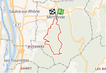
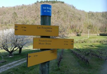
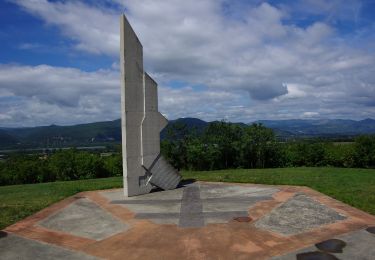
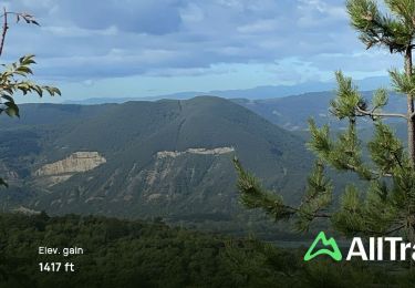
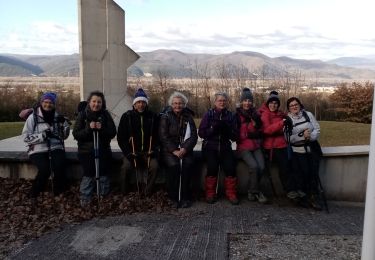
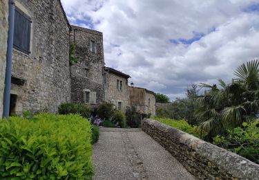
Randonnée Marche de 11,3 km à découvrir à Auvergne-Rhône-Alpes, Drôme, Mirmande. Cette randonnée est proposée par chancha.
Description
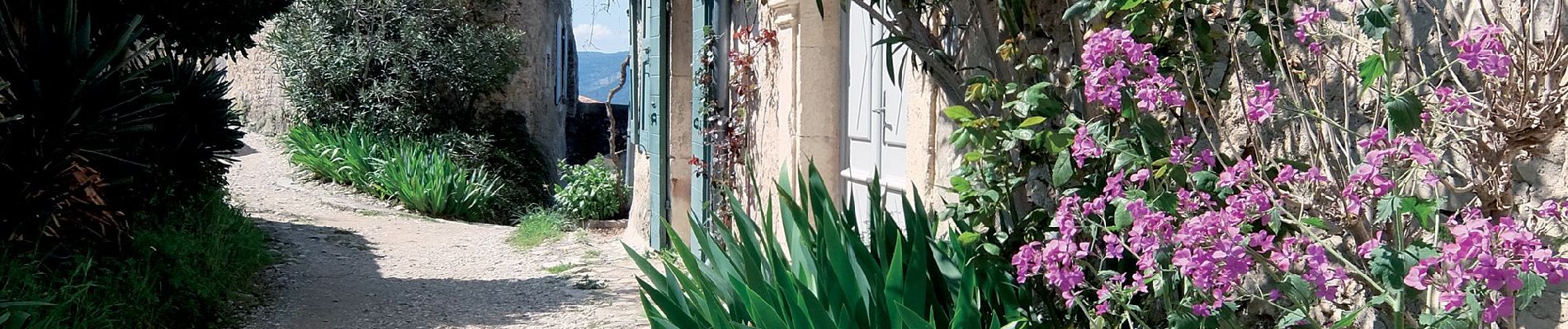
De Mirmande, classé parmi « Les Plus Beaux Villages de France® », parcourez les crêtes pour jouir du panorama sur la vallée du Rhône. En revenant, perdez-vous dans le labyrinthe des ruelles du village.
Localisation
Pays :
France
Région :
Auvergne-Rhône-Alpes
Département/Province :
Drôme
Commune :
Mirmande
Localité :
Unknown
Départ:(Dec)
Départ:(UTM)
645533 ; 4950959 (31T) N.
Commentaires
Randonnées à proximité
![Randonnée Moteur Saulce-sur-Rhône - sortie 4x4 - Photo](https://media.geolcdn.com/t/375/260/ext.jpg?maxdim=2&url=https%3A%2F%2Fstatic1.geolcdn.com%2Fsiteimages%2Fupload%2Ffiles%2F15247431544x4.jpg)
![Moteur Moteur](https://static1.geolcdn.com/sitytour/trail-icons/400.png)
sortie 4x4
Moteur
Difficile
(1)
Saulce-sur-Rhône,
Auvergne-Rhône-Alpes,
Drôme,
France
![](/images/other/stat-length.png)
94 km | 136 km-effort
10h 48min
![](https://static1.geolcdn.com/siteimages/upload/files/16400158638029165_repeat_loop_refresh_sync_direction_icon.png)
Non
![Randonnée Marche Mirmande - Mirmande - Photo](https://media.geolcdn.com/t/375/260/ext.jpg?maxdim=2&url=https%3A%2F%2Fstatic1.geolcdn.com%2Fsiteimages%2Fupload%2Ffiles%2F1553511878bg_sport_marche.png)
![Marche Marche](https://static1.geolcdn.com/sitytour/trail-icons/101.png)
Mirmande
Marche
Moyen
(3)
Mirmande,
Auvergne-Rhône-Alpes,
Drôme,
France
![](/images/other/stat-length.png)
5,7 km | 9 km-effort
2h 5min
![](https://static1.geolcdn.com/siteimages/upload/files/16400158638029165_repeat_loop_refresh_sync_direction_icon.png)
Oui
![Randonnée Marche Mirmande - Mirmande - Photo](https://media.geolcdn.com/t/375/260/ext.jpg?maxdim=2&url=https%3A%2F%2Fmedia.geolcdn.com%2Ff%2F2da286aa-7aa8-4366-a5c0-6dbf062bb022.jpg)
![Marche Marche](https://static1.geolcdn.com/sitytour/trail-icons/101.png)
Mirmande
Marche
Très difficile
Mirmande,
Auvergne-Rhône-Alpes,
Drôme,
France
![](/images/other/stat-length.png)
14,7 km | 23 km-effort
4h 19min
![](https://static1.geolcdn.com/siteimages/upload/files/16400158638029165_repeat_loop_refresh_sync_direction_icon.png)
Oui
![Randonnée Marche Grane - De Val Brian au Mont Brian - Photo](https://media.geolcdn.com/t/375/260/ext.jpg?maxdim=2&url=https%3A%2F%2Fmedia.geolcdn.com%2Ff%2Fbc6d4726-3ae6-481c-b979-5b3a43f540de.jpg)
![Marche Marche](https://static1.geolcdn.com/sitytour/trail-icons/101.png)
De Val Brian au Mont Brian
Marche
Très facile
(1)
Grane,
Auvergne-Rhône-Alpes,
Drôme,
France
![](/images/other/stat-length.png)
4,8 km | 8,5 km-effort
1h 30min
![](https://static1.geolcdn.com/siteimages/upload/files/16400158638029165_repeat_loop_refresh_sync_direction_icon.png)
Oui
![Randonnée Marche Grane - De Val Brian au lac sans nom - Photo](https://media.geolcdn.com/t/375/260/ext.jpg?maxdim=2&url=https%3A%2F%2Fmedia.geolcdn.com%2Ff%2F0dfbfd01-b6ba-4eaf-a75e-fcb6bdc5753b.jpg)
![Marche Marche](https://static1.geolcdn.com/sitytour/trail-icons/101.png)
De Val Brian au lac sans nom
Marche
Très facile
Grane,
Auvergne-Rhône-Alpes,
Drôme,
France
![](/images/other/stat-length.png)
3,9 km | 5 km-effort
1h 40min
![](https://static1.geolcdn.com/siteimages/upload/files/16400158638029165_repeat_loop_refresh_sync_direction_icon.png)
Non
![Randonnée Marche Mirmande - Mirmande : Mémorial de la Résistance 13km. - Photo](https://media.geolcdn.com/t/375/260/ext.jpg?maxdim=2&url=https%3A%2F%2Fmedia.geolcdn.com%2Ff%2F30bc2663-e937-4dc3-9bf9-1dcf49bb7696.JPG)
![Marche Marche](https://static1.geolcdn.com/sitytour/trail-icons/101.png)
Mirmande : Mémorial de la Résistance 13km.
Marche
Moyen
Mirmande,
Auvergne-Rhône-Alpes,
Drôme,
France
![](/images/other/stat-length.png)
14,7 km | 21 km-effort
6h 6min
![](https://static1.geolcdn.com/siteimages/upload/files/16400158638029165_repeat_loop_refresh_sync_direction_icon.png)
Oui
![Randonnée Marche Mirmande - Mirmande Col de Papillère 13km - Photo](https://media.geolcdn.com/t/375/260/ext.jpg?maxdim=2&url=https%3A%2F%2Fmedia.geolcdn.com%2Ff%2F56340d2d-44de-4320-aa32-88b357fb905b.jpg)
![Marche Marche](https://static1.geolcdn.com/sitytour/trail-icons/101.png)
Mirmande Col de Papillère 13km
Marche
Moyen
Mirmande,
Auvergne-Rhône-Alpes,
Drôme,
France
![](/images/other/stat-length.png)
12,9 km | 19,5 km-effort
6h 45min
![](https://static1.geolcdn.com/siteimages/upload/files/16400158638029165_repeat_loop_refresh_sync_direction_icon.png)
Oui
![Randonnée Marche Mirmande - Les Balcons du Rhône - Photo](https://media.geolcdn.com/t/375/260/ext.jpg?maxdim=2&url=https%3A%2F%2Fmedia.geolcdn.com%2Ff%2F9e184bce-e66f-4b87-996c-eb61a578f9c2.jpg)
![Marche Marche](https://static1.geolcdn.com/sitytour/trail-icons/101.png)
Les Balcons du Rhône
Marche
Moyen
(1)
Mirmande,
Auvergne-Rhône-Alpes,
Drôme,
France
![](/images/other/stat-length.png)
15,9 km | 22 km-effort
4h 39min
![](https://static1.geolcdn.com/siteimages/upload/files/16400158638029165_repeat_loop_refresh_sync_direction_icon.png)
Oui
![Randonnée Marche Mirmande - mirmande - Photo](https://media.geolcdn.com/t/375/260/ext.jpg?maxdim=2&url=https%3A%2F%2Fmedia.geolcdn.com%2Ff%2F476fb7d6-eaba-49e3-bed5-0f9144b1e5ee.jpg)
![Marche Marche](https://static1.geolcdn.com/sitytour/trail-icons/101.png)
mirmande
Marche
Facile
Mirmande,
Auvergne-Rhône-Alpes,
Drôme,
France
![](/images/other/stat-length.png)
2 km | 2,9 km-effort
1h 4min
![](https://static1.geolcdn.com/siteimages/upload/files/16400158638029165_repeat_loop_refresh_sync_direction_icon.png)
Oui