4,4 km | 5,9 km-effort
SityTrail - 3277726 - rebouc-les-landes-de-rebouc-x-g3-x--3277726
JACQUESD
Utilisateur
Longueur
8,5 km
Altitude max
980 m
Dénivelé positif
417 m
Km-Effort
14,1 km
Altitude min
589 m
Dénivelé négatif
417 m
Boucle
Oui
Date de création :
2023-09-28 14:22:11.668
Dernière modification :
2023-09-28 14:22:11.668
3h12
Difficulté : Difficile
Application GPS de randonnée GRATUITE
À propos
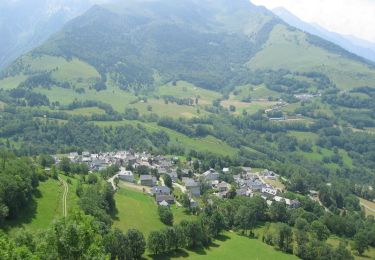
Randonnée Marche de 8,5 km à découvrir à Occitanie, Hautes-Pyrénées, Hèches. Cette randonnée est proposée par JACQUESD.
Description
Sortie commune du 17 juin 2022
Points d'intérêt
Localisation
Pays :
France
Région :
Occitanie
Département/Province :
Hautes-Pyrénées
Commune :
Hèches
Localité :
Unknown
Départ:(Dec)
Départ:(UTM)
286308 ; 4764235 (31T) N.
Commentaires
Randonnées à proximité
FEU 2015 - Etape 3
Marche
Facile
(3)
Esparros,
Occitanie,
Hautes-Pyrénées,
France
23 km | 32 km-effort
6h 45min
Non
FEU 2015 - Etape 2
Marche
Facile
(1)
Lortet,
Occitanie,
Hautes-Pyrénées,
France
7,8 km | 12,5 km-effort
2h 34min
Non
Pacte des loups
Marche
Moyen
(2)
Esparros,
Occitanie,
Hautes-Pyrénées,
France
10,9 km | 18 km-effort
Inconnu
Oui
REBOUC sortie commune LPC trace revue et corrigée "3822705"
Marche
Moyen
Hèches,
Occitanie,
Hautes-Pyrénées,
France
6,1 km | 8,5 km-effort
1h 55min
Oui
plo de Berdaoulou
Marche
Moyen
Sarrancolin,
Occitanie,
Hautes-Pyrénées,
France
12,9 km | 26 km-effort
7h 12min
Oui
Voie d'Aure
A pied
Très difficile
Lortet,
Occitanie,
Hautes-Pyrénées,
France
56 km | 87 km-effort
19h 50min
Non
Pacte des loups
Marche
Moyen
Esparros,
Occitanie,
Hautes-Pyrénées,
France
7,8 km | 13,3 km-effort
5h 27min
Oui
Le col d'Azet en VTT
V.T.T.
Très difficile
Sarrancolin,
Occitanie,
Hautes-Pyrénées,
France
28 km | 43 km-effort
2h 30min
Non