![](/images/other/stat-length.png)
![Randonnée Marche Clohars-Carnoët - Doëlan - Photo](https://media.geolcdn.com/t/1900/400/044e8edc-5004-4749-bd59-d33fd778f2e3.jpg&format=pjpeg&maxdim=2)
Doëlan
norbertdenise
Utilisateur
![Longueur](/images/other/stat-length.png)
Longueur
6,7 km
![Altitude max](https://static1.geolcdn.com/siteimages/upload/files/1508320355ic_sort_altitude_max_24dp.png)
Altitude max
34 m
![Dénivelé positif](https://static1.geolcdn.com/siteimages/upload/files/1508320355ic_sort_den_pos_24dp.png)
Dénivelé positif
76 m
![Km-Effort](/images/other/stat-length.png)
Km-Effort
7,7 km
![Altitude min](https://static1.geolcdn.com/siteimages/upload/files/1508320355ic_sort_altitude_min_24dp.png)
Altitude min
1 m
![Dénivelé négatif](https://static1.geolcdn.com/siteimages/upload/files/1508320355ic_sort_den_neg_24dp.png)
Dénivelé négatif
73 m
![Boucle](https://static1.geolcdn.com/siteimages/upload/files/16400158638029165_repeat_loop_refresh_sync_direction_icon.png)
Boucle
Oui
Date de création :
2023-09-27 13:08:21.291
Dernière modification :
2023-09-27 20:21:43.073
![Marche](https://static1.geolcdn.com/sitytour/trail-icons/101.png)
1h44
Difficulté : Moyen
![Scannez ce code QR pour ouvrir la randonnée dans l'application SityTrail](https://capi.geolives.com/qq0zvz2zws4bq2lad0pu/sitytour/trails/3820523/qr.png?size=200)
Application GPS de randonnée GRATUITE
À propos
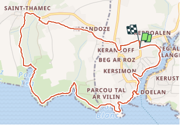
Randonnée Marche de 6,7 km à découvrir à Bretagne, Finistère, Clohars-Carnoët. Cette randonnée est proposée par norbertdenise.
Description
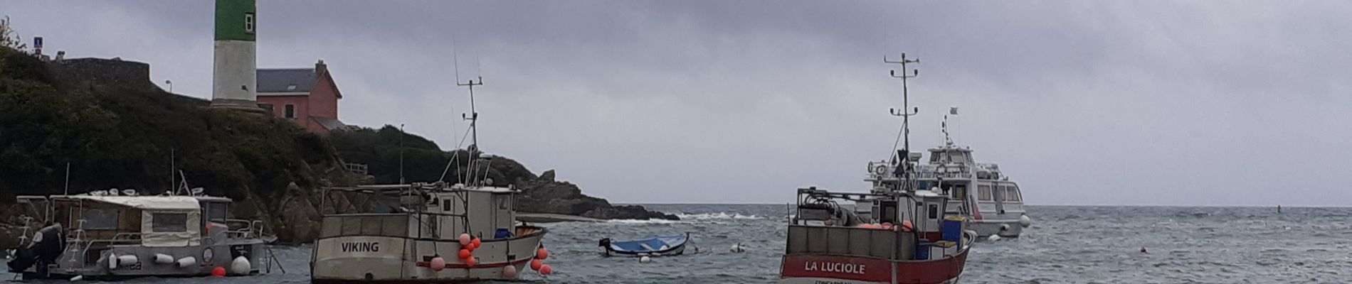
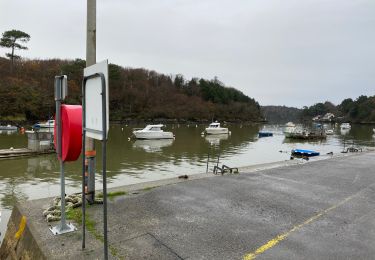
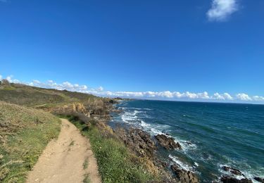
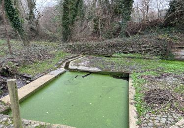
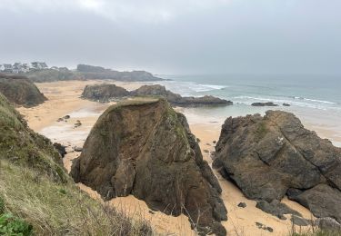
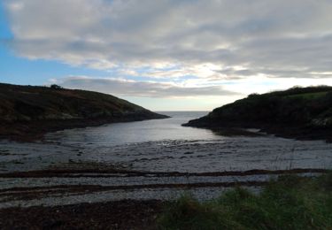
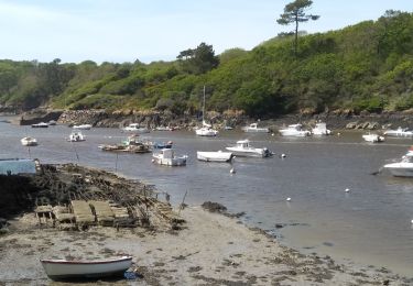
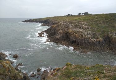
Ballade le long de l'anse de Doëlan où se trouve le port et le long de la côte avec retour par les terres jusqu'à la chapelle de Kerdoalen
Localisation
Pays :
France
Région :
Bretagne
Département/Province :
Finistère
Commune :
Clohars-Carnoët
Localité :
Unknown
Départ:(Dec)
Départ:(UTM)
454350 ; 5291661 (30T) N.
Commentaires
Randonnées à proximité
![Randonnée Marche Moëlan-sur-Mer - Merrien Doelan cote 11,5 km - Photo](https://media.geolcdn.com/t/375/260/599544b5-7665-42c5-9bba-b91c68249624.jpg&format=jpg&maxdim=2)
![Marche Marche](https://static1.geolcdn.com/sitytour/trail-icons/101.png)
Merrien Doelan cote 11,5 km
Marche
Moyen
Moëlan-sur-Mer,
Bretagne,
Finistère,
France
![](/images/other/stat-length.png)
12 km | 13,7 km-effort
3h 41min
![](https://static1.geolcdn.com/siteimages/upload/files/16400158638029165_repeat_loop_refresh_sync_direction_icon.png)
Non
![Randonnée Marche Clohars-Carnoët - Le Pouldu - Photo](https://media.geolcdn.com/t/375/260/1a38db66-97d5-4b5b-9eac-2a7eff6538ed.jpg&format=jpg&maxdim=2)
![Marche Marche](https://static1.geolcdn.com/sitytour/trail-icons/101.png)
![Randonnée Marche Clohars-Carnoët - Pouldu port peintres 6,3 km - Photo](https://media.geolcdn.com/t/375/260/d878685e-3577-4835-a424-00b6066e1383.jpg&format=jpg&maxdim=2)
![Marche Marche](https://static1.geolcdn.com/sitytour/trail-icons/101.png)
Pouldu port peintres 6,3 km
Marche
Facile
Clohars-Carnoët,
Bretagne,
Finistère,
France
![](/images/other/stat-length.png)
6,3 km | 7,2 km-effort
2h 12min
![](https://static1.geolcdn.com/siteimages/upload/files/16400158638029165_repeat_loop_refresh_sync_direction_icon.png)
Oui
![Randonnée Marche Clohars-Carnoët - Pouldu Roche Percée et retour 9,5 km - Photo](https://media.geolcdn.com/t/375/260/9c185896-328f-4e1d-8063-56e555ea4d34.jpg&format=jpg&maxdim=2)
![Marche Marche](https://static1.geolcdn.com/sitytour/trail-icons/101.png)
Pouldu Roche Percée et retour 9,5 km
Marche
Moyen
Clohars-Carnoët,
Bretagne,
Finistère,
France
![](/images/other/stat-length.png)
9,5 km | 10,7 km-effort
2h 46min
![](https://static1.geolcdn.com/siteimages/upload/files/16400158638029165_repeat_loop_refresh_sync_direction_icon.png)
Oui
![Randonnée Marche Moëlan-sur-Mer - routoirs à lin de Pouldouran - Photo](https://media.geolcdn.com/t/375/260/3361eba2-e966-4e2b-bed4-315e6af4295a.jpg&format=jpg&maxdim=2)
![Marche Marche](https://static1.geolcdn.com/sitytour/trail-icons/101.png)
routoirs à lin de Pouldouran
Marche
Facile
Moëlan-sur-Mer,
Bretagne,
Finistère,
France
![](/images/other/stat-length.png)
126 km | 155 km-effort
3h 11min
![](https://static1.geolcdn.com/siteimages/upload/files/16400158638029165_repeat_loop_refresh_sync_direction_icon.png)
Non
![Randonnée Marche Moëlan-sur-Mer - MOELAN Sur MER - Photo](https://media.geolcdn.com/t/375/260/9f5d6a9f-89a4-4a35-9d4e-86b22f763fe6.jpg&format=jpg&maxdim=2)
![Marche Marche](https://static1.geolcdn.com/sitytour/trail-icons/101.png)
MOELAN Sur MER
Marche
Moyen
Moëlan-sur-Mer,
Bretagne,
Finistère,
France
![](/images/other/stat-length.png)
10,2 km | 11,8 km-effort
3h 22min
![](https://static1.geolcdn.com/siteimages/upload/files/16400158638029165_repeat_loop_refresh_sync_direction_icon.png)
Oui
![Randonnée Marche Moëlan-sur-Mer - MOËLAN SUR MER - Photo](https://media.geolcdn.com/t/375/260/c89b66af-d30f-4599-933a-95fcfe3459c4.jpg&format=jpg&maxdim=2)
![Marche Marche](https://static1.geolcdn.com/sitytour/trail-icons/101.png)
MOËLAN SUR MER
Marche
Moyen
Moëlan-sur-Mer,
Bretagne,
Finistère,
France
![](/images/other/stat-length.png)
9,7 km | 10,9 km-effort
2h 45min
![](https://static1.geolcdn.com/siteimages/upload/files/16400158638029165_repeat_loop_refresh_sync_direction_icon.png)
Oui
![Randonnée Marche Clohars-Carnoët - CLOHARS CARNOËT - Photo](https://media.geolcdn.com/t/375/260/47e82c60-5d8a-4e58-8e2f-70522285a529.jpg&format=jpg&maxdim=2)
![Marche Marche](https://static1.geolcdn.com/sitytour/trail-icons/101.png)
CLOHARS CARNOËT
Marche
Facile
Clohars-Carnoët,
Bretagne,
Finistère,
France
![](/images/other/stat-length.png)
9,7 km | 11 km-effort
2h 27min
![](https://static1.geolcdn.com/siteimages/upload/files/16400158638029165_repeat_loop_refresh_sync_direction_icon.png)
Oui
![Randonnée Marche Clohars-Carnoët - GR 34 - Photo](https://media.geolcdn.com/t/375/260/ext.jpg?maxdim=2&url=https%3A%2F%2Fservices.sitytrail.com%2FGeolivesWS%2FDownloadMedia.ashx%3FTrailID%3D1128587%26Media%3Dfix__20190330123705.jpg)
![Marche Marche](https://static1.geolcdn.com/sitytour/trail-icons/101.png)
GR 34
Marche
Moyen
Clohars-Carnoët,
Bretagne,
Finistère,
France
![](/images/other/stat-length.png)
11,8 km | 13,4 km-effort
4h 39min
![](https://static1.geolcdn.com/siteimages/upload/files/16400158638029165_repeat_loop_refresh_sync_direction_icon.png)
Oui