![](/images/other/stat-length.png)
![Randonnée Marche Saint-Dié-des-Vosges - Massif de l'Ormont et ses rochers remarquables - Photo](https://media.geolcdn.com/t/1900/400/5bfc527b-060c-4d01-aae8-b360a5c8e4f1.jpg&format=pjpeg&maxdim=2)
Massif de l'Ormont et ses rochers remarquables
Bart2015
Utilisateur
![Longueur](/images/other/stat-length.png)
![Altitude max](https://static1.geolcdn.com/siteimages/upload/files/1508320355ic_sort_altitude_max_24dp.png)
![Dénivelé positif](https://static1.geolcdn.com/siteimages/upload/files/1508320355ic_sort_den_pos_24dp.png)
![Km-Effort](/images/other/stat-length.png)
![Altitude min](https://static1.geolcdn.com/siteimages/upload/files/1508320355ic_sort_altitude_min_24dp.png)
![Dénivelé négatif](https://static1.geolcdn.com/siteimages/upload/files/1508320355ic_sort_den_neg_24dp.png)
![Boucle](https://static1.geolcdn.com/siteimages/upload/files/16400158638029165_repeat_loop_refresh_sync_direction_icon.png)
![Marche](https://static1.geolcdn.com/sitytour/trail-icons/101.png)
5h38
Difficulté : Très difficile
![Scannez ce code QR pour ouvrir la randonnée dans l'application SityTrail](https://capi.geolives.com/qq0zvz2zws4bq2lad0pu/sitytour/trails/3809543/qr.png?size=200)
Application GPS de randonnée GRATUITE
À propos
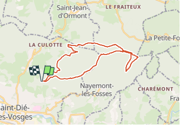
Randonnée Marche de 15,9 km à découvrir à Grand Est, Vosges, Saint-Dié-des-Vosges. Cette randonnée est proposée par Bart2015.
Description
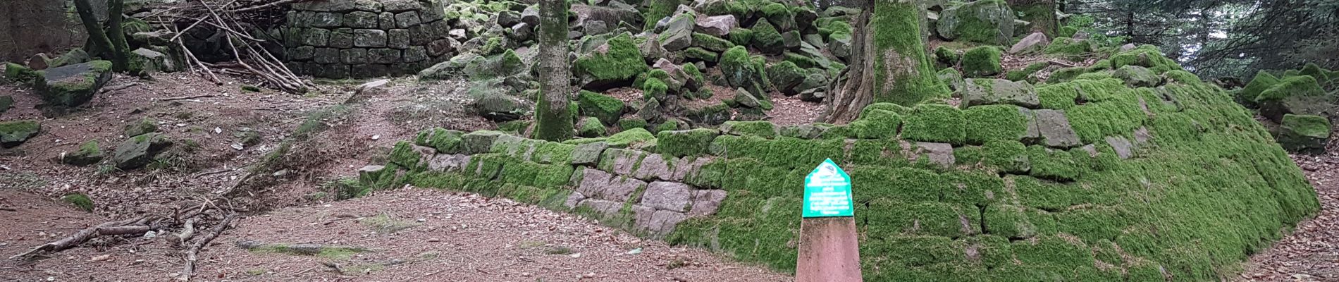
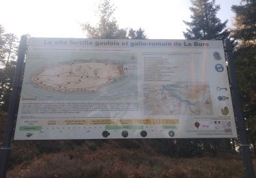
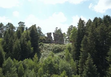
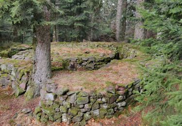
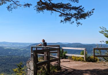
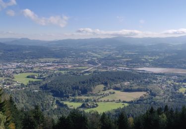
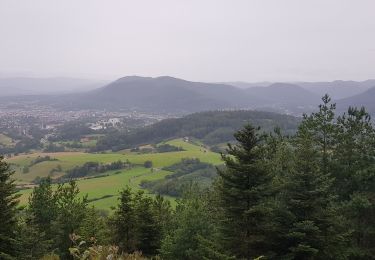
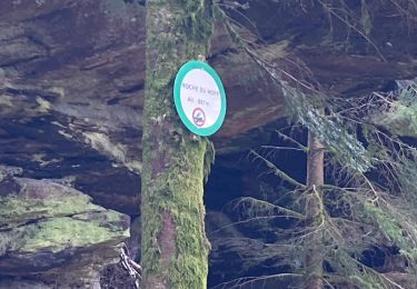
Cette belle randonnée vous emmène sur les hauteurs de St Dié-des-Vosges au travers de rochers remarquables qui vous accompagne sur les crètes. Certains sont équipés d'échelle d'escalade qui vous permettront de découvrir des panoramas magnifiques sur la région alentour. Cette montagne gréseuse et mystérieuse regorge d’histoires fantastiques de fée, de géant, de sorcière, etc. Elle était également un point d’observation privilégié durant la Grande Guerre, les nombreux vestiges surprenants en témoignent ...
Bonne rando ...
NB : elle peut être raccourcie en empruntant le sentier menant à la cascade des Molière au niveau de la Roche du Sapin Sec ...
Localisation
Commentaires
Randonnées à proximité
![Randonnée V.T.T. Saint-Dié-des-Vosges - vtt la voivre La Bure 29-03-19 - Photo](https://media.geolcdn.com/t/375/260/651ec868-e046-448c-a37f-e725fa61f50d.jpg&format=jpg&maxdim=2)
![V.T.T. V.T.T.](https://static1.geolcdn.com/sitytour/trail-icons/202.png)
V.T.T.
![](/images/other/stat-length.png)
![](https://static1.geolcdn.com/siteimages/upload/files/16400158638029165_repeat_loop_refresh_sync_direction_icon.png)
![Randonnée A pied Taintrux - GR de Pays de Déodatie - Photo](https://media.geolcdn.com/t/375/260/8c9d86c2-6a8a-421f-b627-7552051e9313.jpeg&format=jpg&maxdim=2)
![A pied A pied](https://static1.geolcdn.com/sitytour/trail-icons/100.png)
A pied
![](/images/other/stat-length.png)
![](https://static1.geolcdn.com/siteimages/upload/files/16400158638029165_repeat_loop_refresh_sync_direction_icon.png)
![Randonnée Marche Saint-Dié-des-Vosges - 2019-03-07 Marche Montée des Schlitteurs - Photo](https://media.geolcdn.com/t/375/260/b6c7faad-e93b-4a65-8c3b-cd428aea5e79.jpg&format=jpg&maxdim=2)
![Marche Marche](https://static1.geolcdn.com/sitytour/trail-icons/101.png)
Marche
![](/images/other/stat-length.png)
![](https://static1.geolcdn.com/siteimages/upload/files/16400158638029165_repeat_loop_refresh_sync_direction_icon.png)
![Randonnée Marche Taintrux - 2024-05-10 Marche Taintrux - Photo](https://media.geolcdn.com/t/375/260/9fe93acc-f8ea-40c3-b435-6f108f3a2d6d.jpg&format=jpg&maxdim=2)
![Marche Marche](https://static1.geolcdn.com/sitytour/trail-icons/101.png)
Marche
![](/images/other/stat-length.png)
![](https://static1.geolcdn.com/siteimages/upload/files/16400158638029165_repeat_loop_refresh_sync_direction_icon.png)
![Randonnée Marche Saint-Dié-des-Vosges - 2021-10-08 Marche St Die Metzeral Jour 1 - Photo](https://media.geolcdn.com/t/375/260/e22b097e-6393-4be9-8a81-a85993f41b61.jpg&format=jpg&maxdim=2)
![Marche Marche](https://static1.geolcdn.com/sitytour/trail-icons/101.png)
Marche
![](/images/other/stat-length.png)
![](https://static1.geolcdn.com/siteimages/upload/files/16400158638029165_repeat_loop_refresh_sync_direction_icon.png)
![Randonnée Marche Saint-Dié-des-Vosges - Balade autour du Col de la Crenée - Photo](https://media.geolcdn.com/t/375/260/b78964f0-a68e-41e2-996e-5f3508692050.jpg&format=jpg&maxdim=2)
![Marche Marche](https://static1.geolcdn.com/sitytour/trail-icons/101.png)
Marche
![](/images/other/stat-length.png)
![](https://static1.geolcdn.com/siteimages/upload/files/16400158638029165_repeat_loop_refresh_sync_direction_icon.png)
![Randonnée Marche Saint-Dié-des-Vosges - Marche 15km Ormont 07-05-21 - Photo](https://media.geolcdn.com/t/375/260/11be56d0-7566-44e9-9c14-ad469692e3f9.jpg&format=jpg&maxdim=2)
![Marche Marche](https://static1.geolcdn.com/sitytour/trail-icons/101.png)
Marche
![](/images/other/stat-length.png)
![](https://static1.geolcdn.com/siteimages/upload/files/16400158638029165_repeat_loop_refresh_sync_direction_icon.png)
![Randonnée Randonnée équestre Ban-de-Sapt - Boucle BanDeSapt Quatre Bornes - Photo](https://media.geolcdn.com/t/375/260/8c19486b-fba8-4f43-93ee-4c2f1ded8b88.jpg&format=jpg&maxdim=2)
![Randonnée équestre Randonnée équestre](https://static1.geolcdn.com/sitytour/trail-icons/301.png)
Randonnée équestre
![](/images/other/stat-length.png)
![](https://static1.geolcdn.com/siteimages/upload/files/16400158638029165_repeat_loop_refresh_sync_direction_icon.png)
![Randonnée Marche Saint-Dié-des-Vosges - ormont - Photo](https://media.geolcdn.com/t/375/260/ext.jpg?maxdim=2&url=https%3A%2F%2Fstatic1.geolcdn.com%2Fsiteimages%2Fupload%2Ffiles%2F1553511878bg_sport_marche.png)
![Marche Marche](https://static1.geolcdn.com/sitytour/trail-icons/101.png)
Marche
![](/images/other/stat-length.png)
![](https://static1.geolcdn.com/siteimages/upload/files/16400158638029165_repeat_loop_refresh_sync_direction_icon.png)