![](/images/other/stat-length.png)
![Randonnée Marche Baztan - De Gorramendi à Akomendi et Irubel kaskoaa - Photo](https://media.geolcdn.com/t/1900/400/ext.pjpeg?maxdim=2&url=https%3A%2F%2Fstatic1.geolcdn.com%2Fsiteimages%2Fupload%2Ffiles%2F1553511878bg_sport_marche.png)
De Gorramendi à Akomendi et Irubel kaskoaa
DECHAMPD
Utilisateur
![Longueur](/images/other/stat-length.png)
Longueur
13,9 km
![Altitude max](https://static1.geolcdn.com/siteimages/upload/files/1508320355ic_sort_altitude_max_24dp.png)
Altitude max
1083 m
![Dénivelé positif](https://static1.geolcdn.com/siteimages/upload/files/1508320355ic_sort_den_pos_24dp.png)
Dénivelé positif
807 m
![Km-Effort](/images/other/stat-length.png)
Km-Effort
25 km
![Altitude min](https://static1.geolcdn.com/siteimages/upload/files/1508320355ic_sort_altitude_min_24dp.png)
Altitude min
694 m
![Dénivelé négatif](https://static1.geolcdn.com/siteimages/upload/files/1508320355ic_sort_den_neg_24dp.png)
Dénivelé négatif
808 m
![Boucle](https://static1.geolcdn.com/siteimages/upload/files/16400158638029165_repeat_loop_refresh_sync_direction_icon.png)
Boucle
Oui
Date de création :
2019-01-14 17:34:41.811
Dernière modification :
2019-01-14 17:34:41.848
![Marche](https://static1.geolcdn.com/sitytour/trail-icons/101.png)
4h58
Difficulté : Moyen
![Scannez ce code QR pour ouvrir la randonnée dans l'application SityTrail](https://capi.geolives.com/qq0zvz2zws4bq2lad0pu/sitytour/trails/380427/qr.png?size=200)
Application GPS de randonnée GRATUITE
À propos
Randonnée Marche de 13,9 km à découvrir à Navarre, Inconnu, Baztan. Cette randonnée est proposée par DECHAMPD.
Description
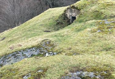
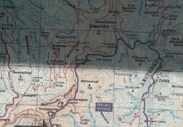
Balade hivernale et sans difficulté le long des crêtes, en "pays" de Baztan.
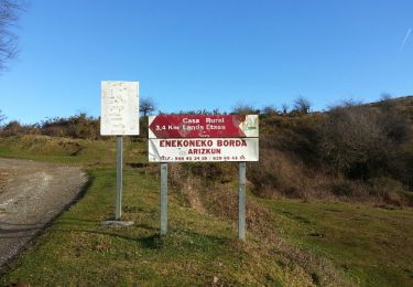
en direction de l'ensemble Gorramendi-Otanarte-Gorramakil, depuis le col Itzulegi / Itzulegiko lepoa. Ce massif est le premier des Pyrénées situé au-dessus de 1000m, en venant de l'Océan Atlantique.
Localisation
Pays :
Espagne
Région :
Navarre
Département/Province :
Inconnu
Commune :
Baztan
Localité :
Unknown
Départ:(Dec)
Départ:(UTM)
625600 ; 4786026 (30T) N.
Commentaires
Randonnées à proximité
![Randonnée A pied Saint-Étienne-de-Baïgorry - SL-NA Elorrieta - Photo](https://media.geolcdn.com/t/375/260/69fa3b6a-5100-4dfb-99ea-46b44a00f11d.jpeg&format=jpg&maxdim=2)
![A pied A pied](https://static1.geolcdn.com/sitytour/trail-icons/100.png)
SL-NA Elorrieta
A pied
Facile
Saint-Étienne-de-Baïgorry,
Nouvelle-Aquitaine,
Pyrénées-Atlantiques,
France
![](/images/other/stat-length.png)
5,8 km | 10 km-effort
2h 15min
![](https://static1.geolcdn.com/siteimages/upload/files/16400158638029165_repeat_loop_refresh_sync_direction_icon.png)
Oui
![Randonnée Marche Baztan - MAILARRETA OTSONDO Frontières en béton dans le massif du Gorramendi 300m. - Photo](https://media.geolcdn.com/t/375/260/8b1035fc-8a50-4048-9924-4944066be27d.jpg&format=jpg&maxdim=2)
![Marche Marche](https://static1.geolcdn.com/sitytour/trail-icons/101.png)
MAILARRETA OTSONDO Frontières en béton dans le massif du Gorramendi 300m.
Marche
Difficile
Baztan,
Navarre,
Inconnu,
Espagne
![](/images/other/stat-length.png)
8,5 km | 12,5 km-effort
2h 50min
![](https://static1.geolcdn.com/siteimages/upload/files/16400158638029165_repeat_loop_refresh_sync_direction_icon.png)
Oui
![Randonnée Marche Baztan - MAILARRETA OTSONDO Frontières en béton dans le massif du Gorramendi - Photo](https://media.geolcdn.com/t/375/260/ext.jpg?maxdim=2&url=https%3A%2F%2Fservices.sitytrail.com%2FGeolivesWS%2FDownloadMedia.ashx%3FTrailID%3D526426%26Media%3Dfix__20160208095835.jpg)
![Marche Marche](https://static1.geolcdn.com/sitytour/trail-icons/101.png)
MAILARRETA OTSONDO Frontières en béton dans le massif du Gorramendi
Marche
Difficile
Baztan,
Navarre,
Inconnu,
Espagne
![](/images/other/stat-length.png)
10 km | 15,3 km-effort
3h 29min
![](https://static1.geolcdn.com/siteimages/upload/files/16400158638029165_repeat_loop_refresh_sync_direction_icon.png)
Oui
![Randonnée A pied Baztan - SL-NA Alkurruntz - Photo](https://media.geolcdn.com/t/375/260/52f4bcee-e0a0-4b91-9588-fad8a39e9c22.jpeg&format=jpg&maxdim=2)
![A pied A pied](https://static1.geolcdn.com/sitytour/trail-icons/100.png)
![Randonnée Marche Saint-Étienne-de-Baïgorry - 20210520 tour depuis Izpegi - Photo](https://media.geolcdn.com/t/375/260/e95b452d-8dd6-4fd8-a386-b8e9176ca32d.jpg&format=jpg&maxdim=2)
![Marche Marche](https://static1.geolcdn.com/sitytour/trail-icons/101.png)
20210520 tour depuis Izpegi
Marche
Facile
Saint-Étienne-de-Baïgorry,
Nouvelle-Aquitaine,
Pyrénées-Atlantiques,
France
![](/images/other/stat-length.png)
8,6 km | 14,7 km-effort
2h 59min
![](https://static1.geolcdn.com/siteimages/upload/files/16400158638029165_repeat_loop_refresh_sync_direction_icon.png)
Oui
![Randonnée Marche Baztan - ALKURRUNTZ depuis le parling de Lizarmeak - Photo](https://media.geolcdn.com/t/375/260/8e46e580-3773-4095-8da1-5fb11edfdedc.jpg&format=jpg&maxdim=2)
![Marche Marche](https://static1.geolcdn.com/sitytour/trail-icons/101.png)
ALKURRUNTZ depuis le parling de Lizarmeak
Marche
Facile
(1)
Baztan,
Navarre,
Inconnu,
Espagne
![](/images/other/stat-length.png)
8,6 km | 13,8 km-effort
2h 52min
![](https://static1.geolcdn.com/siteimages/upload/files/16400158638029165_repeat_loop_refresh_sync_direction_icon.png)
Non
![Randonnée Marche Baztan - Meatzetako Bizkarra depuis le col d'Urrizti (proche d'Otsondo) - Photo](https://media.geolcdn.com/t/375/260/ext.jpg?maxdim=2&url=https%3A%2F%2Fservices.sitytrail.com%2FGeolivesWS%2FDownloadMedia.ashx%3FTrailID%3D526426%26Media%3Dfix__20160208095835.jpg)
![Marche Marche](https://static1.geolcdn.com/sitytour/trail-icons/101.png)
Meatzetako Bizkarra depuis le col d'Urrizti (proche d'Otsondo)
Marche
Difficile
Baztan,
Navarre,
Inconnu,
Espagne
![](/images/other/stat-length.png)
9,7 km | 15,2 km-effort
3h 26min
![](https://static1.geolcdn.com/siteimages/upload/files/16400158638029165_repeat_loop_refresh_sync_direction_icon.png)
Oui
![Randonnée Marche Baztan - Baztan vallée Aritzakun PR NA 6 - Photo](https://media.geolcdn.com/t/375/260/ext.jpg?maxdim=2&url=https%3A%2F%2Fservices.sitytrail.com%2FGeolivesWS%2FDownloadMedia.ashx%3FTrailID%3D402986%26Media%3Dfix__20150402155929.jpg)
![Marche Marche](https://static1.geolcdn.com/sitytour/trail-icons/101.png)
Baztan vallée Aritzakun PR NA 6
Marche
Très difficile
(2)
Baztan,
Navarre,
Inconnu,
Espagne
![](/images/other/stat-length.png)
14,2 km | 22 km-effort
5h 6min
![](https://static1.geolcdn.com/siteimages/upload/files/16400158638029165_repeat_loop_refresh_sync_direction_icon.png)
Oui
![Randonnée Marche Baztan - Alkunrrutz 2024/07/09 - Photo](https://media.geolcdn.com/t/375/260/0036da28-2f1e-4d27-b8ed-481df7747bc4.jpg&format=jpg&maxdim=2)
![Marche Marche](https://static1.geolcdn.com/sitytour/trail-icons/101.png)
Alkunrrutz 2024/07/09
Marche
Moyen
Baztan,
Navarre,
Inconnu,
Espagne
![](/images/other/stat-length.png)
8,2 km | 11,7 km-effort
2h 39min
![](https://static1.geolcdn.com/siteimages/upload/files/16400158638029165_repeat_loop_refresh_sync_direction_icon.png)
Non