


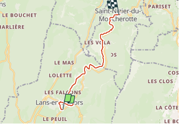

8,7 km | 17,3 km-effort


Utilisateur


Application GPS de randonnée GRATUITE
 SityTrail
IGN / Instituts géographiques
SityTrail World
Le monde est à vous
Randonnée V.T.C. de 9,4 km à découvrir à Auvergne-Rhône-Alpes, Isère, Lans-en-Vercors. Cette randonnée est proposée par petole.
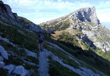
Itinéraire hors route sur chemin gravillonné. Passages délicats en forte montée avec couche profonde de gravillons

Marche

Raquettes à neige

Marche

Marche

Marche

Raquettes à neige

Raquettes à neige

Marche
Marche