![](/images/other/stat-length.png)
![Randonnée Randonnée équestre Lignières-de-Touraine - 10 aout 2023 ligniere - Photo](https://media.geolcdn.com/t/1900/400/ext.pjpeg?maxdim=2&url=https%3A%2F%2Fstatic1.geolcdn.com%2Fsiteimages%2Fupload%2Ffiles%2F1524743154cheval.jpg)
10 aout 2023 ligniere
roi
Utilisateur
![Longueur](/images/other/stat-length.png)
Longueur
16,9 km
![Altitude max](https://static1.geolcdn.com/siteimages/upload/files/1508320355ic_sort_altitude_max_24dp.png)
Altitude max
47 m
![Dénivelé positif](https://static1.geolcdn.com/siteimages/upload/files/1508320355ic_sort_den_pos_24dp.png)
Dénivelé positif
85 m
![Km-Effort](/images/other/stat-length.png)
Km-Effort
18 km
![Altitude min](https://static1.geolcdn.com/siteimages/upload/files/1508320355ic_sort_altitude_min_24dp.png)
Altitude min
33 m
![Dénivelé négatif](https://static1.geolcdn.com/siteimages/upload/files/1508320355ic_sort_den_neg_24dp.png)
Dénivelé négatif
87 m
![Boucle](https://static1.geolcdn.com/siteimages/upload/files/16400158638029165_repeat_loop_refresh_sync_direction_icon.png)
Boucle
Non
Date de création :
2023-09-10 07:04:47.0
Dernière modification :
2023-09-10 10:10:18.311
![Randonnée équestre](https://static1.geolcdn.com/sitytour/trail-icons/301.png)
3h04
Difficulté : Facile
![Scannez ce code QR pour ouvrir la randonnée dans l'application SityTrail](https://capi.geolives.com/qq0zvz2zws4bq2lad0pu/sitytour/trails/3801654/qr.png?size=200)
Application GPS de randonnée GRATUITE
À propos
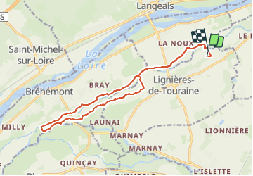
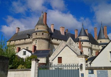
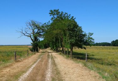
Randonnée Randonnée équestre de 16,9 km à découvrir à Centre-Val de Loire, Indre-et-Loire, Lignières-de-Touraine. Cette randonnée est proposée par roi.
Description
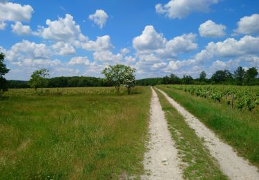
Fait avec les galops de langeais. Quasi pas de route. Très sympa. A faire ferré quand même car petit cailloux. Enregistrement non mis en pause pendant l’arrêt casse croûte
Localisation
Pays :
France
Région :
Centre-Val de Loire
Département/Province :
Indre-et-Loire
Commune :
Lignières-de-Touraine
Localité :
Unknown
Départ:(Dec)
Départ:(UTM)
305931 ; 5242470 (31T) N.
Commentaires
Randonnées à proximité
![Randonnée Marche Vallères - Vallères le Hay - Zig zag Lignières-de-Touraine - 27.2km 300m 6h00 (50mn) - 2024 06 05 - Photo](https://media.geolcdn.com/t/375/260/b3324c15-4c92-4d98-acdf-5b4b32a3e010.jpg&format=jpg&maxdim=2)
![Marche Marche](https://static1.geolcdn.com/sitytour/trail-icons/101.png)
Vallères le Hay - Zig zag Lignières-de-Touraine - 27.2km 300m 6h00 (50mn) - 2...
Marche
Moyen
Vallères,
Centre-Val de Loire,
Indre-et-Loire,
France
![](/images/other/stat-length.png)
27 km | 31 km-effort
6h 0min
![](https://static1.geolcdn.com/siteimages/upload/files/16400158638029165_repeat_loop_refresh_sync_direction_icon.png)
Oui
![Randonnée Marche Vallères - Vallères - Zig zag Manoir de Fontenay - 26.2km 350m 6h00 (35mn) - 2024 05 31 - Photo](https://media.geolcdn.com/t/375/260/2dd7bae2-e64d-4c31-aa25-080d87181237.jpg&format=jpg&maxdim=2)
![Marche Marche](https://static1.geolcdn.com/sitytour/trail-icons/101.png)
Vallères - Zig zag Manoir de Fontenay - 26.2km 350m 6h00 (35mn) - 2024 05 31
Marche
Facile
Vallères,
Centre-Val de Loire,
Indre-et-Loire,
France
![](/images/other/stat-length.png)
26 km | 31 km-effort
6h 0min
![](https://static1.geolcdn.com/siteimages/upload/files/16400158638029165_repeat_loop_refresh_sync_direction_icon.png)
Oui
![Randonnée Marche Lignières-de-Touraine - Lignières-de-Touraine - Zig zag Château de l'Islette - 25.9km 365m 5h30 (30mn) - 2024 05 26 - Photo](https://media.geolcdn.com/t/375/260/185ea1ff-808f-469f-bf38-e6f6a9b76503.jpg&format=jpg&maxdim=2)
![Marche Marche](https://static1.geolcdn.com/sitytour/trail-icons/101.png)
Lignières-de-Touraine - Zig zag Château de l'Islette - 25.9km 365m 5h30 (30mn...
Marche
Facile
Lignières-de-Touraine,
Centre-Val de Loire,
Indre-et-Loire,
France
![](/images/other/stat-length.png)
25 km | 30 km-effort
5h 30min
![](https://static1.geolcdn.com/siteimages/upload/files/16400158638029165_repeat_loop_refresh_sync_direction_icon.png)
Oui
![Randonnée Marche Cinq-Mars-la-Pile - Cinq-Mars-la-Pile - Langeais - 14km 205m 3h05 - 2024 02 14 - Photo](https://media.geolcdn.com/t/375/260/bfe42b2e-405a-46df-8533-fbac70b0d338.jpg&format=jpg&maxdim=2)
![Marche Marche](https://static1.geolcdn.com/sitytour/trail-icons/101.png)
Cinq-Mars-la-Pile - Langeais - 14km 205m 3h05 - 2024 02 14
Marche
Facile
Cinq-Mars-la-Pile,
Centre-Val de Loire,
Indre-et-Loire,
France
![](/images/other/stat-length.png)
14 km | 16,7 km-effort
3h 5min
![](https://static1.geolcdn.com/siteimages/upload/files/16400158638029165_repeat_loop_refresh_sync_direction_icon.png)
Oui
![Randonnée Marche Langeais - Langeais - PR Saint-Michel-sur-Loire - 20.8km 325m 5h10 (30mn) - 2023 04 15 - Photo](https://media.geolcdn.com/t/375/260/40cd30ca-2538-4ad0-9532-e878aad2404e.jpg&format=jpg&maxdim=2)
![Marche Marche](https://static1.geolcdn.com/sitytour/trail-icons/101.png)
Langeais - PR Saint-Michel-sur-Loire - 20.8km 325m 5h10 (30mn) - 2023 04 15
Marche
Moyen
Langeais,
Centre-Val de Loire,
Indre-et-Loire,
France
![](/images/other/stat-length.png)
21 km | 25 km-effort
5h 10min
![](https://static1.geolcdn.com/siteimages/upload/files/16400158638029165_repeat_loop_refresh_sync_direction_icon.png)
Oui
![Randonnée Marche Azay-le-Rideau - Azay-le-Rideau - Goupillières Baulay - 15.1km 185m 3h35 - 2022 07 12 - Photo](https://media.geolcdn.com/t/375/260/8707bc61-0cf0-4af2-87b1-fc906fb58702.jpg&format=jpg&maxdim=2)
![Marche Marche](https://static1.geolcdn.com/sitytour/trail-icons/101.png)
Azay-le-Rideau - Goupillières Baulay - 15.1km 185m 3h35 - 2022 07 12
Marche
Facile
Azay-le-Rideau,
Centre-Val de Loire,
Indre-et-Loire,
France
![](/images/other/stat-length.png)
15,1 km | 17,6 km-effort
3h 35min
![](https://static1.geolcdn.com/siteimages/upload/files/16400158638029165_repeat_loop_refresh_sync_direction_icon.png)
Oui
![Randonnée Marche Cinq-Mars-la-Pile - Cinq-Mars-la-Pile - le Mortier Rougeau - 19.5km 265m 4h30 - 2022 04 17 - Photo](https://media.geolcdn.com/t/375/260/f382cab4-57ba-447e-b146-a35d4860c6b9.jpg&format=jpg&maxdim=2)
![Marche Marche](https://static1.geolcdn.com/sitytour/trail-icons/101.png)
Cinq-Mars-la-Pile - le Mortier Rougeau - 19.5km 265m 4h30 - 2022 04 17
Marche
Facile
Cinq-Mars-la-Pile,
Centre-Val de Loire,
Indre-et-Loire,
France
![](/images/other/stat-length.png)
19,7 km | 23 km-effort
4h 30min
![](https://static1.geolcdn.com/siteimages/upload/files/16400158638029165_repeat_loop_refresh_sync_direction_icon.png)
Oui
![Randonnée Marche Azay-le-Rideau - Azay-le-Rideau - l'Islette - 17km 220m 4h05 (20mn) - 2021 06 12 - Photo](https://media.geolcdn.com/t/375/260/ed17a717-c8e8-4396-b1e0-0d3bc31c4be8.jpg&format=jpg&maxdim=2)
![Marche Marche](https://static1.geolcdn.com/sitytour/trail-icons/101.png)
Azay-le-Rideau - l'Islette - 17km 220m 4h05 (20mn) - 2021 06 12
Marche
Facile
Azay-le-Rideau,
Centre-Val de Loire,
Indre-et-Loire,
France
![](/images/other/stat-length.png)
17 km | 20 km-effort
4h 5min
![](https://static1.geolcdn.com/siteimages/upload/files/16400158638029165_repeat_loop_refresh_sync_direction_icon.png)
Oui
![Randonnée Marche Vallères - Vallères - Circuit 11km - 10.7km 115m 2h20 - 2020 07 11 - Photo](https://media.geolcdn.com/t/375/260/dacfb651-3bef-48cd-bbc1-bfa3f2be3086.jpg&format=jpg&maxdim=2)
![Marche Marche](https://static1.geolcdn.com/sitytour/trail-icons/101.png)
Vallères - Circuit 11km - 10.7km 115m 2h20 - 2020 07 11
Marche
Très facile
Vallères,
Centre-Val de Loire,
Indre-et-Loire,
France
![](/images/other/stat-length.png)
10,7 km | 12,2 km-effort
2h 20min
![](https://static1.geolcdn.com/siteimages/upload/files/16400158638029165_repeat_loop_refresh_sync_direction_icon.png)
Oui