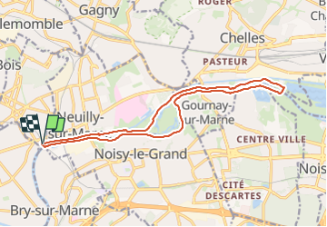
![](/images/other/stat-length.png)
![Randonnée Marche Neuilly-Plaisance - Neuilly Plaisance gare Rer sortie Bords de Marne/ Base Nautique Vaires sur Marne - Photo](https://media.geolcdn.com/t/1900/400/3fb9e5a2-0030-4f1a-a960-e880d0c7625d.jpg&format=pjpeg&maxdim=2)
Neuilly Plaisance gare Rer sortie Bords de Marne/ Base Nautique Vaires sur Marne
thierry cachot
Utilisateur
![Longueur](/images/other/stat-length.png)
![Altitude max](https://static1.geolcdn.com/siteimages/upload/files/1508320355ic_sort_altitude_max_24dp.png)
![Dénivelé positif](https://static1.geolcdn.com/siteimages/upload/files/1508320355ic_sort_den_pos_24dp.png)
![Km-Effort](/images/other/stat-length.png)
![Altitude min](https://static1.geolcdn.com/siteimages/upload/files/1508320355ic_sort_altitude_min_24dp.png)
![Dénivelé négatif](https://static1.geolcdn.com/siteimages/upload/files/1508320355ic_sort_den_neg_24dp.png)
![Boucle](https://static1.geolcdn.com/siteimages/upload/files/16400158638029165_repeat_loop_refresh_sync_direction_icon.png)
![Marche](https://static1.geolcdn.com/sitytour/trail-icons/101.png)
2h52
Difficulté : Facile
![Scannez ce code QR pour ouvrir la randonnée dans l'application SityTrail](https://capi.geolives.com/qq0zvz2zws4bq2lad0pu/sitytour/trails/3795902/qr.png?size=200)
Application GPS de randonnée GRATUITE
À propos
Randonnée Marche de 15,9 km à découvrir à Île-de-France, Seine-Saint-Denis, Neuilly-Plaisance. Cette randonnée est proposée par thierry cachot.
Description
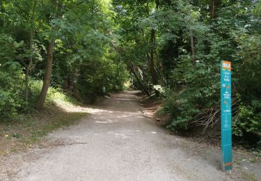
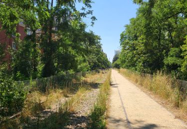
Rando facile en longeant la Marne.
A moins de 7 kms du départ vers la passerelle de Champs, il y a un bar resto.
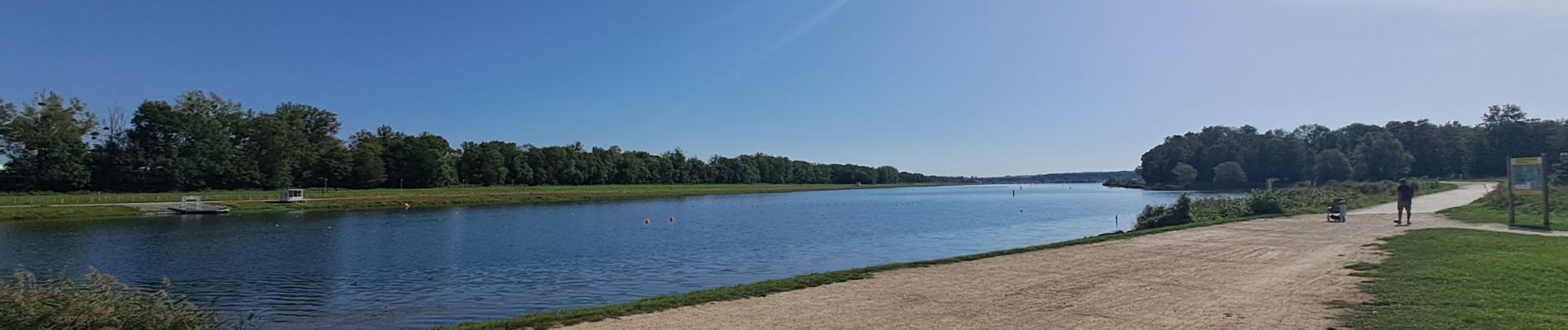
Possible de pique-niquer facilement à l'entrée du Parc de Noisiel ou à la base nautique de Vaires sur Marne à mi-chemin ou dans le parc de la Haute Île à 4,5 kms de l'arrivée. Aire de jeux pour les enfants
A 1,5 km de l'arrivée, possibilité de se restaurer à la guinguette "chez Fifi ".
Si vous voulez prolonger la randonnée de 4kms, vous pouvez faire le tour de la base nautique.
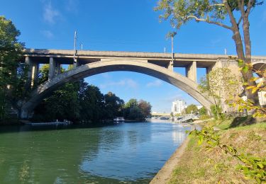
Si vous voulez réduire de 4kms, vous pouvez emprunter la passerelle de Champs.
Localisation
Commentaires
Randonnées à proximité
![Randonnée A pied Champigny-sur-Marne - Sur les bords de Marne - Photo](https://media.geolcdn.com/t/375/260/0848a8c4-6d65-4224-9dca-3686da6f2272.jpg&format=jpg&maxdim=2)
![A pied A pied](https://static1.geolcdn.com/sitytour/trail-icons/100.png)
A pied
![](/images/other/stat-length.png)
![](https://static1.geolcdn.com/siteimages/upload/files/16400158638029165_repeat_loop_refresh_sync_direction_icon.png)
![Randonnée Marche Saint-Maur-des-Fossés - Boucle St Maur - Vincennes - Photo](https://media.geolcdn.com/t/375/260/07d4e882-57e1-4d05-a0e2-c5807ef2ec4c.jpg&format=jpg&maxdim=2)
![Marche Marche](https://static1.geolcdn.com/sitytour/trail-icons/101.png)
Marche
![](/images/other/stat-length.png)
![](https://static1.geolcdn.com/siteimages/upload/files/16400158638029165_repeat_loop_refresh_sync_direction_icon.png)
![Randonnée Marche Gournay-sur-Marne - Boucle Gournay/ Marne - Noisy le Grand - Champs sur Marne - Photo](https://media.geolcdn.com/t/375/260/89921577-96fb-496f-92ce-fb28ab23f5a4.jpg&format=jpg&maxdim=2)
![Marche Marche](https://static1.geolcdn.com/sitytour/trail-icons/101.png)
Marche
![](/images/other/stat-length.png)
![](https://static1.geolcdn.com/siteimages/upload/files/16400158638029165_repeat_loop_refresh_sync_direction_icon.png)
![Randonnée Marche Nogent-sur-Marne - Autour des Minimes - Photo](https://media.geolcdn.com/t/375/260/ext.jpg?maxdim=2&url=https%3A%2F%2Fstatic1.geolcdn.com%2Fsiteimages%2Fupload%2Ffiles%2F1553511878bg_sport_marche.png)
![Marche Marche](https://static1.geolcdn.com/sitytour/trail-icons/101.png)
Marche
![](/images/other/stat-length.png)
![](https://static1.geolcdn.com/siteimages/upload/files/16400158638029165_repeat_loop_refresh_sync_direction_icon.png)
![Randonnée V.T.T. Fontenay-sous-Bois - vtt bois de vincennes - Photo](https://media.geolcdn.com/t/375/260/ext.jpg?maxdim=2&url=https%3A%2F%2Fstatic1.geolcdn.com%2Fsiteimages%2Fupload%2Ffiles%2F1524743154velo.jpg)
![V.T.T. V.T.T.](https://static1.geolcdn.com/sitytour/trail-icons/202.png)
V.T.T.
![](/images/other/stat-length.png)
![](https://static1.geolcdn.com/siteimages/upload/files/16400158638029165_repeat_loop_refresh_sync_direction_icon.png)
![Randonnée Marche Champigny-sur-Marne - BM Bord de Marne : Nogent-Gournay AR 21km - Photo](https://media.geolcdn.com/t/375/260/d8a7ca9d-36a1-43a8-b0ad-da38a2a2adfc.jpg&format=jpg&maxdim=2)
![Marche Marche](https://static1.geolcdn.com/sitytour/trail-icons/101.png)
Marche
![](/images/other/stat-length.png)
![](https://static1.geolcdn.com/siteimages/upload/files/16400158638029165_repeat_loop_refresh_sync_direction_icon.png)
![Randonnée Marche Saint-Maur-des-Fossés - GR15-02 Saint-Maur-des-Fossés à Gagny - Photo](https://media.geolcdn.com/t/375/260/734eac77-714f-4f28-a17b-70e184f69fb7.jpg&format=jpg&maxdim=2)
![Marche Marche](https://static1.geolcdn.com/sitytour/trail-icons/101.png)
Marche
![](/images/other/stat-length.png)
![](https://static1.geolcdn.com/siteimages/upload/files/16400158638029165_repeat_loop_refresh_sync_direction_icon.png)
![Randonnée Marche Nogent-sur-Marne - 2023 06 25 - Photo](https://media.geolcdn.com/t/375/260/5e8f4917-23cc-40cc-a8e3-6d600f9f06b3.jpg&format=jpg&maxdim=2)
![Marche Marche](https://static1.geolcdn.com/sitytour/trail-icons/101.png)
Marche
![](/images/other/stat-length.png)
![](https://static1.geolcdn.com/siteimages/upload/files/16400158638029165_repeat_loop_refresh_sync_direction_icon.png)
![Randonnée Marche Noisy-le-Grand - Bois Saint Martin - Photo](https://media.geolcdn.com/t/375/260/6e1d2fd3-558a-4a60-9963-c8dd2d0297c2.jpg&format=jpg&maxdim=2)
![Marche Marche](https://static1.geolcdn.com/sitytour/trail-icons/101.png)
Marche
![](/images/other/stat-length.png)
![](https://static1.geolcdn.com/siteimages/upload/files/16400158638029165_repeat_loop_refresh_sync_direction_icon.png)
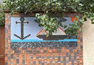
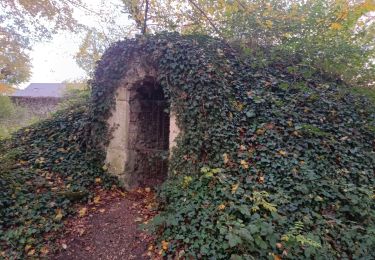
Merci pour les indications et les photos !