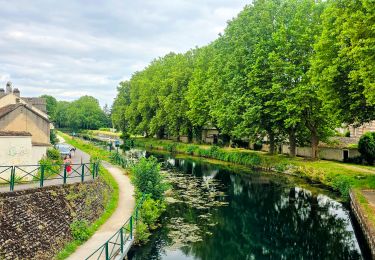
Randonnée  Nargis -  - Photo
 olivieraron
olivieraron

Utilisateur

© OpenStreetMap contributors
Longueur
Longueur
211 km
Altitude max
Altitude max
176 m
Dénivelé positif
Dénivelé positif
2558 m
Km-Effort
Km-Effort  
245 km
Altitude min
Altitude min
52 m
Dénivelé négatif
Dénivelé négatif
2514 m
Boucle
Boucle
Non
Date de création :
2023-09-05 06:52:02.907
Dernière modification :
2023-09-05 06:52:02.907

(0 Avis)


Scannez ce code QR pour ouvrir la randonnée dans l'application SityTrail

Application GPS de randonnée GRATUITE

Logo SityTrail SityTrail

IGN / Instituts géographiques

Télécharger SityTrail sur l'App Store Télécharger SityTrail sur Google Play

Logo SityTrail SityTrail World

Le monde est à vous

Télécharger SityTrail sur l'App Store Télécharger SityTrail sur Google Play Télécharger SityTrail sur Huawei AppGallery

À propos

Randonnée de 211 km à découvrir à Centre-Val de Loire, Loiret, Nargis. Cette randonnée est proposée par olivieraron.

Profil altimétrique

Points d'intérêt

Point d'intérêt Saint-Hilaire-les-Andrésis - End - Photo
olivieraron
SAINT-HILAIRE-LES-ANDRÉSIS 
Point d'intérêt Limours - Start - Photo
olivieraron
LIMOURS 
Point d'intérêt Saint-Hilaire-les-Andrésis - End - Photo
olivieraron
SAINT-HILAIRE-LES-ANDRÉSIS 
Point d'intérêt Nargis - Start - Photo
olivieraron
NARGIS 

Localisation

Pays :
France
Région :
Centre-Val de Loire
Département/Province :
Loiret
Commune :
Nargis
Localité :
Unknown
Départ:(Dec)
Départ:(UTM)
481282 ; 5331072 (31U) N.

Randonnées à proximité

Randonnée Marche Château-Landon - Linéaire de Chateau Landon à Nemours - Photo
Marche
GUIDE
chessyca

Marche

Difficile
Château-Landon, Île-de-France, Seine-et-Marne, France
32 km | 37 km-effort
6h 49min
Non
Randonnée Marche Château-Landon - De Château Landon à Nemours - Photo
Marche
GUIDE
chessyca

Marche

Moyen
Château-Landon, Île-de-France, Seine-et-Marne, France
32 km | 37 km-effort
6h 59min
Non
Randonnée Marche Château-Landon - Promenade à Château Landon et ses alentours - Photo
Marche
GUIDE
chessyca

Marche

Très facile
Château-Landon, Île-de-France, Seine-et-Marne, France
12,7 km | 15,1 km-effort
2h 50min
Oui
Randonnée V.T.T. Dordives - prepa transvolcanique - Photo
V.T.T.
a142862

V.T.T.

Facile
Dordives, Centre-Val de Loire, Loiret, France
32 km | 36 km-effort
1h 29min
Oui
Randonnée Marche Dordives - château de Dordives - Photo
Marche
raypat

Marche

Difficile
Dordives, Centre-Val de Loire, Loiret, France
13,7 km | 16 km-effort
3h 29min
Oui
Randonnée Vélo de route Château-Landon - Château landon à cepoy  - Photo
Vélo de route
01264e

Vélo de route

Difficile
Château-Landon, Île-de-France, Seine-et-Marne, France
35 km | 39 km-effort
2h 48min
Oui
Randonnée Marche Dordives - Dordives  - Photo
Marche
JacquesMARQUET

Marche

Très difficile
Dordives, Centre-Val de Loire, Loiret, France
23 km | 27 km-effort
6h 4min
Oui
Randonnée Marche Château-Landon - Château Landon-Nemours.12122022 - Photo
Marche
aucamus

Marche

Très difficile
Château-Landon, Île-de-France, Seine-et-Marne, France
33 km | 38 km-effort
8h 31min
Non
Randonnée Marche Préfontaines - prefontaies - Photo
Marche
raypat

Marche

Difficile
Préfontaines, Centre-Val de Loire, Loiret, France
17,6 km | 19 km-effort
4h 24min
Oui


Fermer
Mes abonnements