


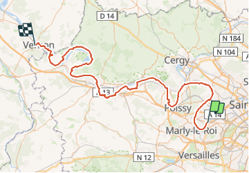

28 km | 32 km-effort


Utilisateur GUIDE


Application GPS de randonnée GRATUITE
 SityTrail
IGN / Instituts géographiques
SityTrail World
Le monde est à vous
Randonnée A pied de 127 km à découvrir à Île-de-France, Yvelines, Chatou. Cette randonnée est proposée par chessyca.
Etape 1 Chatou Sartrouville
Etape 2 Sartrouville Conflans Ste Honorine
Etape 3 Conflans Ste Honorine Triels
Etape 4 Triels Aubergenville
Etape 5 Aubergenville Mantes
Etape 6 Mantes Vétheuil
Etape 7 Vétheuil Bonnières
Etape 8 Bonnières Vernon

Marche

Marche

Marche

A pied

Marche
Marche
Marche

Marche
Marche