Randonnée  Auxonne - leo  - Photo
© OpenStreetMap contributors
Longueur
Longueur
26 km
Altitude max
Altitude max
199 m
Dénivelé positif
Dénivelé positif
156 m
Km-Effort
Km-Effort  
29 km
Altitude min
Altitude min
173 m
Dénivelé négatif
Dénivelé négatif
156 m
Boucle
Boucle
Oui
Date de création :
2023-09-02 09:37:30.0
Dernière modification :
2023-09-02 10:59:45.579

(0 Avis)


Scannez ce code QR pour ouvrir la randonnée dans l'application SityTrail

Application GPS de randonnée GRATUITE

Logo SityTrail SityTrail

IGN / Instituts géographiques

Télécharger SityTrail sur l'App Store Télécharger SityTrail sur Google Play

Logo SityTrail SityTrail World

Le monde est à vous

Télécharger SityTrail sur l'App Store Télécharger SityTrail sur Google Play Télécharger SityTrail sur Huawei AppGallery

À propos

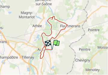
Randonnée de 26 km à découvrir à Bourgogne-Franche-Comté, Côte-d'Or, Auxonne. Cette randonnée est proposée par 000762.3a9a7f75452d48f0bbfd1e467ebc0d26.0900.

Description

en avec velo a 1 vitesse (dirt)

Profil altimétrique

Localisation

Pays :
France
Région :
Bourgogne-Franche-Comté
Département/Province :
Côte-d'Or
Commune :
Auxonne
Localité :
Unknown
Départ:(Dec)
Départ:(UTM)
682217 ; 5229465 (31T) N.

Randonnées à proximité

Randonnée V.T.T. Auxonne - Peintre Chevigny - Photo
V.T.T.
PhilAux

V.T.T.

Très facile
(1)
Auxonne, Bourgogne-Franche-Comté, Côte-d'Or, France
27 km | 30 km-effort
2h 0min
Oui
Randonnée V.T.T. Auxonne - Auxonne Parcey - Photo
V.T.T.
PhilAux

V.T.T.

Moyen
(2)
Auxonne, Bourgogne-Franche-Comté, Côte-d'Or, France
32 km | 36 km-effort
2h 22min
Non
Randonnée Marche Athée - Magny - Villers - Photo
Marche
Pat le Chat

Marche

Facile
Athée, Bourgogne-Franche-Comté, Côte-d'Or, France
13,2 km | 15,5 km-effort
3h 9min
Non
Randonnée Marche Athée - Collonges Soirans l'Etoile - Photo
Marche
Pat le Chat

Marche

Très facile
Athée, Bourgogne-Franche-Comté, Côte-d'Or, France
14,1 km | 15,6 km-effort
3h 26min
Oui
Randonnée Marche Athée - Sympa - Photo
Marche
Pat le Chat

Marche

Très facile
Athée, Bourgogne-Franche-Comté, Côte-d'Or, France
9,2 km | 10,8 km-effort
49min
Oui
Randonnée V.T.T. Auxonne - Parcey 3 - Photo
V.T.T.
PhilAux

V.T.T.

Très facile
Auxonne, Bourgogne-Franche-Comté, Côte-d'Or, France
36 km | 39 km-effort
2h 40min
Non
Randonnée Marche Athée - Auxonne 1 - Photo
Marche
Lemaire A

Marche

Facile
Athée, Bourgogne-Franche-Comté, Côte-d'Or, France
3,5 km | 3,8 km-effort
1h 54min
Oui
Randonnée Marche Athée - Athée et Poncey l'Etang la Saône - Photo
Marche
Pat le Chat

Marche

Facile
Athée, Bourgogne-Franche-Comté, Côte-d'Or, France
13,2 km | 14,6 km-effort
3h 32min
Non
Randonnée Marche Athée - Athée et Villers - Photo
Marche
Pat le Chat

Marche

Très facile
Athée, Bourgogne-Franche-Comté, Côte-d'Or, France
8,5 km | 9,5 km-effort
2h 9min
Non


Fermer
Mes abonnements