![](/images/other/stat-length.png)
![Randonnée Marche Brunssum - Brunsumm - 1055 - Photo](https://media.geolcdn.com/t/1900/400/a9d4ae47-6d3e-4d55-a221-1cbefb6a45e5.jpg&format=pjpeg&maxdim=2)
Brunsumm - 1055
mumu.larandonneuse
Utilisateur GUIDE
![Longueur](/images/other/stat-length.png)
![Altitude max](https://static1.geolcdn.com/siteimages/upload/files/1508320355ic_sort_altitude_max_24dp.png)
![Dénivelé positif](https://static1.geolcdn.com/siteimages/upload/files/1508320355ic_sort_den_pos_24dp.png)
![Km-Effort](/images/other/stat-length.png)
![Altitude min](https://static1.geolcdn.com/siteimages/upload/files/1508320355ic_sort_altitude_min_24dp.png)
![Dénivelé négatif](https://static1.geolcdn.com/siteimages/upload/files/1508320355ic_sort_den_neg_24dp.png)
![Boucle](https://static1.geolcdn.com/siteimages/upload/files/16400158638029165_repeat_loop_refresh_sync_direction_icon.png)
![Marche](https://static1.geolcdn.com/sitytour/trail-icons/101.png)
3h29
Difficulté : Facile
![Scannez ce code QR pour ouvrir la randonnée dans l'application SityTrail](https://capi.geolives.com/qq0zvz2zws4bq2lad0pu/sitytour/trails/3792136/qr.png?size=200)
Application GPS de randonnée GRATUITE
À propos
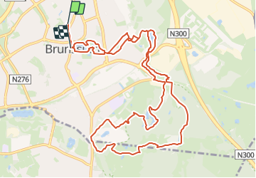
Randonnée Marche de 13 km à découvrir à Limbourg, Inconnu, Brunssum. Cette randonnée est proposée par mumu.larandonneuse.
Description
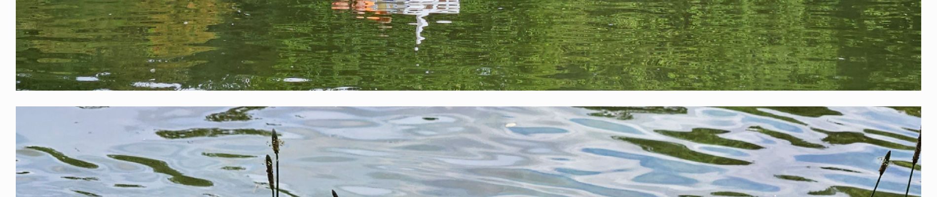
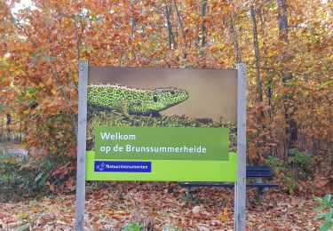
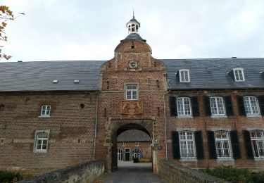
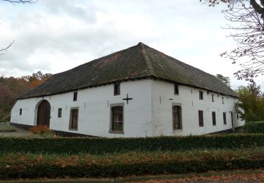
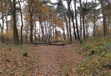
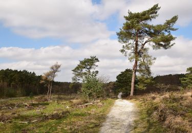
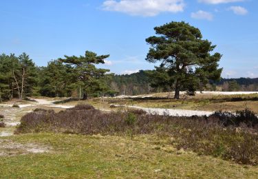
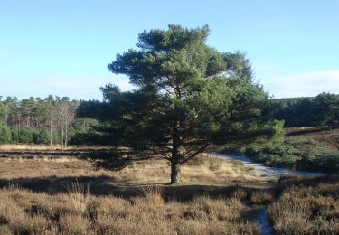
Une promenade aventureuse avec de nombreux jolis sentiers forestiers et de bruyère, des ruisseaux, des parcs et de beaux étangs. Au cours de cette promenade vallonnée, vous traversez immédiatement le magnifique Vijverpark le long des étangs. Vous traversez ensuite un ancien quartier minier. Vous marchez à nouveau dans le Schutterspark le long de magnifiques étangs, puis vous suivez un beau sentier au-dessus d'une montagne minière. À travers les forêts, vous arriverez à la Brunssummerheide sur le Roode Beek, un endroit merveilleux pour faire une pause. Vous parcourez la bruyère pendant un certain temps, puis vous marchez à travers les bois jusqu'à l'étang magnifiquement situé appelé Koffiepoel. Par la belle vallée du Roode Beek, vous retournerez au Schutterspark. Ensuite, vous traversez à nouveau le quartier résidentiel. Enfin, vous traversez à nouveau le magnifique Vijverpark. Apportez vos propres provisions pour le voyage. Il y a plein de beaux endroits. Au fond se trouve une terrasse spacieuse.
➡️ www wandelgidszuidlimburg.com n° 1055.
Localisation
Commentaires
Randonnées à proximité
![Randonnée Marche Brunssum - Brunssum_1288 - Photo](https://media.geolcdn.com/t/375/260/be5d1686-e005-4060-95f9-6d7688290c56.jpg&format=jpg&maxdim=2)
![Marche Marche](https://static1.geolcdn.com/sitytour/trail-icons/101.png)
Marche
![](/images/other/stat-length.png)
![](https://static1.geolcdn.com/siteimages/upload/files/16400158638029165_repeat_loop_refresh_sync_direction_icon.png)
![Randonnée A pied Beekdaelen - Schepenroute - Photo](https://media.geolcdn.com/t/375/260/3dc83ec1-eb05-4590-bc82-c92e8a8aa294.jpeg&format=jpg&maxdim=2)
![A pied A pied](https://static1.geolcdn.com/sitytour/trail-icons/100.png)
A pied
![](/images/other/stat-length.png)
![](https://static1.geolcdn.com/siteimages/upload/files/16400158638029165_repeat_loop_refresh_sync_direction_icon.png)
![Randonnée A pied Beekdaelen - Droepnaasroute - Photo](https://media.geolcdn.com/t/375/260/1a0117ec-7eca-4d8e-8dcf-4542aea011c8.jpeg&format=jpg&maxdim=2)
![A pied A pied](https://static1.geolcdn.com/sitytour/trail-icons/100.png)
A pied
![](/images/other/stat-length.png)
![](https://static1.geolcdn.com/siteimages/upload/files/16400158638029165_repeat_loop_refresh_sync_direction_icon.png)
![Randonnée A pied Landgraaf - Brunssummer Heide Paarse route - Photo](https://media.geolcdn.com/t/375/260/fc5733ac-21b1-4256-9efd-d70ddf8f828f.jpeg&format=jpg&maxdim=2)
![A pied A pied](https://static1.geolcdn.com/sitytour/trail-icons/100.png)
A pied
![](/images/other/stat-length.png)
![](https://static1.geolcdn.com/siteimages/upload/files/16400158638029165_repeat_loop_refresh_sync_direction_icon.png)
![Randonnée A pied Heerlen - Brunssummer Heide Lichtgroene route - Photo](https://media.geolcdn.com/t/375/260/508b716c-8807-4753-8004-f75de6f128b2.jpeg&format=jpg&maxdim=2)
![A pied A pied](https://static1.geolcdn.com/sitytour/trail-icons/100.png)
A pied
![](/images/other/stat-length.png)
![](https://static1.geolcdn.com/siteimages/upload/files/16400158638029165_repeat_loop_refresh_sync_direction_icon.png)
![Randonnée A pied Heerlen - Brunssummer Heide Lichtblauwe route - Photo](https://media.geolcdn.com/t/375/260/39c8b9d7-66fe-45a6-8073-0f378ccb205b.jpeg&format=jpg&maxdim=2)
![A pied A pied](https://static1.geolcdn.com/sitytour/trail-icons/100.png)
A pied
![](/images/other/stat-length.png)
![](https://static1.geolcdn.com/siteimages/upload/files/16400158638029165_repeat_loop_refresh_sync_direction_icon.png)
![Randonnée A pied Heerlen - Brunssummer Heide Donkergroene route - Photo](https://media.geolcdn.com/t/375/260/ad778f8c-75f7-4599-b089-d9f2e7b1eaf0.jpeg&format=jpg&maxdim=2)
![A pied A pied](https://static1.geolcdn.com/sitytour/trail-icons/100.png)
A pied
![](/images/other/stat-length.png)
![](https://static1.geolcdn.com/siteimages/upload/files/16400158638029165_repeat_loop_refresh_sync_direction_icon.png)
![Randonnée A pied Beekdaelen - Rode Route - Photo](https://media.geolcdn.com/t/375/260/ee24fe33-e676-4d4e-8211-77f2cd86e479.jpeg&format=jpg&maxdim=2)
![A pied A pied](https://static1.geolcdn.com/sitytour/trail-icons/100.png)
A pied
![](/images/other/stat-length.png)
![](https://static1.geolcdn.com/siteimages/upload/files/16400158638029165_repeat_loop_refresh_sync_direction_icon.png)
![Randonnée A pied Beekdaelen - Groene Route - Photo](https://media.geolcdn.com/t/375/260/ee24fe33-e676-4d4e-8211-77f2cd86e479.jpeg&format=jpg&maxdim=2)
![A pied A pied](https://static1.geolcdn.com/sitytour/trail-icons/100.png)
A pied
![](/images/other/stat-length.png)
![](https://static1.geolcdn.com/siteimages/upload/files/16400158638029165_repeat_loop_refresh_sync_direction_icon.png)
💚 Une rando coup de cœur ! Magnifique 🥰