


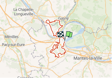

18,4 km | 24 km-effort

Utilisateur


Application GPS de randonnée GRATUITE
 SityTrail
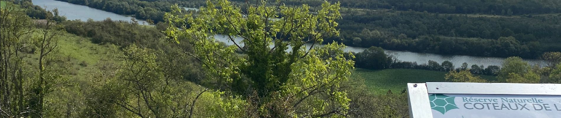
IGN / Instituts géographiques
SityTrail World
Le monde est à vous
Randonnée V.T.T. de 64 km à découvrir à Île-de-France, Yvelines, Rolleboise. Cette randonnée est proposée par francisjames.
Boucle pour aller à Giverny en passant sous l’autoroute À 13 mais chemin obstrué avant le tunnel ; passage à un autre endroit.


Marche

Marche
Marche
Marche
Marche
Marche
Marche
Marche
Marche