5,7 km | 7,1 km-effort
20230905 Cote Opale N°5 Hardelot Etaples
patb54
Utilisateur
Longueur
22 km
Altitude max
68 m
Dénivelé positif
171 m
Km-Effort
24 km
Altitude min
0 m
Dénivelé négatif
188 m
Boucle
Non
Date de création :
2023-08-25 14:14:37.729
Dernière modification :
2023-08-25 14:17:41.499
5h26
Difficulté : Très difficile
Application GPS de randonnée GRATUITE
À propos
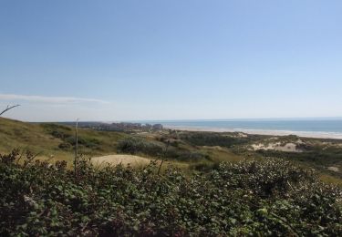
Randonnée Marche de 22 km à découvrir à Hauts-de-France, Pas-de-Calais, Neufchâtel-Hardelot. Cette randonnée est proposée par patb54.
Description
Itinerance la Pelerine
Localisation
Pays :
France
Région :
Hauts-de-France
Département/Province :
Pas-de-Calais
Commune :
Neufchâtel-Hardelot
Localité :
Unknown
Départ:(Dec)
Départ:(UTM)
401334 ; 5609850 (31U) N.
Commentaires
Randonnées à proximité
Plages et Dunes d'Ecault - Saint-Étienne au Mont
Marche
Moyen
(2)
Saint-Étienne-au-Mont,
Hauts-de-France,
Pas-de-Calais,
France
1h 45min
Oui
Mont Violette - Nesles
Marche
Moyen
(1)
Nesles,
Hauts-de-France,
Pas-de-Calais,
France
11,6 km | 15,4 km-effort
3h 0min
Oui
Le sentier des dunes
Marche
Facile
(2)
Équihen-Plage,
Hauts-de-France,
Pas-de-Calais,
France
5,5 km | 6,9 km-effort
1h 59min
Oui
Le Mont Saint Frieux
Marche
Facile
(1)
Dannes,
Hauts-de-France,
Pas-de-Calais,
France
6,1 km | 7,8 km-effort
2h 0min
Oui
Hardelot Plage
Marche nordique
Facile
(1)
Neufchâtel-Hardelot,
Hauts-de-France,
Pas-de-Calais,
France
4,5 km | 4,9 km-effort
1h 3min
Oui
DANNES MONT SAINT PRIEUX
Marche
Moyen
(1)
Dannes,
Hauts-de-France,
Pas-de-Calais,
France
6,4 km | 8 km-effort
2h 16min
Oui
Hardelot2
Marche
Moyen
Neufchâtel-Hardelot,
Hauts-de-France,
Pas-de-Calais,
France
9,3 km | 10,5 km-effort
2h 19min
Oui
Boucle Mont Saint Frieux
Marche
Facile
Dannes,
Hauts-de-France,
Pas-de-Calais,
France
6,5 km | 8,1 km-effort
1h 45min
Oui
Circuit Sentier du Mont des Prêtres - Hesdigneul les Boulogne
Marche
Facile
(2)
Hesdigneul-lès-Boulogne,
Hauts-de-France,
Pas-de-Calais,
France
5,2 km | 6,1 km-effort
1h 30min
Oui