![](/images/other/stat-length.png)
![Randonnée Marche Nogent-le-Rotrou - NOGENT LE ROTROU - Photo](https://media.geolcdn.com/t/1900/400/c00ba3d7-9b96-49a3-b019-bc489240b465.jpg&format=pjpeg&maxdim=2)
NOGENT LE ROTROU
jeannine grandjean
Utilisateur
![Longueur](/images/other/stat-length.png)
Longueur
5,8 km
![Altitude max](https://static1.geolcdn.com/siteimages/upload/files/1508320355ic_sort_altitude_max_24dp.png)
Altitude max
155 m
![Dénivelé positif](https://static1.geolcdn.com/siteimages/upload/files/1508320355ic_sort_den_pos_24dp.png)
Dénivelé positif
79 m
![Km-Effort](/images/other/stat-length.png)
Km-Effort
6,9 km
![Altitude min](https://static1.geolcdn.com/siteimages/upload/files/1508320355ic_sort_altitude_min_24dp.png)
Altitude min
102 m
![Dénivelé négatif](https://static1.geolcdn.com/siteimages/upload/files/1508320355ic_sort_den_neg_24dp.png)
Dénivelé négatif
79 m
![Boucle](https://static1.geolcdn.com/siteimages/upload/files/16400158638029165_repeat_loop_refresh_sync_direction_icon.png)
Boucle
Oui
Date de création :
2023-08-22 08:44:24.0
Dernière modification :
2023-08-28 14:58:37.492
![Marche](https://static1.geolcdn.com/sitytour/trail-icons/101.png)
1h33
Difficulté : Moyen
![Scannez ce code QR pour ouvrir la randonnée dans l'application SityTrail](https://capi.geolives.com/qq0zvz2zws4bq2lad0pu/sitytour/trails/3780936/qr.png?size=200)
Application GPS de randonnée GRATUITE
À propos
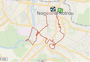
Randonnée Marche de 5,8 km à découvrir à Centre-Val de Loire, Eure-et-Loir, Nogent-le-Rotrou. Cette randonnée est proposée par jeannine grandjean.
Description
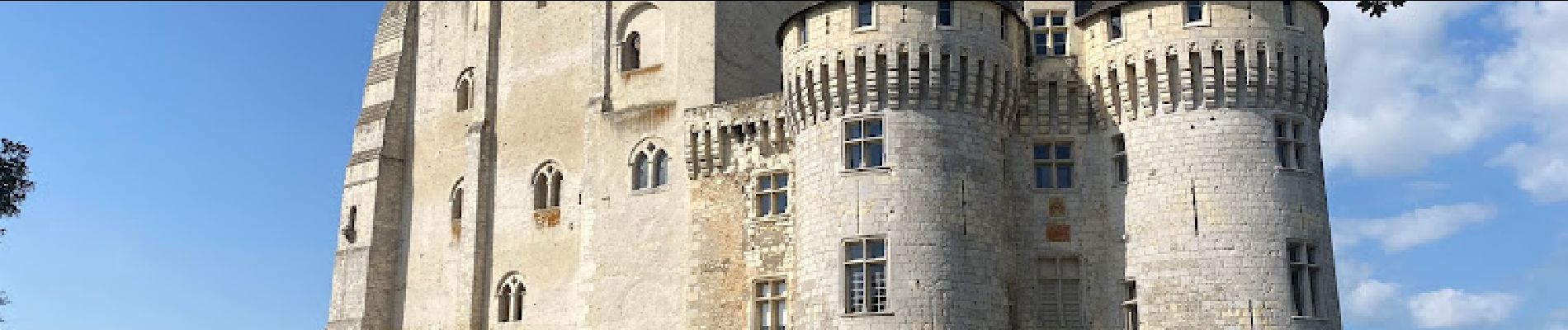
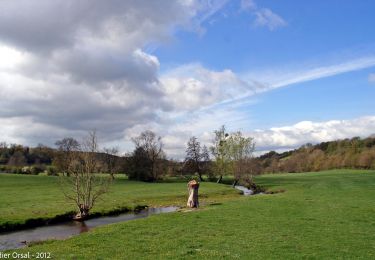
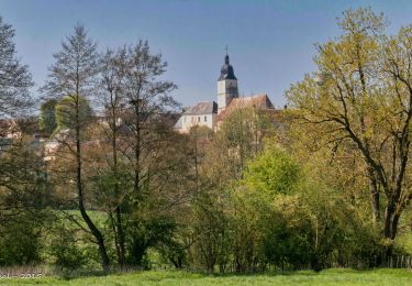
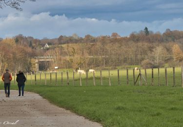
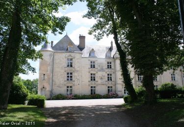
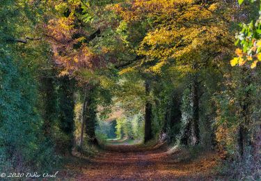
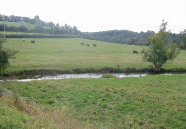
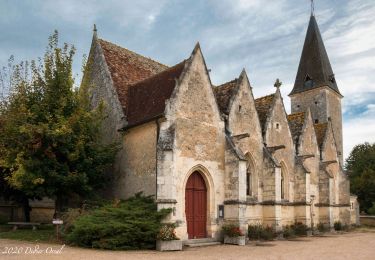
Ce parcours permet de découvrir la petite ville de Nogent le Retrou, son château, son hôtel de ville, ses églises, ses magnifiques demeures, ses jardins ainsi que la promenade le long de la rivière Huisne
Localisation
Pays :
France
Région :
Centre-Val de Loire
Département/Province :
Eure-et-Loir
Commune :
Nogent-le-Rotrou
Localité :
Unknown
Départ:(Dec)
Départ:(UTM)
338528 ; 5354281 (31U) N.
Commentaires
Randonnées à proximité
![Randonnée Marche Trizay-Coutretot-Saint-Serge - 100 Kms Perche Boucle B - Photo](https://media.geolcdn.com/t/375/260/ext.jpg?maxdim=2&url=https%3A%2F%2Fstatic1.geolcdn.com%2Fsiteimages%2Fupload%2Ffiles%2F1553511878bg_sport_marche.png)
![Marche Marche](https://static1.geolcdn.com/sitytour/trail-icons/101.png)
100 Kms Perche Boucle B
Marche
Difficile
(2)
Trizay-Coutretot-Saint-Serge,
Centre-Val de Loire,
Eure-et-Loir,
France
![](/images/other/stat-length.png)
48 km | 56 km-effort
12h 1min
![](https://static1.geolcdn.com/siteimages/upload/files/16400158638029165_repeat_loop_refresh_sync_direction_icon.png)
Oui
![Randonnée Marche Arcisses - Ozée 9,1 km - Photo](https://media.geolcdn.com/t/375/260/ext.jpg?maxdim=2&url=https%3A%2F%2Fstatic1.geolcdn.com%2Fsiteimages%2Fupload%2Ffiles%2F1553511878bg_sport_marche.png)
![Marche Marche](https://static1.geolcdn.com/sitytour/trail-icons/101.png)
Ozée 9,1 km
Marche
Moyen
(1)
Arcisses,
Centre-Val de Loire,
Eure-et-Loir,
France
![](/images/other/stat-length.png)
9,1 km | 11,2 km-effort
2h 32min
![](https://static1.geolcdn.com/siteimages/upload/files/16400158638029165_repeat_loop_refresh_sync_direction_icon.png)
Oui
![Randonnée Marche Nogent-le-Rotrou - Nogent-le-Rotrou - Saint-Victor-de-Buthon 19 km - Photo](https://media.geolcdn.com/t/375/260/c6e34c0a-1640-462d-a835-4ae8958f9be6.jpg&format=jpg&maxdim=2)
![Marche Marche](https://static1.geolcdn.com/sitytour/trail-icons/101.png)
Nogent-le-Rotrou - Saint-Victor-de-Buthon 19 km
Marche
Très difficile
Nogent-le-Rotrou,
Centre-Val de Loire,
Eure-et-Loir,
France
![](/images/other/stat-length.png)
19 km | 23 km-effort
5h 5min
![](https://static1.geolcdn.com/siteimages/upload/files/16400158638029165_repeat_loop_refresh_sync_direction_icon.png)
Non
![Randonnée Marche Nogent-le-Rotrou - Nogent-le-Rotrou - Thiron-Gardais via La Gaudaine 22 km - Photo](https://media.geolcdn.com/t/375/260/8889b3ec-9799-4b99-8939-6db73505b4bd.jpg&format=jpg&maxdim=2)
![Marche Marche](https://static1.geolcdn.com/sitytour/trail-icons/101.png)
Nogent-le-Rotrou - Thiron-Gardais via La Gaudaine 22 km
Marche
Très difficile
Nogent-le-Rotrou,
Centre-Val de Loire,
Eure-et-Loir,
France
![](/images/other/stat-length.png)
22 km | 26 km-effort
6h 0min
![](https://static1.geolcdn.com/siteimages/upload/files/16400158638029165_repeat_loop_refresh_sync_direction_icon.png)
Non
![Randonnée Marche Nogent-le-Rotrou - Nogent-le-Rotrou - Saint-Pierre-la-Bruyère 5,5 km - Photo](https://media.geolcdn.com/t/375/260/eef3d37d-dc69-482d-942f-97ed22dd3c19.jpg&format=jpg&maxdim=2)
![Marche Marche](https://static1.geolcdn.com/sitytour/trail-icons/101.png)
Nogent-le-Rotrou - Saint-Pierre-la-Bruyère 5,5 km
Marche
Facile
Nogent-le-Rotrou,
Centre-Val de Loire,
Eure-et-Loir,
France
![](/images/other/stat-length.png)
5,5 km | 6,9 km-effort
3h 42min
![](https://static1.geolcdn.com/siteimages/upload/files/16400158638029165_repeat_loop_refresh_sync_direction_icon.png)
Non
![Randonnée Marche Saint-Pierre-la-Bruyère - Condé-sur-Huisne - Saint-Pierre-la-Bruyère via Villeray 8,5 km - Photo](https://media.geolcdn.com/t/375/260/3374e628-d3bf-422a-bb99-175704d9ab1f.jpg&format=jpg&maxdim=2)
![Marche Marche](https://static1.geolcdn.com/sitytour/trail-icons/101.png)
Condé-sur-Huisne - Saint-Pierre-la-Bruyère via Villeray 8,5 km
Marche
Facile
Saint-Pierre-la-Bruyère,
Normandie,
Orne,
France
![](/images/other/stat-length.png)
8,5 km | 10 km-effort
3h 23min
![](https://static1.geolcdn.com/siteimages/upload/files/16400158638029165_repeat_loop_refresh_sync_direction_icon.png)
Non
![Randonnée Marche Nogent-le-Rotrou - Nogent-le-Rotrou - Rémalard 18 km - Photo](https://media.geolcdn.com/t/375/260/1835aee7-b0ee-4537-8ec7-1bcd9c9221c3.jpg&format=jpg&maxdim=2)
![Marche Marche](https://static1.geolcdn.com/sitytour/trail-icons/101.png)
Nogent-le-Rotrou - Rémalard 18 km
Marche
Facile
Nogent-le-Rotrou,
Centre-Val de Loire,
Eure-et-Loir,
France
![](/images/other/stat-length.png)
18 km | 21 km-effort
4h 24min
![](https://static1.geolcdn.com/siteimages/upload/files/16400158638029165_repeat_loop_refresh_sync_direction_icon.png)
Non
![Randonnée Marche Arcisses - Autour de Margon - Photo](https://media.geolcdn.com/t/375/260/ext.jpg?maxdim=2&url=https%3A%2F%2Fservices.sitytrail.com%2FGeolivesWS%2FDownloadMedia.ashx%3FTrailID%3D172829%26Media%3D14263_6.jpg)
![Marche Marche](https://static1.geolcdn.com/sitytour/trail-icons/101.png)
Autour de Margon
Marche
Moyen
Arcisses,
Centre-Val de Loire,
Eure-et-Loir,
France
![](/images/other/stat-length.png)
18,2 km | 21 km-effort
3h 25min
![](https://static1.geolcdn.com/siteimages/upload/files/16400158638029165_repeat_loop_refresh_sync_direction_icon.png)
Oui
![Randonnée Marche Perche en Nocé - Nobles Logis (Dancé) 16 km - Photo](https://media.geolcdn.com/t/375/260/8d0efab6-a151-4e32-b833-27bc87018a6f.jpg&format=jpg&maxdim=2)
![Marche Marche](https://static1.geolcdn.com/sitytour/trail-icons/101.png)
Nobles Logis (Dancé) 16 km
Marche
Moyen
Perche en Nocé,
Normandie,
Orne,
France
![](/images/other/stat-length.png)
16,5 km | 19,4 km-effort
4h 14min
![](https://static1.geolcdn.com/siteimages/upload/files/16400158638029165_repeat_loop_refresh_sync_direction_icon.png)
Oui