![](/images/other/stat-length.png)
![Randonnée Marche Simmerath - Balade en boucle autour du Urftsee - Photo](https://media.geolcdn.com/t/1900/400/ext.pjpeg?maxdim=2&url=https%3A%2F%2Fstatic1.geolcdn.com%2Fsiteimages%2Fupload%2Ffiles%2F1553511878bg_sport_marche.png)
Balade en boucle autour du Urftsee
danyhermans1607@gmail.com
Utilisateur
![Longueur](/images/other/stat-length.png)
Longueur
15,7 km
![Altitude max](https://static1.geolcdn.com/siteimages/upload/files/1508320355ic_sort_altitude_max_24dp.png)
Altitude max
519 m
![Dénivelé positif](https://static1.geolcdn.com/siteimages/upload/files/1508320355ic_sort_den_pos_24dp.png)
Dénivelé positif
400 m
![Km-Effort](/images/other/stat-length.png)
Km-Effort
21 km
![Altitude min](https://static1.geolcdn.com/siteimages/upload/files/1508320355ic_sort_altitude_min_24dp.png)
Altitude min
280 m
![Dénivelé négatif](https://static1.geolcdn.com/siteimages/upload/files/1508320355ic_sort_den_neg_24dp.png)
Dénivelé négatif
401 m
![Boucle](https://static1.geolcdn.com/siteimages/upload/files/16400158638029165_repeat_loop_refresh_sync_direction_icon.png)
Boucle
Oui
Date de création :
2023-08-17 15:29:51.807
Dernière modification :
2023-08-17 15:32:09.461
![Marche](https://static1.geolcdn.com/sitytour/trail-icons/101.png)
4h46
Difficulté : Très difficile
![Scannez ce code QR pour ouvrir la randonnée dans l'application SityTrail](https://capi.geolives.com/qq0zvz2zws4bq2lad0pu/sitytour/trails/3775394/qr.png?size=200)
Application GPS de randonnée GRATUITE
À propos
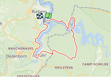
Randonnée Marche de 15,7 km à découvrir à Rhénanie-du-Nord-Westphalie, Région urbaine d'Aix-la-Chapelle, Simmerath. Cette randonnée est proposée par danyhermans1607@gmail.com .
Description
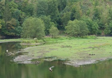
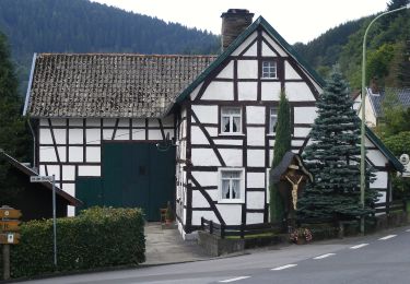
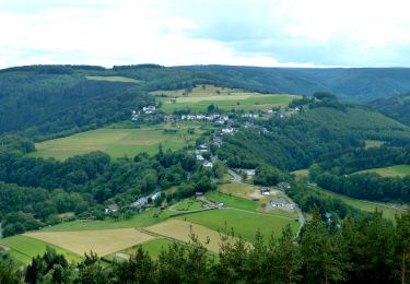
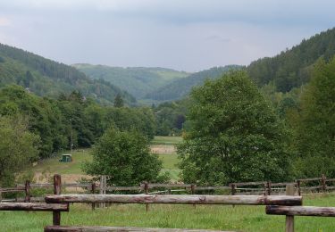
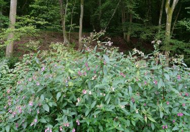
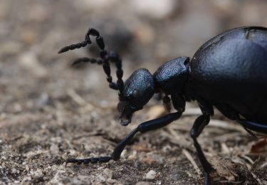
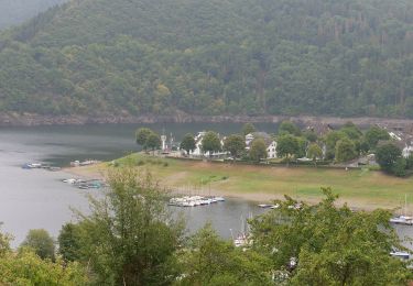
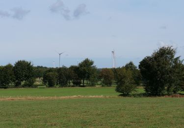
Balade le long d'un bras du lac de retenue, puis traversée d'une fagne et en passant par Einruhr retour le long du lac
Localisation
Pays :
Allemagne
Région :
Rhénanie-du-Nord-Westphalie
Département/Province :
Région urbaine d'Aix-la-Chapelle
Commune :
Simmerath
Localité :
Unknown
Départ:(Dec)
Départ:(UTM)
315083 ; 5609295 (32U) N.
Commentaires
Randonnées à proximité
![Randonnée A pied Simmerath - Rur-Panoramaweg - Photo](https://media.geolcdn.com/t/375/260/2795907d-7526-44c1-9477-0f6134259112.jpeg&format=jpg&maxdim=2)
![A pied A pied](https://static1.geolcdn.com/sitytour/trail-icons/100.png)
Rur-Panoramaweg
A pied
Facile
Simmerath,
Rhénanie-du-Nord-Westphalie,
Région urbaine d'Aix-la-Chapelle,
Allemagne
![](/images/other/stat-length.png)
6,5 km | 8,8 km-effort
1h 59min
![](https://static1.geolcdn.com/siteimages/upload/files/16400158638029165_repeat_loop_refresh_sync_direction_icon.png)
Oui
![Randonnée A pied Simmerath - DE-66 - Photo](https://media.geolcdn.com/t/375/260/fa66a26d-4511-42c8-a062-8ad490b60e8c.jpeg&format=jpg&maxdim=2)
![A pied A pied](https://static1.geolcdn.com/sitytour/trail-icons/100.png)
DE-66
A pied
Facile
Simmerath,
Rhénanie-du-Nord-Westphalie,
Région urbaine d'Aix-la-Chapelle,
Allemagne
![](/images/other/stat-length.png)
5,8 km | 7,8 km-effort
1h 46min
![](https://static1.geolcdn.com/siteimages/upload/files/16400158638029165_repeat_loop_refresh_sync_direction_icon.png)
Oui
![Randonnée A pied Simmerath - Eifelverein OG Eicherscheid - Weg 26 - Photo](https://media.geolcdn.com/t/375/260/fcd757c8-ec1d-4acf-8fb1-17e19fc4113a.jpeg&format=jpg&maxdim=2)
![A pied A pied](https://static1.geolcdn.com/sitytour/trail-icons/100.png)
Eifelverein OG Eicherscheid - Weg 26
A pied
Facile
Simmerath,
Rhénanie-du-Nord-Westphalie,
Région urbaine d'Aix-la-Chapelle,
Allemagne
![](/images/other/stat-length.png)
7,2 km | 9,4 km-effort
2h 8min
![](https://static1.geolcdn.com/siteimages/upload/files/16400158638029165_repeat_loop_refresh_sync_direction_icon.png)
Oui
![Randonnée A pied Simmerath - Eichheck-Runde - Photo](https://media.geolcdn.com/t/375/260/fcd757c8-ec1d-4acf-8fb1-17e19fc4113a.jpeg&format=jpg&maxdim=2)
![A pied A pied](https://static1.geolcdn.com/sitytour/trail-icons/100.png)
Eichheck-Runde
A pied
Facile
Simmerath,
Rhénanie-du-Nord-Westphalie,
Région urbaine d'Aix-la-Chapelle,
Allemagne
![](/images/other/stat-length.png)
8,1 km | 11,5 km-effort
2h 37min
![](https://static1.geolcdn.com/siteimages/upload/files/16400158638029165_repeat_loop_refresh_sync_direction_icon.png)
Oui
![Randonnée A pied Simmerath - DE-75 - Photo](https://media.geolcdn.com/t/375/260/c505253f-52aa-440c-b8a3-7e2fb2ea2c75.jpeg&format=jpg&maxdim=2)
![A pied A pied](https://static1.geolcdn.com/sitytour/trail-icons/100.png)
DE-75
A pied
Moyen
Simmerath,
Rhénanie-du-Nord-Westphalie,
Région urbaine d'Aix-la-Chapelle,
Allemagne
![](/images/other/stat-length.png)
14,9 km | 20 km-effort
4h 35min
![](https://static1.geolcdn.com/siteimages/upload/files/16400158638029165_repeat_loop_refresh_sync_direction_icon.png)
Oui
![Randonnée A pied Simmerath - Rursee-Höhenweg - Photo](https://media.geolcdn.com/t/375/260/9689468a-e6ff-4fc8-b3d8-02d9c76065f6.jpeg&format=jpg&maxdim=2)
![A pied A pied](https://static1.geolcdn.com/sitytour/trail-icons/100.png)
Rursee-Höhenweg
A pied
Facile
Simmerath,
Rhénanie-du-Nord-Westphalie,
Région urbaine d'Aix-la-Chapelle,
Allemagne
![](/images/other/stat-length.png)
11,7 km | 15,6 km-effort
3h 33min
![](https://static1.geolcdn.com/siteimages/upload/files/16400158638029165_repeat_loop_refresh_sync_direction_icon.png)
Oui
![Randonnée A pied Simmerath - Dorfrundgang Rurberg - Photo](https://media.geolcdn.com/t/375/260/ed716069-f580-4f3e-b0ee-2ed7b1660355.jpeg&format=jpg&maxdim=2)
![A pied A pied](https://static1.geolcdn.com/sitytour/trail-icons/100.png)
Dorfrundgang Rurberg
A pied
Facile
Simmerath,
Rhénanie-du-Nord-Westphalie,
Région urbaine d'Aix-la-Chapelle,
Allemagne
![](/images/other/stat-length.png)
4,2 km | 5,4 km-effort
1h 13min
![](https://static1.geolcdn.com/siteimages/upload/files/16400158638029165_repeat_loop_refresh_sync_direction_icon.png)
Oui
![Randonnée A pied Simmerath - Panoramaweg - Photo](https://media.geolcdn.com/t/375/260/be110b12-1459-48ff-ab1e-06f3fa9d3c3d.jpeg&format=jpg&maxdim=2)
![A pied A pied](https://static1.geolcdn.com/sitytour/trail-icons/100.png)
Panoramaweg
A pied
Facile
Simmerath,
Rhénanie-du-Nord-Westphalie,
Région urbaine d'Aix-la-Chapelle,
Allemagne
![](/images/other/stat-length.png)
11 km | 13,3 km-effort
3h 0min
![](https://static1.geolcdn.com/siteimages/upload/files/16400158638029165_repeat_loop_refresh_sync_direction_icon.png)
Non
![Randonnée A pied Simmerath - Dorfrundgang Strauch - Photo](https://media.geolcdn.com/t/375/260/b0345c4f-b492-40b8-ac28-a449591e5453.jpeg&format=jpg&maxdim=2)
![A pied A pied](https://static1.geolcdn.com/sitytour/trail-icons/100.png)
Dorfrundgang Strauch
A pied
Facile
Simmerath,
Rhénanie-du-Nord-Westphalie,
Région urbaine d'Aix-la-Chapelle,
Allemagne
![](/images/other/stat-length.png)
6,5 km | 7,3 km-effort
1h 39min
![](https://static1.geolcdn.com/siteimages/upload/files/16400158638029165_repeat_loop_refresh_sync_direction_icon.png)
Oui