
La Haute Route : J11

Greg813
Utilisateur

Longueur
18,8 km

Altitude max
2372 m

Dénivelé positif
964 m

Km-Effort
34 km

Altitude min
1598 m

Dénivelé négatif
1622 m
Boucle
Non
Date de création :
2023-08-17 06:01:44.132
Dernière modification :
2024-09-15 07:25:10.778
5h07
Difficulté : Difficile

Application GPS de randonnée GRATUITE
À propos
Randonnée Marche de 18,8 km à découvrir à Valais, Viège, Randa. Cette randonnée est proposée par Greg813.
Description
Trek de 10 jours dans le Valais suisse avec Mettons le Monde en Marche. Parcours de la Haute Route Chamonix-Zermatt avec nuits en refuge.
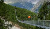
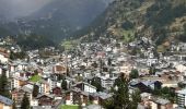
Etape 10 : Europahutte - Zermatt
Pour d'autres photos, voir le site de l'association :
https://mmm-rando.org/la-presque-haute-route-chable-zermatt/
Localisation
Pays :
Suisse
Région :
Valais
Département/Province :
Viège
Commune :
Randa
Localité :
Unknown
Départ:(Dec)
Départ:(UTM)
407722 ; 5106487 (32T) N.
Commentaires
Randonnées à proximité

CHX ZRMT Étape 10 de Rwanda à Zermatt


Marche
Moyen
Randa,
Valais,
Viège,
Suisse

18,5 km | 37 km-effort
6h 9min
Non


2024-09-03_14h09m17_t8979743_arigscheis (nr. 41)


sport
Très facile
Täsch,
Valais,
Viège,
Suisse

9,4 km | 21 km-effort
Inconnu
Oui

Randa - Pont suspendu Charles Kuonen


Marche
Difficile
Randa,
Valais,
Viège,
Suisse

8,4 km | 19,2 km-effort
5h 21min
Oui

Zermatt - stelisee sans télécabines


Marche
Très difficile
Randa,
Valais,
Viège,
Suisse

28 km | 46 km-effort
10h 31min
Oui

Pont Suspendu Randa


Marche
Très difficile
Randa,
Valais,
Viège,
Suisse

9,1 km | 23 km-effort
5h 8min
Non


 SityTrail


