![](/images/other/stat-length.png)
![Randonnée Marche Abriès-Ristolas - L'Echalp au refuge Jervis par le col Lacroix - Photo](https://media.geolcdn.com/t/1900/400/ext.pjpeg?maxdim=2&url=https%3A%2F%2Fstatic1.geolcdn.com%2Fsiteimages%2Fupload%2Ffiles%2F1553511878bg_sport_marche.png)
L'Echalp au refuge Jervis par le col Lacroix
CSMSRANDOS
Utilisateur
![Longueur](/images/other/stat-length.png)
Longueur
11,2 km
![Altitude max](https://static1.geolcdn.com/siteimages/upload/files/1508320355ic_sort_altitude_max_24dp.png)
Altitude max
2312 m
![Dénivelé positif](https://static1.geolcdn.com/siteimages/upload/files/1508320355ic_sort_den_pos_24dp.png)
Dénivelé positif
1161 m
![Km-Effort](/images/other/stat-length.png)
Km-Effort
27 km
![Altitude min](https://static1.geolcdn.com/siteimages/upload/files/1508320355ic_sort_altitude_min_24dp.png)
Altitude min
1709 m
![Dénivelé négatif](https://static1.geolcdn.com/siteimages/upload/files/1508320355ic_sort_den_neg_24dp.png)
Dénivelé négatif
1161 m
![Boucle](https://static1.geolcdn.com/siteimages/upload/files/16400158638029165_repeat_loop_refresh_sync_direction_icon.png)
Boucle
Oui
Date de création :
2023-08-16 08:48:07.452
Dernière modification :
2023-08-16 12:00:45.337
![Marche](https://static1.geolcdn.com/sitytour/trail-icons/101.png)
6h03
Difficulté : Très difficile
![Scannez ce code QR pour ouvrir la randonnée dans l'application SityTrail](https://capi.geolives.com/qq0zvz2zws4bq2lad0pu/sitytour/trails/3773709/qr.png?size=200)
Application GPS de randonnée GRATUITE
À propos
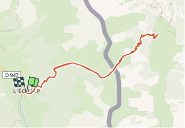
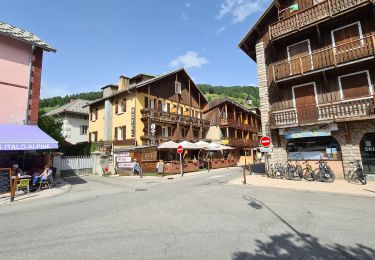
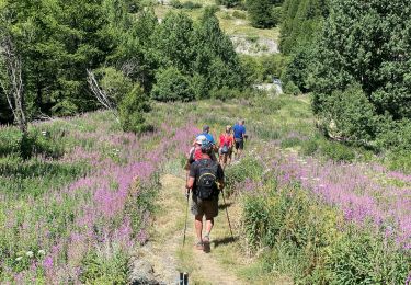
Randonnée Marche de 11,2 km à découvrir à Provence-Alpes-Côte d'Azur, Hautes-Alpes, Abriès-Ristolas. Cette randonnée est proposée par CSMSRANDOS.
Description
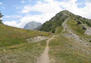
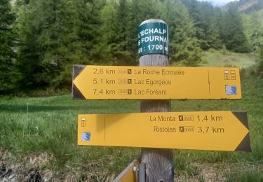
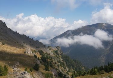
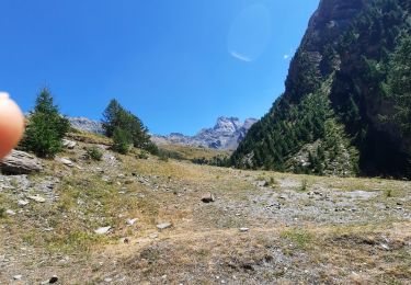
Départ de l'Echalp jusqu’au col La Croix.
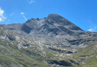
Descente jusqu’au refuge Jervis ( bon repas italien)
Puis retour par le même chemin.
Localisation
Pays :
France
Région :
Provence-Alpes-Côte d'Azur
Département/Province :
Hautes-Alpes
Commune :
Abriès-Ristolas
Localité :
Ristolas
Départ:(Dec)
Départ:(UTM)
341216 ; 4958121 (32T) N.
Commentaires
Randonnées à proximité
![Randonnée Marche Abriès-Ristolas - collette et crête de Gilly - Photo](https://media.geolcdn.com/t/375/260/ext.jpg?maxdim=2&url=https%3A%2F%2Fservices.sitytrail.com%2FGeolivesWS%2FDownloadMedia.ashx%3FTrailID%3D446478%26Media%3D5a2314a0-5704-407c-911d-1beb50f4e518.JPG)
![Marche Marche](https://static1.geolcdn.com/sitytour/trail-icons/101.png)
collette et crête de Gilly
Marche
Facile
(1)
Abriès-Ristolas,
Provence-Alpes-Côte d'Azur,
Hautes-Alpes,
France
![](/images/other/stat-length.png)
6,5 km | 13,7 km-effort
3h 51min
![](https://static1.geolcdn.com/siteimages/upload/files/16400158638029165_repeat_loop_refresh_sync_direction_icon.png)
Oui
![Randonnée Marche Abriès-Ristolas - ABRIES .ECHÀLP. RISTOLAS.LAC EGORGEOU . BOUQUETINS O - Photo](https://media.geolcdn.com/t/375/260/0b5f13ba-92f4-44de-8892-1b1bd667648a.jpg&format=jpg&maxdim=2)
![Marche Marche](https://static1.geolcdn.com/sitytour/trail-icons/101.png)
ABRIES .ECHÀLP. RISTOLAS.LAC EGORGEOU . BOUQUETINS O
Marche
Difficile
Abriès-Ristolas,
Provence-Alpes-Côte d'Azur,
Hautes-Alpes,
France
![](/images/other/stat-length.png)
9,3 km | 14,5 km-effort
3h 1min
![](https://static1.geolcdn.com/siteimages/upload/files/16400158638029165_repeat_loop_refresh_sync_direction_icon.png)
Oui
![Randonnée A pied Bobbio Pellice - (SI E24) Villanova Pellice - Ghigo di Prali - Photo](https://media.geolcdn.com/t/375/260/b59d20aa-b00c-44d5-860a-27761cb78582.jpeg&format=jpg&maxdim=2)
![A pied A pied](https://static1.geolcdn.com/sitytour/trail-icons/100.png)
(SI E24) Villanova Pellice - Ghigo di Prali
A pied
Difficile
Bobbio Pellice,
Piémont,
Turin,
Italie
![](/images/other/stat-length.png)
19 km | 38 km-effort
8h 31min
![](https://static1.geolcdn.com/siteimages/upload/files/16400158638029165_repeat_loop_refresh_sync_direction_icon.png)
Non
![Randonnée Marche Abriès-Ristolas - l echalp, la montat - Photo](https://media.geolcdn.com/t/375/260/987318c0-4e03-46ad-a735-99dd4d7908e8.jpg&format=jpg&maxdim=2)
![Marche Marche](https://static1.geolcdn.com/sitytour/trail-icons/101.png)
l echalp, la montat
Marche
Difficile
Abriès-Ristolas,
Provence-Alpes-Côte d'Azur,
Hautes-Alpes,
France
![](/images/other/stat-length.png)
9,4 km | 18,1 km-effort
4h 51min
![](https://static1.geolcdn.com/siteimages/upload/files/16400158638029165_repeat_loop_refresh_sync_direction_icon.png)
Oui
![Randonnée Marche Abriès-Ristolas - Queyras 08 - Ristolas - Abriès - Photo](https://media.geolcdn.com/t/375/260/8f39446e-4ab6-4158-b028-124d8ed0f858.jpg&format=jpg&maxdim=2)
![Marche Marche](https://static1.geolcdn.com/sitytour/trail-icons/101.png)
Queyras 08 - Ristolas - Abriès
Marche
Très difficile
Abriès-Ristolas,
Provence-Alpes-Côte d'Azur,
Hautes-Alpes,
France
![](/images/other/stat-length.png)
16,5 km | 28 km-effort
8h 2min
![](https://static1.geolcdn.com/siteimages/upload/files/16400158638029165_repeat_loop_refresh_sync_direction_icon.png)
Non
![Randonnée Marche Abriès-Ristolas - Belvédère du Viso - Photo](https://media.geolcdn.com/t/375/260/215f9969-2f60-45f2-92b4-9879664eb7b5.jpg&format=jpg&maxdim=2)
![Marche Marche](https://static1.geolcdn.com/sitytour/trail-icons/101.png)
Belvédère du Viso
Marche
Moyen
Abriès-Ristolas,
Provence-Alpes-Côte d'Azur,
Hautes-Alpes,
France
![](/images/other/stat-length.png)
8,9 km | 12,6 km-effort
2h 27min
![](https://static1.geolcdn.com/siteimages/upload/files/16400158638029165_repeat_loop_refresh_sync_direction_icon.png)
Non
![Randonnée Marche Abriès-Ristolas - Lacroix - Photo](https://media.geolcdn.com/t/375/260/d76ef24d-da62-43ec-9b27-b9679d8c5917.jpg&format=jpg&maxdim=2)
![Marche Marche](https://static1.geolcdn.com/sitytour/trail-icons/101.png)
Lacroix
Marche
Très difficile
Abriès-Ristolas,
Provence-Alpes-Côte d'Azur,
Hautes-Alpes,
France
![](/images/other/stat-length.png)
9,4 km | 22 km-effort
2h 57min
![](https://static1.geolcdn.com/siteimages/upload/files/16400158638029165_repeat_loop_refresh_sync_direction_icon.png)
Oui
![Randonnée Marche Abriès-Ristolas - J11 Queyras 2022 - Photo](https://media.geolcdn.com/t/375/260/bc59477d-5047-48dc-945b-6313b3c2a7b5.jpg&format=jpg&maxdim=2)
![Marche Marche](https://static1.geolcdn.com/sitytour/trail-icons/101.png)
J11 Queyras 2022
Marche
Moyen
Abriès-Ristolas,
Provence-Alpes-Côte d'Azur,
Hautes-Alpes,
France
![](/images/other/stat-length.png)
9,8 km | 22 km-effort
2h 56min
![](https://static1.geolcdn.com/siteimages/upload/files/16400158638029165_repeat_loop_refresh_sync_direction_icon.png)
Oui
![Randonnée Marche Abriès-Ristolas - J10 Queyras 2022 - Photo](https://media.geolcdn.com/t/375/260/6b1abaf5-e070-41a7-b2a8-0b5f74371fc6.jpg&format=jpg&maxdim=2)
![Marche Marche](https://static1.geolcdn.com/sitytour/trail-icons/101.png)
J10 Queyras 2022
Marche
Très difficile
Abriès-Ristolas,
Provence-Alpes-Côte d'Azur,
Hautes-Alpes,
France
![](/images/other/stat-length.png)
22 km | 42 km-effort
6h 12min
![](https://static1.geolcdn.com/siteimages/upload/files/16400158638029165_repeat_loop_refresh_sync_direction_icon.png)
Oui