Randonnée Marche Villers-en-Haye - villers en haye - Photo
 kikkko
kikkko

Utilisateur

© OpenStreetMap contributors
Longueur
Longueur
9,4 km
Altitude max
Altitude max
303 m
Dénivelé positif
Dénivelé positif
152 m
Km-Effort
Km-Effort  
11,4 km
Altitude min
Altitude min
205 m
Dénivelé négatif
Dénivelé négatif
153 m
Boucle
Boucle
Oui
Date de création :
2015-01-14 00:00:00.0
Dernière modification :
2015-01-14 00:00:00.0

(0 Avis)

Marche
Marche
2h42
Difficulté : Facile

Scannez ce code QR pour ouvrir la randonnée dans l'application SityTrail

Application GPS de randonnée GRATUITE

Logo SityTrail SityTrail

IGN / Instituts géographiques

Télécharger SityTrail sur l'App Store Télécharger SityTrail sur Google Play

Logo SityTrail SityTrail World

Le monde est à vous

Télécharger SityTrail sur l'App Store Télécharger SityTrail sur Google Play Télécharger SityTrail sur Huawei AppGallery

À propos

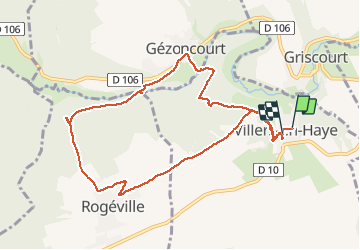
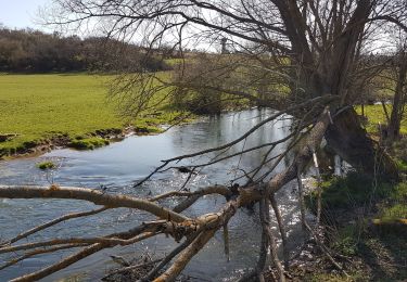
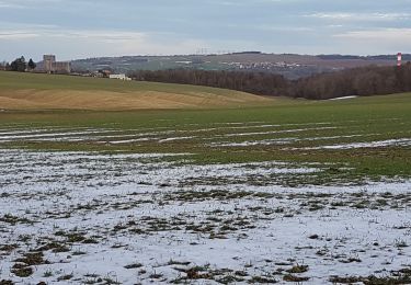
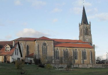
Randonnée Marche de 9,4 km à découvrir à Grand Est, Meurthe-et-Moselle, Villers-en-Haye. Cette randonnée est proposée par kikkko.

Description

En passant par le moulin de Villevaux

Profil altimétrique

Localisation

Pays :
France
Région :
Grand Est
Département/Province :
Meurthe-et-Moselle
Commune :
Villers-en-Haye
Localité :
Unknown
Départ:(Dec)
Départ:(UTM)
280769 ; 5412653 (32U) N.

Randonnées à proximité

Randonnée Vélo Dieulouard - La petite Suisse Lorraine - Circuit n° 11 - Photo
Vélo
tracegps

Vélo

Moyen
(1)
Dieulouard, Grand Est, Meurthe-et-Moselle, France
29 km | 35 km-effort
1h 30min
Oui
Randonnée Marche Saizerais - SAIZERAIS - LES CORNOUILLERS ET LES HOSPICES - Photo
Marche
jean-marie.parachini

Marche

Très facile
Saizerais, Grand Est, Meurthe-et-Moselle, France
8,6 km | 10 km-effort
3h 53min
Oui
Randonnée Marche Rogéville - ROGEVILLE - LA PETITE SUISSE PAR MAMEY ET GEZONCOURT - Photo
Marche
jean-marie.parachini

Marche

Moyen
Rogéville, Grand Est, Meurthe-et-Moselle, France
23 km | 29 km-effort
7h 53min
Oui
Randonnée Marche Dieulouard - DIEULOUARD - VERS BELLEVILLE ET SAIZERAIS - Photo
Marche
jean-marie.parachini

Marche

Facile
Dieulouard, Grand Est, Meurthe-et-Moselle, France
13,9 km | 16,7 km-effort
4h 43min
Oui
Randonnée Marche Gézoncourt - GEZONCOURT - PETITE SUISSE LORRAINE - Photo
Marche
jean-marie.parachini

Marche

Très facile
Gézoncourt, Grand Est, Meurthe-et-Moselle, France
8,5 km | 10,3 km-effort
5h 9min
Oui
Randonnée Marche Dieulouard - LA VIERGE DE BELLEVILLE - Photo
Marche
jean-marie.parachini

Marche

Facile
Dieulouard, Grand Est, Meurthe-et-Moselle, France
13,4 km | 16,1 km-effort
3h 19min
Oui
Randonnée Cheval Saizerais - Le Bois St Ignon - Saizerais - Photo
Cheval
tracegps

Cheval

Facile
Saizerais, Grand Est, Meurthe-et-Moselle, France
6,9 km | 8 km-effort
1h 15min
Oui
Randonnée V.T.T. Saizerais - Le Bois St Ignon - Saizerais - Photo
V.T.T.
tracegps

V.T.T.

Facile
Saizerais, Grand Est, Meurthe-et-Moselle, France
6,9 km | 8 km-effort
45min
Oui
Randonnée Marche Saizerais - Le Bois St Ignon - Saizerais - Photo
Marche
tracegps

Marche

Facile
Saizerais, Grand Est, Meurthe-et-Moselle, France
6,9 km | 8 km-effort
1h 45min
Oui


Fermer
Mes abonnements