![](/images/other/stat-length.png)
![Randonnée Marche Chemilli - Chemilli - Les fours à chanvre 6 km - Photo](https://media.geolcdn.com/t/1900/400/ext.pjpeg?maxdim=2&url=https%3A%2F%2Fstatic1.geolcdn.com%2Fsiteimages%2Fupload%2Ffiles%2F1553511878bg_sport_marche.png)
Chemilli - Les fours à chanvre 6 km
ODDAD78
Utilisateur
![Longueur](/images/other/stat-length.png)
![Altitude max](https://static1.geolcdn.com/siteimages/upload/files/1508320355ic_sort_altitude_max_24dp.png)
![Dénivelé positif](https://static1.geolcdn.com/siteimages/upload/files/1508320355ic_sort_den_pos_24dp.png)
![Km-Effort](/images/other/stat-length.png)
![Altitude min](https://static1.geolcdn.com/siteimages/upload/files/1508320355ic_sort_altitude_min_24dp.png)
![Dénivelé négatif](https://static1.geolcdn.com/siteimages/upload/files/1508320355ic_sort_den_neg_24dp.png)
![Boucle](https://static1.geolcdn.com/siteimages/upload/files/16400158638029165_repeat_loop_refresh_sync_direction_icon.png)
![Marche](https://static1.geolcdn.com/sitytour/trail-icons/101.png)
1h34
Difficulté : Moyen
![V.T.T.](https://static1.geolcdn.com/sitytour/trail-icons/202.png)
28m
Difficulté : Facile
![V.T.C.](https://static1.geolcdn.com/sitytour/trail-icons/203.png)
--
Difficulté : Facile
![Scannez ce code QR pour ouvrir la randonnée dans l'application SityTrail](https://capi.geolives.com/qq0zvz2zws4bq2lad0pu/sitytour/trails/3769139/qr.png?size=200)
Application GPS de randonnée GRATUITE
À propos
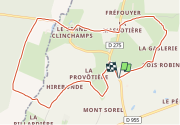
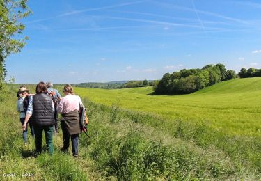
Randonnée Marche de 6 km à découvrir à Normandie, Orne, Chemilli. Cette randonnée est proposée par ODDAD78.
Description
Suivre la rue du Nord jusqu'au lieu-dit Le carrefour.
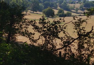
1. Prendre à gauche un chemin rural goudronné qui, par les Maisons Brûlées et Bois Robin, conduit à la Gaslerie (ancienne ferme). Traverser la cour et poursuivre par un chemin en herbe qui, bientôt, vire à gauche (point de vue sur la forêt domaniale de Bellême) et débouche sur la voie communale (VC3).
2. Tourner à gauche. La Petite Lasserie. La Petite Massotière. Au lieu-dit "le Vivier", prendre à gauche la D 275 sur une centaine de mètres.
3. A hauteur du délaissé de route, emprunter à droite un chemin herbeux en pente douce débouchant sur un chemin empierré. Tourner à gauche pour gagner le hameau du Grand Clinchamps. Descendre à droite la D 644. Franchir le ruisseau de Clinchamps. Ferme des Brianderies. Poursuivre tout droit.
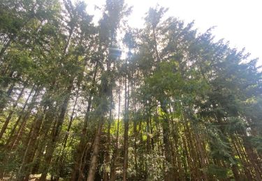
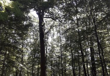
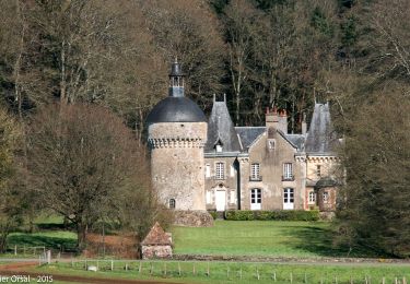
4. A l'orée de la forêt de Clinchamps, prendre à gauche un chemin empierré. Passer devant la Roiserie. Toujours en lisière de forêt, continuer par un chemin en herbe. A l'entrée du sous-bois, quitter ce chemin pour virer à gauche en descendant. Jolie vue, à droite, sur l'ancien manoir de la Pillardière (aujourd'hui ce site accueille le jardin remarquable "Le jardin de Montperthuis"). Traverser à nouveau le ruisseau de Clinchamps sur une passerelle et remonter pour rejoindre la VC2.
5. Tourner à gauche. Hirebonde. La Provostière (four à chanvre bien conservé).
6. Prendre à droite un chemin en herbe qui contourne une parcelle et revient sur la VC2. A droite.
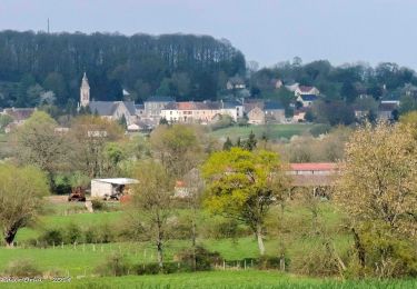
Arrivé dans le bourg de Chemilli, face à l'église, tourner à droite.
(Pas à pas : Rando-Perche)
Localisation
Commentaires
Randonnées à proximité
![Randonnée Marche Belforêt-en-Perche - La Perrière, forêt et village - Photo](https://media.geolcdn.com/t/375/260/577dee63-88bb-4820-9f32-19708dbf9028.jpg&format=jpg&maxdim=2)
![Marche Marche](https://static1.geolcdn.com/sitytour/trail-icons/101.png)
Marche
![](/images/other/stat-length.png)
![](https://static1.geolcdn.com/siteimages/upload/files/16400158638029165_repeat_loop_refresh_sync_direction_icon.png)
![Randonnée Marche Belforêt-en-Perche - le chêne de l'école - Photo](https://media.geolcdn.com/t/375/260/ff98d102-5639-4196-8c72-5f92c76ce997.jpg&format=jpg&maxdim=2)
![Marche Marche](https://static1.geolcdn.com/sitytour/trail-icons/101.png)
Marche
![](/images/other/stat-length.png)
![](https://static1.geolcdn.com/siteimages/upload/files/16400158638029165_repeat_loop_refresh_sync_direction_icon.png)
![Randonnée Marche Belforêt-en-Perche - La Perrière - Saint-Germain-de-la-Coudre via Bellême (TCP) 28 km - Photo](https://media.geolcdn.com/t/375/260/f8f9cc81-98b3-4885-ae43-f599f03cc6ff.jpg&format=jpg&maxdim=2)
![Marche Marche](https://static1.geolcdn.com/sitytour/trail-icons/101.png)
Marche
![](/images/other/stat-length.png)
![](https://static1.geolcdn.com/siteimages/upload/files/16400158638029165_repeat_loop_refresh_sync_direction_icon.png)
![Randonnée Marche Belforêt-en-Perche - La Perrière - Saint-Germain-de-la-Coudre via Igé (TCP) 27 km - Photo](https://media.geolcdn.com/t/375/260/e70793eb-3e3a-4fb9-8791-69252ddd8772.jpg&format=jpg&maxdim=2)
![Marche Marche](https://static1.geolcdn.com/sitytour/trail-icons/101.png)
Marche
![](/images/other/stat-length.png)
![](https://static1.geolcdn.com/siteimages/upload/files/16400158638029165_repeat_loop_refresh_sync_direction_icon.png)
![Randonnée Marche Belforêt-en-Perche - La Perrière - Mortagne-au-Perche (TCP) 29 km - Photo](https://media.geolcdn.com/t/375/260/d8328879-50fd-44ca-9e33-04c0ec1d4331.jpg&format=jpg&maxdim=2)
![Marche Marche](https://static1.geolcdn.com/sitytour/trail-icons/101.png)
Marche
![](/images/other/stat-length.png)
![](https://static1.geolcdn.com/siteimages/upload/files/16400158638029165_repeat_loop_refresh_sync_direction_icon.png)
![Randonnée Marche Belforêt-en-Perche - La Perrière : village millénaire - Photo](https://media.geolcdn.com/t/375/260/ext.jpg?maxdim=2&url=https%3A%2F%2Fservices.sitytrail.com%2FGeolivesWS%2FDownloadMedia.ashx%3FTrailID%3D111665%26Media%3D7903_3.jpg)
![Marche Marche](https://static1.geolcdn.com/sitytour/trail-icons/101.png)
Marche
![](/images/other/stat-length.png)
![](https://static1.geolcdn.com/siteimages/upload/files/16400158638029165_repeat_loop_refresh_sync_direction_icon.png)
![Randonnée Marche Belforêt-en-Perche - la perrière par la forêt - Photo](https://media.geolcdn.com/t/375/260/dc5026c3-20c4-40ca-bab8-55b19f74d196.jpg&format=jpg&maxdim=2)
![Marche Marche](https://static1.geolcdn.com/sitytour/trail-icons/101.png)
Marche
![](/images/other/stat-length.png)
![](https://static1.geolcdn.com/siteimages/upload/files/16400158638029165_repeat_loop_refresh_sync_direction_icon.png)
![Randonnée Marche Belforêt-en-Perche - fourneaux gr jusqu'au ruisseau - Photo](https://media.geolcdn.com/t/375/260/b31f6ae7-3d4c-4741-ab3e-a7d27ca40061.jpg&format=jpg&maxdim=2)
![Marche Marche](https://static1.geolcdn.com/sitytour/trail-icons/101.png)
Marche
![](/images/other/stat-length.png)
![](https://static1.geolcdn.com/siteimages/upload/files/16400158638029165_repeat_loop_refresh_sync_direction_icon.png)
![Randonnée Voiture Belforêt-en-Perche - 2024-12-11 VduP les Chaises - Photo](https://media.geolcdn.com/t/375/260/ext.jpg?maxdim=2&url=https%3A%2F%2Fstatic1.geolcdn.com%2Fsiteimages%2Fupload%2Ffiles%2F15247431544x4.jpg)
![Voiture Voiture](https://static1.geolcdn.com/sitytour/trail-icons/401.png)
Voiture
![](/images/other/stat-length.png)
![](https://static1.geolcdn.com/siteimages/upload/files/16400158638029165_repeat_loop_refresh_sync_direction_icon.png)