Randonnée Marche Lanuéjols - aiguebonne riviere - Photo

aiguebonne riviere

 lavit.pascal
lavit.pascal

Utilisateur

© OpenStreetMap contributors
Longueur
Longueur
10,2 km
Altitude max
Altitude max
1112 m
Dénivelé positif
Dénivelé positif
457 m
Km-Effort
Km-Effort  
15 km
Altitude min
Altitude min
713 m
Dénivelé négatif
Dénivelé négatif
71 m
Boucle
Boucle
Non
Date de création :
2023-08-06 13:29:12.083
Dernière modification :
2023-08-06 14:18:05.148

(0 Avis)

Marche
Marche
48m
Difficulté : Difficile

Scannez ce code QR pour ouvrir la randonnée dans l'application SityTrail

Application GPS de randonnée GRATUITE

Logo SityTrail SityTrail

IGN / Instituts géographiques

Télécharger SityTrail sur l'App Store Télécharger SityTrail sur Google Play

Logo SityTrail SityTrail World

Le monde est à vous

Télécharger SityTrail sur l'App Store Télécharger SityTrail sur Google Play Télécharger SityTrail sur Huawei AppGallery

À propos

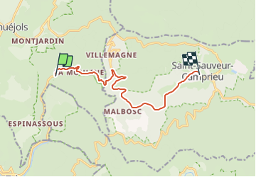
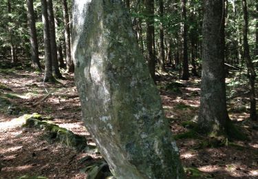
Randonnée Marche de 10,2 km à découvrir à Occitanie, Gard, Lanuéjols. Cette randonnée est proposée par lavit.pascal.

Description

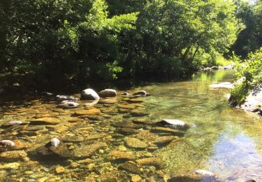
rivière avec Rump et Klara

Profil altimétrique

Localisation

Pays :
France
Région :
Occitanie
Département/Province :
Gard
Commune :
Lanuéjols
Localité :
Unknown
Départ:(UTM)
532528 ; 4884534 (31T) N.

Randonnées à proximité

Randonnée Marche Saint-Sauveur-Camprieu - Dourbies Camprieu boucle - Photo
Marche
GUIDE
Roger Philippe Wallez

Marche

Très difficile
Saint-Sauveur-Camprieu, Occitanie, Gard, France
21 km | 29 km-effort
7h 34min
Non
Randonnée Marche Trèves - rando 2 jours  - Photo
Marche
GUIDE
nadinebondoux

Marche

Moyen
Trèves, Occitanie, Gard, France
8,9 km | 15,6 km-effort
2h 56min
Non
Randonnée Marche Trèves - st firmin - Photo
Marche
aldeu

Marche

Moyen
(1)
Trèves, Occitanie, Gard, France
6,9 km | 11,9 km-effort
2h 38min
Oui
Randonnée Marche Trèves - Trêves via Dourbies - Photo
Marche
GUIDE
Roger Philippe Wallez

Marche

Très difficile
Trèves, Occitanie, Gard, France
163 km | 205 km-effort
10h 6min
Non
Randonnée Marche Lanuéjols - Boucle Lanuejols - Pont de Claperousse - Photo
Marche
LBarel

Marche

Très facile
Lanuéjols, Occitanie, Gard, France
7,4 km | 9,2 km-effort
2h 0min
Oui
Randonnée Marche Lanuéjols - Commeiras - Photo
Marche
boudpn

Marche

Lanuéjols, Occitanie, Gard, France
16,3 km | 24 km-effort
6h 23min
Oui
Randonnée A pied Lanuéjols - 48 Gorges du Trevezel 11 06 17 - Photo
A pied
silvestreclaudine

A pied

Moyen
Lanuéjols, Occitanie, Gard, France
18,7 km | 30 km-effort
Inconnu
Oui
Randonnée Marche Trèves - trevezel in live - Photo
Marche
CASSISFRAMBOISE

Marche

Très difficile
Trèves, Occitanie, Gard, France
17,6 km | 30 km-effort
4h 51min
Oui
Randonnée A pied Saint-Sauveur-Camprieu - GR 66A - Photo
A pied
GUIDE+

A pied

Facile
Saint-Sauveur-Camprieu, Occitanie, Gard, France
10,6 km | 14,3 km-effort
3h 14min
Non


Fermer
Mes abonnements