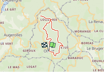
![](/images/other/stat-length.png)
![Randonnée Marche Olmet - Olmet_Chateau_Faye - Photo](https://media.geolcdn.com/t/1900/400/03bd1c7f-f33d-4567-a966-aad40435fd04.jpg&format=pjpeg&maxdim=2)
Olmet_Chateau_Faye
jagarnier
Utilisateur GUIDE
![Longueur](/images/other/stat-length.png)
![Altitude max](https://static1.geolcdn.com/siteimages/upload/files/1508320355ic_sort_altitude_max_24dp.png)
![Dénivelé positif](https://static1.geolcdn.com/siteimages/upload/files/1508320355ic_sort_den_pos_24dp.png)
![Km-Effort](/images/other/stat-length.png)
![Altitude min](https://static1.geolcdn.com/siteimages/upload/files/1508320355ic_sort_altitude_min_24dp.png)
![Dénivelé négatif](https://static1.geolcdn.com/siteimages/upload/files/1508320355ic_sort_den_neg_24dp.png)
![Boucle](https://static1.geolcdn.com/siteimages/upload/files/16400158638029165_repeat_loop_refresh_sync_direction_icon.png)
![Marche](https://static1.geolcdn.com/sitytour/trail-icons/101.png)
3h45
Difficulté : Moyen
![Scannez ce code QR pour ouvrir la randonnée dans l'application SityTrail](https://capi.geolives.com/qq0zvz2zws4bq2lad0pu/sitytour/trails/3759528/qr.png?size=200)
Application GPS de randonnée GRATUITE
À propos
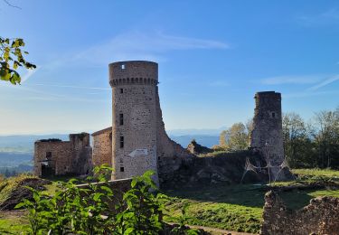
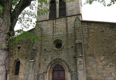
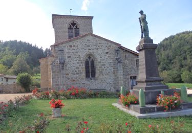
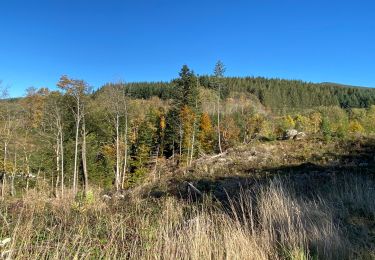
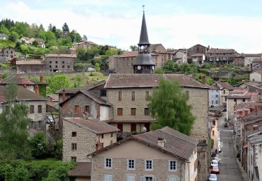
Randonnée Marche de 12,4 km à découvrir à Auvergne-Rhône-Alpes, Puy-de-Dôme, Olmet. Cette randonnée est proposée par jagarnier.
Description
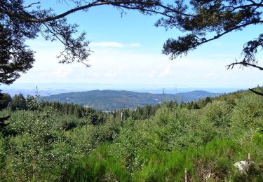
"Un vieux chemin grimpe là-haut, d'étage en étage, sans rien voir d'autres que les rames plates des fayards. En octobre, les branches mouillées dont le vert tourne au jaune, au blond. Le chemin continue de monter sous le grignotement de la pluie, entre ces ramages de feuilles, comme s'il passait par des salles peintes et illuminées." Henri POURRAT
Localisation
Commentaires
Randonnées à proximité
![Randonnée A pied Marat - Saint-James - Photo](https://media.geolcdn.com/t/375/260/a2bced50-ee56-4ce5-9a1f-b4d5a4a068f1.jpeg&format=jpg&maxdim=2)
![A pied A pied](https://static1.geolcdn.com/sitytour/trail-icons/100.png)
A pied
![](/images/other/stat-length.png)
![](https://static1.geolcdn.com/siteimages/upload/files/16400158638029165_repeat_loop_refresh_sync_direction_icon.png)
![Randonnée A pied Marat - Le Communal de Rucheix - Photo](https://media.geolcdn.com/t/375/260/1e257f52-82b8-49c1-82e6-80dcbc6e086c.jpeg&format=jpg&maxdim=2)
![A pied A pied](https://static1.geolcdn.com/sitytour/trail-icons/100.png)
A pied
![](/images/other/stat-length.png)
![](https://static1.geolcdn.com/siteimages/upload/files/16400158638029165_repeat_loop_refresh_sync_direction_icon.png)
![Randonnée Marche Olmet - Olmet_Chateau-de-la-Faye_T - Photo](https://media.geolcdn.com/t/375/260/e0d34068-bfd4-4ac8-8903-92f7c0b63772.jpg&format=jpg&maxdim=2)
![Marche Marche](https://static1.geolcdn.com/sitytour/trail-icons/101.png)
Marche
![](/images/other/stat-length.png)
![](https://static1.geolcdn.com/siteimages/upload/files/16400158638029165_repeat_loop_refresh_sync_direction_icon.png)
![Randonnée A pied Olmet - Le Chateau de la Faye - Photo](https://media.geolcdn.com/t/375/260/f291cdbc-0827-471d-b2b7-7f17f57ee6c7.jpeg&format=jpg&maxdim=2)
![A pied A pied](https://static1.geolcdn.com/sitytour/trail-icons/100.png)
A pied
![](/images/other/stat-length.png)
![](https://static1.geolcdn.com/siteimages/upload/files/16400158638029165_repeat_loop_refresh_sync_direction_icon.png)
![Randonnée A pied Saint-Gervais-sous-Meymont - Autour de la Maison du Parc - Photo](https://media.geolcdn.com/t/375/260/0cb21de0-a948-4a11-a8b1-73f69021aafa.jpeg&format=jpg&maxdim=2)
![A pied A pied](https://static1.geolcdn.com/sitytour/trail-icons/100.png)
A pied
![](/images/other/stat-length.png)
![](https://static1.geolcdn.com/siteimages/upload/files/16400158638029165_repeat_loop_refresh_sync_direction_icon.png)
![Randonnée Marche La Renaudie - Le circuit des ponts - Photo](https://media.geolcdn.com/t/375/260/0b9f0d27-be20-4e4f-adcf-f6efe26f9445.jpg&format=jpg&maxdim=2)
![Marche Marche](https://static1.geolcdn.com/sitytour/trail-icons/101.png)
Marche
![](/images/other/stat-length.png)
![](https://static1.geolcdn.com/siteimages/upload/files/16400158638029165_repeat_loop_refresh_sync_direction_icon.png)
![Marche Marche](https://static1.geolcdn.com/sitytour/trail-icons/101.png)
Marche
![](/images/other/stat-length.png)
![](https://static1.geolcdn.com/siteimages/upload/files/16400158638029165_repeat_loop_refresh_sync_direction_icon.png)
![Randonnée Marche Olmet - Olmet_Ruisseaux - Photo](https://media.geolcdn.com/t/375/260/0878d6d3-1e6c-43cb-9e8e-366251fbcb27.jpg&format=jpg&maxdim=2)
![Marche Marche](https://static1.geolcdn.com/sitytour/trail-icons/101.png)
Marche
![](/images/other/stat-length.png)
![](https://static1.geolcdn.com/siteimages/upload/files/16400158638029165_repeat_loop_refresh_sync_direction_icon.png)
![Randonnée Marche Le Brugeron - Brugeron_Puy_Gros - Photo](https://media.geolcdn.com/t/375/260/b1ee8ce2-69bd-49ac-abe0-df65f9e4bccd.jpg&format=jpg&maxdim=2)
![Marche Marche](https://static1.geolcdn.com/sitytour/trail-icons/101.png)
Marche
![](/images/other/stat-length.png)
![](https://static1.geolcdn.com/siteimages/upload/files/16400158638029165_repeat_loop_refresh_sync_direction_icon.png)