


10,8 km | 13,8 km-effort

Randonnées de Vélo Loisir Provence GUIDE+


Application GPS de randonnée GRATUITE
 SityTrail
IGN / Instituts géographiques
SityTrail World
Le monde est à vous
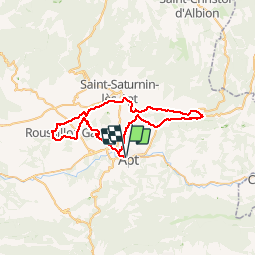
Randonnée Vélo de 51 km à découvrir à Provence-Alpes-Côte d'Azur, Vaucluse, Apt. Cette randonnée est proposée par Vélo Loisir Provence.
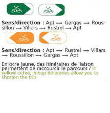
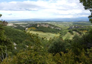
Un itinéraire haut en couleurs ! Par de petites routes pittoresques et peu fréquentées, cet itinéraire, accessible à tous, traverse quelques-uns des plus beaux paysages et des villages les plus remarquables du Parc naturel régional du Luberon. Terre de matières et de couleurs où la lumière joue les contrastes des saisons, les gisements d’ocre de Vaucluse sont des sites naturels exceptionnels. Laissez-vous imprégner par la beauté magique de ces lieux ! Les liaisons permettent de raccourir l'itinéraire : libre à vous de vous balader 15 km sur une petite boucle. Ce parcours emprunte des petites routes à proximité des sites ocriers. Vous ne serez pas amenés à pédaler dans les sentiers d'ocres !


Marche

Marche
Vélo

Marche
Marche
Marche
Marche
Marche
Marche
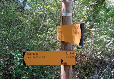
Très mal balisé
superbe parcours villages magnifiques cadre agréable