![](/images/other/stat-length.png)
![Randonnée Marche Lüsen - Luson - Lüsner Alm - Sommet du Campill - Photo](https://media.geolcdn.com/t/1900/400/4e1953fb-b50a-4fca-85d5-0eb9ec465125.jpg&format=pjpeg&maxdim=2)
Lüsner Alm - Sommet du Campill
VacheKiri67
Utilisateur
![Longueur](/images/other/stat-length.png)
![Altitude max](https://static1.geolcdn.com/siteimages/upload/files/1508320355ic_sort_altitude_max_24dp.png)
![Dénivelé positif](https://static1.geolcdn.com/siteimages/upload/files/1508320355ic_sort_den_pos_24dp.png)
![Km-Effort](/images/other/stat-length.png)
![Altitude min](https://static1.geolcdn.com/siteimages/upload/files/1508320355ic_sort_altitude_min_24dp.png)
![Dénivelé négatif](https://static1.geolcdn.com/siteimages/upload/files/1508320355ic_sort_den_neg_24dp.png)
![Boucle](https://static1.geolcdn.com/siteimages/upload/files/16400158638029165_repeat_loop_refresh_sync_direction_icon.png)
![Marche](https://static1.geolcdn.com/sitytour/trail-icons/101.png)
5h13
Difficulté : Moyen
![Scannez ce code QR pour ouvrir la randonnée dans l'application SityTrail](https://capi.geolives.com/qq0zvz2zws4bq2lad0pu/sitytour/trails/3740348/qr.png?size=200)
Application GPS de randonnée GRATUITE
À propos
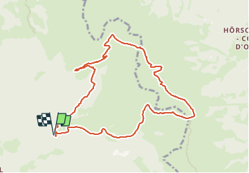
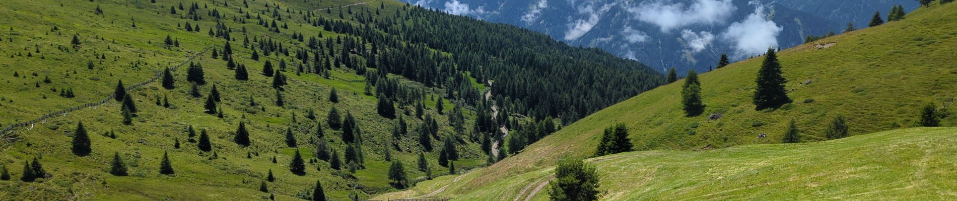
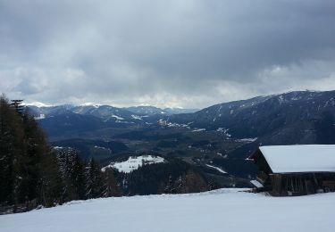
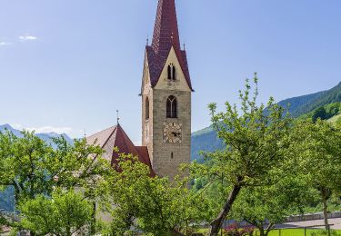
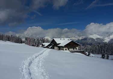
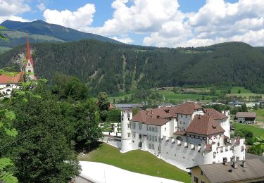
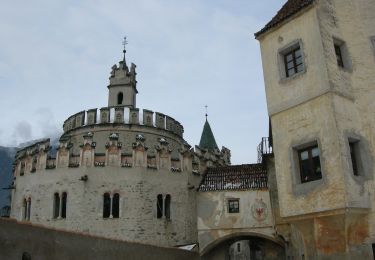
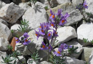
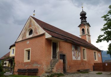
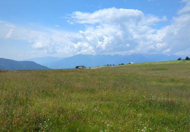
Randonnée Marche de 10,5 km à découvrir à Trentin-Haut-Adige, Haut-Adige, Lüsen - Luson. Cette randonnée est proposée par VacheKiri67.
Description
Faite le 19/07/2023. D'après "Wandern in Südtirol : Eisacktal, das Tal der Wege - 6 Zum Campill-Gipfel auf der Lüsner Alm". Durée indiquée pour le circuit : 4h00. Parking payant au Schwaiger Böden P3. Nous nous sommes abrités à 6 dans la toute petite chapelle au Jakob-stöckl pendant un orage subit.
Localisation
Commentaires
Randonnées à proximité
![Randonnée A pied St. Lorenzen - San Lorenzo di Sebato - Wanderweg 10 - Photo](https://media.geolcdn.com/t/375/260/db563c96-c89f-42fe-89e3-af6be66e3232.jpeg&format=jpg&maxdim=2)
![A pied A pied](https://static1.geolcdn.com/sitytour/trail-icons/100.png)
A pied
![](/images/other/stat-length.png)
![](https://static1.geolcdn.com/siteimages/upload/files/16400158638029165_repeat_loop_refresh_sync_direction_icon.png)
![Randonnée A pied Lüsen - Luson - Panoramaweg - Photo](https://media.geolcdn.com/t/375/260/98e6eae6-9f33-4233-a38f-215ddc16a805.jpeg&format=jpg&maxdim=2)
![A pied A pied](https://static1.geolcdn.com/sitytour/trail-icons/100.png)
A pied
![](/images/other/stat-length.png)
![](https://static1.geolcdn.com/siteimages/upload/files/16400158638029165_repeat_loop_refresh_sync_direction_icon.png)
![Randonnée A pied Lüsen - Luson - Wanderweg 3b - Lüsen - Photo](https://media.geolcdn.com/t/375/260/98e6eae6-9f33-4233-a38f-215ddc16a805.jpeg&format=jpg&maxdim=2)
![A pied A pied](https://static1.geolcdn.com/sitytour/trail-icons/100.png)
A pied
![](/images/other/stat-length.png)
![](https://static1.geolcdn.com/siteimages/upload/files/16400158638029165_repeat_loop_refresh_sync_direction_icon.png)
![Randonnée A pied Rodeneck - Rodengo - Wanderroute 68 - Photo](https://media.geolcdn.com/t/375/260/34e9c99b-2ba6-41db-a7bc-8b504f1938d4.jpeg&format=jpg&maxdim=2)
![A pied A pied](https://static1.geolcdn.com/sitytour/trail-icons/100.png)
A pied
![](/images/other/stat-length.png)
![](https://static1.geolcdn.com/siteimages/upload/files/16400158638029165_repeat_loop_refresh_sync_direction_icon.png)
![Randonnée A pied St. Lorenzen - San Lorenzo di Sebato - Wanderroute 67 - Photo](https://media.geolcdn.com/t/375/260/f7846c4c-abcd-4057-983b-fc1896884cc8.jpeg&format=jpg&maxdim=2)
![A pied A pied](https://static1.geolcdn.com/sitytour/trail-icons/100.png)
A pied
![](/images/other/stat-length.png)
![](https://static1.geolcdn.com/siteimages/upload/files/16400158638029165_repeat_loop_refresh_sync_direction_icon.png)
![Randonnée A pied Rodeneck - Rodengo - IT-4 - Photo](https://media.geolcdn.com/t/375/260/aa769cfd-1240-4b70-9616-a3b6f423f3b5.jpeg&format=jpg&maxdim=2)
![A pied A pied](https://static1.geolcdn.com/sitytour/trail-icons/100.png)
A pied
![](/images/other/stat-length.png)
![](https://static1.geolcdn.com/siteimages/upload/files/16400158638029165_repeat_loop_refresh_sync_direction_icon.png)
![Randonnée A pied Lüsen - Luson - IT-1 - Photo](https://media.geolcdn.com/t/375/260/796cd8a5-765b-46ce-b8a7-863d644cdf09.jpeg&format=jpg&maxdim=2)
![A pied A pied](https://static1.geolcdn.com/sitytour/trail-icons/100.png)
A pied
![](/images/other/stat-length.png)
![](https://static1.geolcdn.com/siteimages/upload/files/16400158638029165_repeat_loop_refresh_sync_direction_icon.png)
![Randonnée A pied Lüsen - Luson - IT-2 - Photo](https://media.geolcdn.com/t/375/260/e6b1b829-6a2f-468d-aeb9-0b707a1d9e2e.jpeg&format=jpg&maxdim=2)
![A pied A pied](https://static1.geolcdn.com/sitytour/trail-icons/100.png)
A pied
![](/images/other/stat-length.png)
![](https://static1.geolcdn.com/siteimages/upload/files/16400158638029165_repeat_loop_refresh_sync_direction_icon.png)
![Randonnée Marche Lüsen - Luson - Lüsner Alm - Rastnerhütte - Photo](https://media.geolcdn.com/t/375/260/53568d57-db9a-4244-bdfb-b706a0b08f6b.jpg&format=jpg&maxdim=2)
![Marche Marche](https://static1.geolcdn.com/sitytour/trail-icons/101.png)
Marche
![](/images/other/stat-length.png)
![](https://static1.geolcdn.com/siteimages/upload/files/16400158638029165_repeat_loop_refresh_sync_direction_icon.png)