![](/images/other/stat-length.png)
![Randonnée Randonnée équestre Trévou-Tréguignec - Saint-Brieuc _ Bretagne - Photo](https://media.geolcdn.com/t/1900/400/ext.pjpeg?maxdim=2&url=https%3A%2F%2Fstatic1.geolcdn.com%2Fsiteimages%2Fupload%2Ffiles%2F1524743154cheval.jpg)
Saint-Brieuc _ Bretagne
Sefi78
Utilisateur
![Longueur](/images/other/stat-length.png)
Longueur
178 km
![Altitude max](https://static1.geolcdn.com/siteimages/upload/files/1508320355ic_sort_altitude_max_24dp.png)
Altitude max
108 m
![Dénivelé positif](https://static1.geolcdn.com/siteimages/upload/files/1508320355ic_sort_den_pos_24dp.png)
Dénivelé positif
2216 m
![Km-Effort](/images/other/stat-length.png)
Km-Effort
208 km
![Altitude min](https://static1.geolcdn.com/siteimages/upload/files/1508320355ic_sort_altitude_min_24dp.png)
Altitude min
-3 m
![Dénivelé négatif](https://static1.geolcdn.com/siteimages/upload/files/1508320355ic_sort_den_neg_24dp.png)
Dénivelé négatif
2228 m
![Boucle](https://static1.geolcdn.com/siteimages/upload/files/16400158638029165_repeat_loop_refresh_sync_direction_icon.png)
Boucle
Non
Date de création :
2023-07-19 17:23:48.646
Dernière modification :
2023-07-19 18:05:06.728
![Randonnée équestre](https://static1.geolcdn.com/sitytour/trail-icons/301.png)
27h19
Difficulté : Facile
![Scannez ce code QR pour ouvrir la randonnée dans l'application SityTrail](https://capi.geolives.com/qq0zvz2zws4bq2lad0pu/sitytour/trails/3740183/qr.png?size=200)
Application GPS de randonnée GRATUITE
À propos
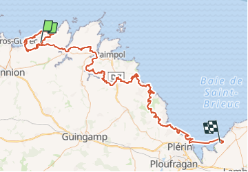
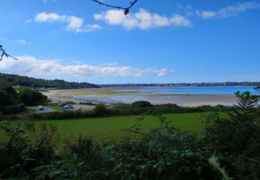
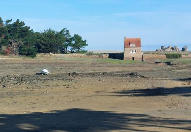
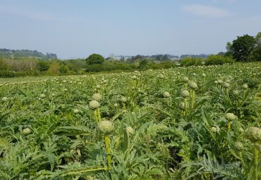
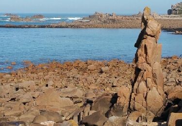
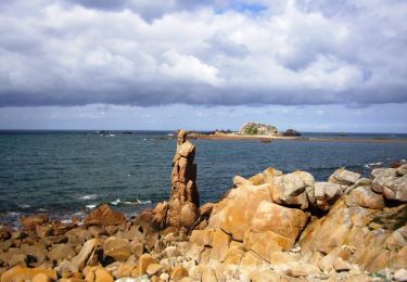
Randonnée Randonnée équestre de 178 km à découvrir à Bretagne, Côtes-d'Armor, Trévou-Tréguignec. Cette randonnée est proposée par Sefi78.
Description
5 étapes :
Trévou-Tréguignec / Trévou-Tréguignec (43 km)
Trévou-Tréguignec / Plourivo (35km)
Plourivo / Lanloup (30km)
Lanloup / Lantic Lantic (31km)
Lantic / Morieux (38km)
Localisation
Pays :
France
Région :
Bretagne
Département/Province :
Côtes-d'Armor
Commune :
Trévou-Tréguignec
Localité :
Unknown
Départ:(Dec)
Départ:(UTM)
476151 ; 5406277 (30U) N.
Commentaires
Randonnées à proximité
![Randonnée Marche Penvénan - Penvénan Port Blanc - GR34 Nantouar - 26.7km 305m 6h (1h) - 2024 07 05 - Photo](https://media.geolcdn.com/t/375/260/bda985c5-8238-4996-9606-a096b85b3cb7.jpg&format=jpg&maxdim=2)
![Marche Marche](https://static1.geolcdn.com/sitytour/trail-icons/101.png)
Penvénan Port Blanc - GR34 Nantouar - 26.7km 305m 6h (1h) - 2024 07 05
Marche
Moyen
Penvénan,
Bretagne,
Côtes-d'Armor,
France
![](/images/other/stat-length.png)
27 km | 31 km-effort
6h 0min
![](https://static1.geolcdn.com/siteimages/upload/files/16400158638029165_repeat_loop_refresh_sync_direction_icon.png)
Oui
![Randonnée Marche Penvénan - Buguélès Penvénan - GR34 Raluzet Placen Amic - 11.4km 160m 2h50 - 2023 09 15 - Photo](https://media.geolcdn.com/t/375/260/e4423474-b66f-4ea0-a231-fcf6eb14eb9f.jpg&format=jpg&maxdim=2)
![Marche Marche](https://static1.geolcdn.com/sitytour/trail-icons/101.png)
Buguélès Penvénan - GR34 Raluzet Placen Amic - 11.4km 160m 2h50 - 2023 09 15
Marche
Difficile
Penvénan,
Bretagne,
Côtes-d'Armor,
France
![](/images/other/stat-length.png)
11,4 km | 13,6 km-effort
2h 50min
![](https://static1.geolcdn.com/siteimages/upload/files/16400158638029165_repeat_loop_refresh_sync_direction_icon.png)
Oui
![Randonnée Marche Trévou-Tréguignec - Trévou-Tréguignec - GR34 Plage Royo Placen Amic - 10.7km 155m 2h45 (45mn) - 2023 09 15 - Photo](https://media.geolcdn.com/t/375/260/e0cb3e2b-f350-4020-b062-e182def2f0e3.jpg&format=jpg&maxdim=2)
![Marche Marche](https://static1.geolcdn.com/sitytour/trail-icons/101.png)
Trévou-Tréguignec - GR34 Plage Royo Placen Amic - 10.7km 155m 2h45 (45mn) - 2...
Marche
Moyen
Trévou-Tréguignec,
Bretagne,
Côtes-d'Armor,
France
![](/images/other/stat-length.png)
10,7 km | 12,7 km-effort
2h 45min
![](https://static1.geolcdn.com/siteimages/upload/files/16400158638029165_repeat_loop_refresh_sync_direction_icon.png)
Oui
![Randonnée Marche Trélévern - Trélévern - GR34 Nantouar Plage du Royo - 13km 210m 3h20 - 2023 09 14 - Photo](https://media.geolcdn.com/t/375/260/8f2c630e-d8f3-4a71-a2db-c6b87f87dcba.jpg&format=jpg&maxdim=2)
![Marche Marche](https://static1.geolcdn.com/sitytour/trail-icons/101.png)
Trélévern - GR34 Nantouar Plage du Royo - 13km 210m 3h20 - 2023 09 14
Marche
Difficile
Trélévern,
Bretagne,
Côtes-d'Armor,
France
![](/images/other/stat-length.png)
13 km | 15,8 km-effort
3h 20min
![](https://static1.geolcdn.com/siteimages/upload/files/16400158638029165_repeat_loop_refresh_sync_direction_icon.png)
Oui
![Randonnée Marche Trévou-Tréguignec - GR34-EtapeIII-J04 - Photo](https://media.geolcdn.com/t/375/260/ext.jpg?maxdim=2&url=https%3A%2F%2Fstatic1.geolcdn.com%2Fsiteimages%2Fupload%2Ffiles%2F1553511878bg_sport_marche.png)
![Marche Marche](https://static1.geolcdn.com/sitytour/trail-icons/101.png)
GR34-EtapeIII-J04
Marche
Moyen
(1)
Trévou-Tréguignec,
Bretagne,
Côtes-d'Armor,
France
![](/images/other/stat-length.png)
22 km | 26 km-effort
6h 30min
![](https://static1.geolcdn.com/siteimages/upload/files/16400158638029165_repeat_loop_refresh_sync_direction_icon.png)
Non
![Randonnée Marche Plougrescant - GR_34_DG_28_Plougrescant_Perros-Guirec_20240914 - Photo](https://media.geolcdn.com/t/375/260/e7f4cfc0-8327-4a35-8f91-6c420e8362fb.jpg&format=jpg&maxdim=2)
![Marche Marche](https://static1.geolcdn.com/sitytour/trail-icons/101.png)
GR_34_DG_28_Plougrescant_Perros-Guirec_20240914
Marche
Facile
Plougrescant,
Bretagne,
Côtes-d'Armor,
France
![](/images/other/stat-length.png)
22 km | 26 km-effort
5h 10min
![](https://static1.geolcdn.com/siteimages/upload/files/16400158638029165_repeat_loop_refresh_sync_direction_icon.png)
Non
![Randonnée Marche Penvénan - Port blanc - Photo](https://media.geolcdn.com/t/375/260/ext.jpg?maxdim=2&url=https%3A%2F%2Fservices.sitytrail.com%2FGeolivesWS%2FDownloadMedia.ashx%3FTrailID%3D976130%26Media%3Dfix__20180522113504.jpg)
![Marche Marche](https://static1.geolcdn.com/sitytour/trail-icons/101.png)
Port blanc
Marche
Moyen
Penvénan,
Bretagne,
Côtes-d'Armor,
France
![](/images/other/stat-length.png)
10,1 km | 12,4 km-effort
2h 42min
![](https://static1.geolcdn.com/siteimages/upload/files/16400158638029165_repeat_loop_refresh_sync_direction_icon.png)
Oui
![Randonnée Marche Trévou-Tréguignec - GR34 de Trévou Tréguignec à Plougrescant (le gouffre) - Photo](https://media.geolcdn.com/t/375/260/ext.jpg?maxdim=2&url=https%3A%2F%2Fservices.sitytrail.com%2FGeolivesWS%2FDownloadMedia.ashx%3FTrailID%3D392803%26Media%3Dfix__20150306111640.jpg)
![Marche Marche](https://static1.geolcdn.com/sitytour/trail-icons/101.png)
GR34 de Trévou Tréguignec à Plougrescant (le gouffre)
Marche
Facile
Trévou-Tréguignec,
Bretagne,
Côtes-d'Armor,
France
![](/images/other/stat-length.png)
18,1 km | 21 km-effort
3h 32min
![](https://static1.geolcdn.com/siteimages/upload/files/16400158638029165_repeat_loop_refresh_sync_direction_icon.png)
Non
![Randonnée Marche Penvénan - Autour de Tréguier - Etape 3 - Photo](https://media.geolcdn.com/t/375/260/ext.jpg?maxdim=2&url=https%3A%2F%2Fservices.sitytrail.com%2FGeolivesWS%2FDownloadMedia.ashx%3FTrailID%3D105816%26Media%3D9744_5.jpg)
![Marche Marche](https://static1.geolcdn.com/sitytour/trail-icons/101.png)
Autour de Tréguier - Etape 3
Marche
Moyen
Penvénan,
Bretagne,
Côtes-d'Armor,
France
![](/images/other/stat-length.png)
16,5 km | 19,6 km-effort
4h 30min
![](https://static1.geolcdn.com/siteimages/upload/files/16400158638029165_repeat_loop_refresh_sync_direction_icon.png)
Non