![](/images/other/stat-length.png)
Gelbressée 060823 vers Château de Fernelmont
pol jassogne
Utilisateur
![Longueur](/images/other/stat-length.png)
Longueur
12,1 km
![Altitude max](https://static1.geolcdn.com/siteimages/upload/files/1508320355ic_sort_altitude_max_24dp.png)
Altitude max
210 m
![Dénivelé positif](https://static1.geolcdn.com/siteimages/upload/files/1508320355ic_sort_den_pos_24dp.png)
Dénivelé positif
143 m
![Km-Effort](/images/other/stat-length.png)
Km-Effort
14 km
![Altitude min](https://static1.geolcdn.com/siteimages/upload/files/1508320355ic_sort_altitude_min_24dp.png)
Altitude min
142 m
![Dénivelé négatif](https://static1.geolcdn.com/siteimages/upload/files/1508320355ic_sort_den_neg_24dp.png)
Dénivelé négatif
145 m
![Boucle](https://static1.geolcdn.com/siteimages/upload/files/16400158638029165_repeat_loop_refresh_sync_direction_icon.png)
Boucle
Oui
Date de création :
2023-07-17 14:45:00.582
Dernière modification :
2023-07-17 15:12:37.414
![Marche](https://static1.geolcdn.com/sitytour/trail-icons/101.png)
3h10
Difficulté : Difficile
![Scannez ce code QR pour ouvrir la randonnée dans l'application SityTrail](https://capi.geolives.com/qq0zvz2zws4bq2lad0pu/sitytour/trails/3737550/qr.png?size=200)
Application GPS de randonnée GRATUITE
À propos
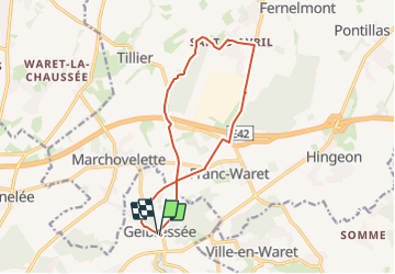
Randonnée Marche de 12,1 km à découvrir à Wallonie, Namur, Namur. Cette randonnée est proposée par pol jassogne.
Description
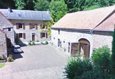
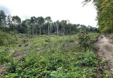
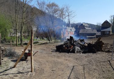
Au départ de l'église de Gelbressée, petite balade le long du bois qui mène à Franc-Warêt, le parcours Vita, l'ancien itinéraire du tram pour arriver au château de Fernelmont. Retour par le village de Sart d'Avril
Localisation
Pays :
Belgique
Région :
Wallonie
Département/Province :
Namur
Commune :
Namur
Localité :
Unknown
Départ:(Dec)
Départ:(UTM)
638563 ; 5597050 (31U) N.
Commentaires
Randonnées à proximité
![Marche Marche](https://static1.geolcdn.com/sitytour/trail-icons/101.png)
RB-Na-26_Franc-Waret_via-racc
Marche
Difficile
(10)
Fernelmont,
Wallonie,
Namur,
Belgique
![](/images/other/stat-length.png)
12,9 km | 15,8 km-effort
3h 35min
![](https://static1.geolcdn.com/siteimages/upload/files/16400158638029165_repeat_loop_refresh_sync_direction_icon.png)
Oui
![Marche Marche](https://static1.geolcdn.com/sitytour/trail-icons/101.png)
RB-Na-26_Franc-Waret
Marche
Très difficile
(14)
Fernelmont,
Wallonie,
Namur,
Belgique
![](/images/other/stat-length.png)
21 km | 26 km-effort
5h 59min
![](https://static1.geolcdn.com/siteimages/upload/files/16400158638029165_repeat_loop_refresh_sync_direction_icon.png)
Oui
![Randonnée Marche Namur - Wartet - Marche-les-Dames_1499 - Photo](https://media.geolcdn.com/t/375/260/aa135fd6-2757-4c70-b0e7-24fa2425e5b7.jpg&format=jpg&maxdim=2)
![Marche Marche](https://static1.geolcdn.com/sitytour/trail-icons/101.png)
Wartet - Marche-les-Dames_1499
Marche
Difficile
(2)
Namur,
Wallonie,
Namur,
Belgique
![](/images/other/stat-length.png)
14,2 km | 19,5 km-effort
4h 25min
![](https://static1.geolcdn.com/siteimages/upload/files/16400158638029165_repeat_loop_refresh_sync_direction_icon.png)
Oui
![Randonnée Marche Namur - De Boninne aux Rochers de Marche-les-Dames - Photo](https://media.geolcdn.com/t/375/260/ext.jpg?maxdim=2&url=https%3A%2F%2Fservices.sitytrail.com%2FGeolivesWS%2FDownloadMedia.ashx%3FTrailID%3D1000620%26Media%3D20180707135425.jpg)
![Marche Marche](https://static1.geolcdn.com/sitytour/trail-icons/101.png)
De Boninne aux Rochers de Marche-les-Dames
Marche
Facile
(1)
Namur,
Wallonie,
Namur,
Belgique
![](/images/other/stat-length.png)
10,8 km | 14,6 km-effort
3h 5min
![](https://static1.geolcdn.com/siteimages/upload/files/16400158638029165_repeat_loop_refresh_sync_direction_icon.png)
Oui
![Randonnée Marche Andenne - Promenade Vezin - Photo](https://media.geolcdn.com/t/375/260/ext.jpg?maxdim=2&url=https%3A%2F%2Fservices.sitytrail.com%2FGeolivesWS%2FDownloadMedia.ashx%3FTrailID%3D272051%26Media%3D7b3740db-ce8a-4aa7-b1b1-8534b8413501.jpg)
![Marche Marche](https://static1.geolcdn.com/sitytour/trail-icons/101.png)
Promenade Vezin
Marche
Facile
(1)
Andenne,
Wallonie,
Namur,
Belgique
![](/images/other/stat-length.png)
6,1 km | 7,8 km-effort
1h 30min
![](https://static1.geolcdn.com/siteimages/upload/files/16400158638029165_repeat_loop_refresh_sync_direction_icon.png)
Non
![Randonnée Marche Andenne - Le Circuit Brichebo - Photo](https://media.geolcdn.com/t/375/260/ext.jpg?maxdim=2&url=https%3A%2F%2Fservices.sitytrail.com%2FGeolivesWS%2FDownloadMedia.ashx%3FTrailID%3D272036%26Media%3Dd35996e5-11a0-4275-aeb6-0cc924ec9b0d.jpg)
![Marche Marche](https://static1.geolcdn.com/sitytour/trail-icons/101.png)
Le Circuit Brichebo
Marche
Facile
(2)
Andenne,
Wallonie,
Namur,
Belgique
![](/images/other/stat-length.png)
8,1 km | 10,5 km-effort
2h 19min
![](https://static1.geolcdn.com/siteimages/upload/files/16400158638029165_repeat_loop_refresh_sync_direction_icon.png)
Oui
![Randonnée Marche Namur - aiguilles et forêt domaniale de Marche les Dames - Photo](https://media.geolcdn.com/t/375/260/4cb18db6-9c88-42ec-ba73-adcf517d3366.jpg&format=jpg&maxdim=2)
![Marche Marche](https://static1.geolcdn.com/sitytour/trail-icons/101.png)
aiguilles et forêt domaniale de Marche les Dames
Marche
Très facile
(1)
Namur,
Wallonie,
Namur,
Belgique
![](/images/other/stat-length.png)
11,2 km | 16,3 km-effort
3h 27min
![](https://static1.geolcdn.com/siteimages/upload/files/16400158638029165_repeat_loop_refresh_sync_direction_icon.png)
Oui
![Randonnée Marche Namur - Gelbressée Abbaye Mldames - Photo](https://media.geolcdn.com/t/375/260/45faa34c-4a6b-49d2-9814-ae32744e4a8e.jpg&format=jpg&maxdim=2)
![Marche Marche](https://static1.geolcdn.com/sitytour/trail-icons/101.png)
Gelbressée Abbaye Mldames
Marche
Moyen
(1)
Namur,
Wallonie,
Namur,
Belgique
![](/images/other/stat-length.png)
6,1 km | 8,6 km-effort
1h 41min
![](https://static1.geolcdn.com/siteimages/upload/files/16400158638029165_repeat_loop_refresh_sync_direction_icon.png)
Oui
![Randonnée Marche Namur - BONINNE - Photo](https://media.geolcdn.com/t/375/260/ext.jpg?maxdim=2&url=https%3A%2F%2Fservices.sitytrail.com%2FGeolivesWS%2FDownloadMedia.ashx%3FTrailID%3D405159%26Media%3Dfix__20150407145726.jpg)
![Marche Marche](https://static1.geolcdn.com/sitytour/trail-icons/101.png)