![](/images/other/stat-length.png)
![Randonnée Marche Nozeroy - Nozeroy la source de l'Ain - Photo](https://media.geolcdn.com/t/1900/400/1ffaa8de-d591-42af-9015-ba62c0a5246c.jpg&format=pjpeg&maxdim=2)
Nozeroy la source de l'Ain
grasgilbert
Utilisateur
![Longueur](/images/other/stat-length.png)
Longueur
10,8 km
![Altitude max](https://static1.geolcdn.com/siteimages/upload/files/1508320355ic_sort_altitude_max_24dp.png)
Altitude max
792 m
![Dénivelé positif](https://static1.geolcdn.com/siteimages/upload/files/1508320355ic_sort_den_pos_24dp.png)
Dénivelé positif
323 m
![Km-Effort](/images/other/stat-length.png)
Km-Effort
15,1 km
![Altitude min](https://static1.geolcdn.com/siteimages/upload/files/1508320355ic_sort_altitude_min_24dp.png)
Altitude min
638 m
![Dénivelé négatif](https://static1.geolcdn.com/siteimages/upload/files/1508320355ic_sort_den_neg_24dp.png)
Dénivelé négatif
326 m
![Boucle](https://static1.geolcdn.com/siteimages/upload/files/16400158638029165_repeat_loop_refresh_sync_direction_icon.png)
Boucle
Oui
Date de création :
2023-07-14 06:50:26.242
Dernière modification :
2023-07-17 17:34:04.38
![Marche](https://static1.geolcdn.com/sitytour/trail-icons/101.png)
3h26
Difficulté : Difficile
![Scannez ce code QR pour ouvrir la randonnée dans l'application SityTrail](https://capi.geolives.com/qq0zvz2zws4bq2lad0pu/sitytour/trails/3733437/qr.png?size=200)
Application GPS de randonnée GRATUITE
À propos
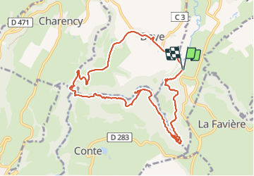
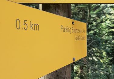
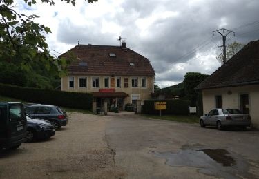
Randonnée Marche de 10,8 km à découvrir à Bourgogne-Franche-Comté, Jura, Nozeroy. Cette randonnée est proposée par grasgilbert.
Description
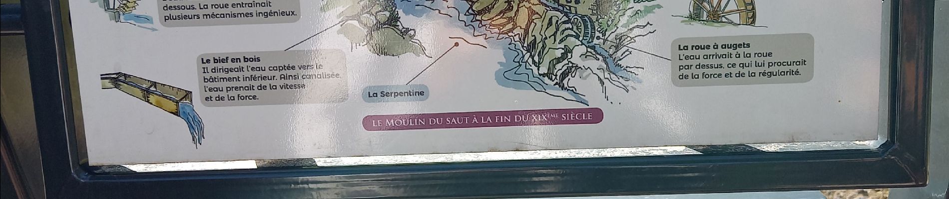
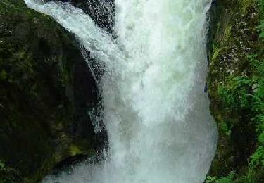
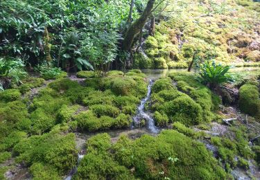
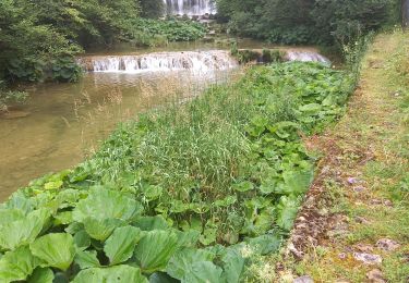
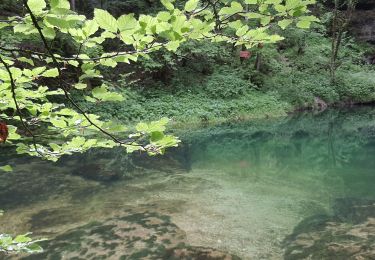
superbe randonnée difficulté moyenne à refaire au printemps après une semaine de pluie pour avoir plein d'eau casse-croûte sur la plage en dessous du pont de l'Ain
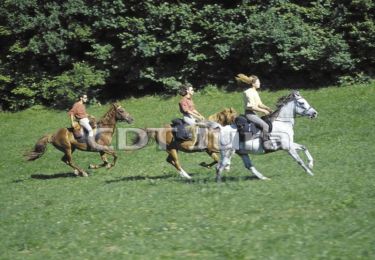
Localisation
Pays :
France
Région :
Bourgogne-Franche-Comté
Département/Province :
Jura
Commune :
Nozeroy
Localité :
Unknown
Départ:(Dec)
Départ:(UTM)
272773 ; 5182982 (32T) N.
Commentaires
Randonnées à proximité
![Randonnée Cheval Longcochon - Haut Jura - Longcochon - Cerniébaud - Photo](https://media.geolcdn.com/t/375/260/ext.jpg?maxdim=2&url=https%3A%2F%2Fservices.sitytrail.com%2FGeolivesWS%2FDownloadMedia.ashx%3FTrailID%3D109529%26Media%3D4106_1.jpg)
![Cheval Cheval](https://static1.geolcdn.com/sitytour/trail-icons/300.png)
Haut Jura - Longcochon - Cerniébaud
Cheval
Difficile
(1)
Longcochon,
Bourgogne-Franche-Comté,
Jura,
France
![](/images/other/stat-length.png)
22 km | 29 km-effort
3h 0min
![](https://static1.geolcdn.com/siteimages/upload/files/16400158638029165_repeat_loop_refresh_sync_direction_icon.png)
Non
![Randonnée Marche Nozeroy - Source de l'Ain - Photo](https://media.geolcdn.com/t/375/260/ext.jpg?maxdim=2&url=https%3A%2F%2Fservices.sitytrail.com%2FGeolivesWS%2FDownloadMedia.ashx%3FTrailID%3D108772%26Media%3D1914_2.jpg)
![Marche Marche](https://static1.geolcdn.com/sitytour/trail-icons/101.png)
Source de l'Ain
Marche
Moyen
(2)
Nozeroy,
Bourgogne-Franche-Comté,
Jura,
France
![](/images/other/stat-length.png)
13,4 km | 18,9 km-effort
3h 30min
![](https://static1.geolcdn.com/siteimages/upload/files/16400158638029165_repeat_loop_refresh_sync_direction_icon.png)
Oui
![Randonnée Marche Bourg-de-Sirod - Perte de l'Ain 15.7.24 - Photo](https://media.geolcdn.com/t/375/260/aaa758b8-4f1b-4118-8f05-a4dd877d998a.jpg&format=jpg&maxdim=2)
![Marche Marche](https://static1.geolcdn.com/sitytour/trail-icons/101.png)
Perte de l'Ain 15.7.24
Marche
Facile
Bourg-de-Sirod,
Bourgogne-Franche-Comté,
Jura,
France
![](/images/other/stat-length.png)
3,3 km | 4,9 km-effort
1h 15min
![](https://static1.geolcdn.com/siteimages/upload/files/16400158638029165_repeat_loop_refresh_sync_direction_icon.png)
Oui
![Randonnée Marche Nozeroy - Source de l'Ain 15.7.24 - Photo](https://media.geolcdn.com/t/375/260/11e5e982-6bdf-4a43-91a6-2d537d4530ca.jpg&format=jpg&maxdim=2)
![Marche Marche](https://static1.geolcdn.com/sitytour/trail-icons/101.png)
Source de l'Ain 15.7.24
Marche
Facile
Nozeroy,
Bourgogne-Franche-Comté,
Jura,
France
![](/images/other/stat-length.png)
6,1 km | 8,5 km-effort
2h 0min
![](https://static1.geolcdn.com/siteimages/upload/files/16400158638029165_repeat_loop_refresh_sync_direction_icon.png)
Non
![Randonnée Marche Conte - roro - Photo](https://media.geolcdn.com/t/375/260/072b554e-54a2-4b17-9822-2410b4a1ff74.jpg&format=jpg&maxdim=2)
![Marche Marche](https://static1.geolcdn.com/sitytour/trail-icons/101.png)
![Randonnée Marche Lent - roro - Photo](https://media.geolcdn.com/t/375/260/1a5c3367-af94-4469-9485-4461b6e48882.jpg&format=jpg&maxdim=2)
![Marche Marche](https://static1.geolcdn.com/sitytour/trail-icons/101.png)
![Randonnée Marche Conte - Source de l'Ain - Photo](https://media.geolcdn.com/t/375/260/191e2e92-af7f-4466-91d4-5ac695203cc3.jpg&format=jpg&maxdim=2)
![Marche Marche](https://static1.geolcdn.com/sitytour/trail-icons/101.png)
Source de l'Ain
Marche
Très facile
Conte,
Bourgogne-Franche-Comté,
Jura,
France
![](/images/other/stat-length.png)
4,4 km | 6,1 km-effort
1h 43min
![](https://static1.geolcdn.com/siteimages/upload/files/16400158638029165_repeat_loop_refresh_sync_direction_icon.png)
Non
![Randonnée Marche Bourg-de-Sirod - les pertes de l'ain - Photo](https://media.geolcdn.com/t/375/260/ext.jpg?maxdim=2&url=https%3A%2F%2Fstatic1.geolcdn.com%2Fsiteimages%2Fupload%2Ffiles%2F1553511878bg_sport_marche.png)
![Marche Marche](https://static1.geolcdn.com/sitytour/trail-icons/101.png)
les pertes de l'ain
Marche
Facile
(1)
Bourg-de-Sirod,
Bourgogne-Franche-Comté,
Jura,
France
![](/images/other/stat-length.png)
8,1 km | 12,8 km-effort
2h 55min
![](https://static1.geolcdn.com/siteimages/upload/files/16400158638029165_repeat_loop_refresh_sync_direction_icon.png)
Oui
![Randonnée Marche Bourg-de-Sirod - Les Chamois - Photo](https://media.geolcdn.com/t/375/260/ext.jpg?maxdim=2&url=https%3A%2F%2Fservices.sitytrail.com%2FGeolivesWS%2FDownloadMedia.ashx%3FTrailID%3D200117%26Media%3D20130623152639.jpg)
![Marche Marche](https://static1.geolcdn.com/sitytour/trail-icons/101.png)
Les Chamois
Marche
Difficile
Bourg-de-Sirod,
Bourgogne-Franche-Comté,
Jura,
France
![](/images/other/stat-length.png)
7,3 km | 11,6 km-effort
2h 27min
![](https://static1.geolcdn.com/siteimages/upload/files/16400158638029165_repeat_loop_refresh_sync_direction_icon.png)
Oui