![](/images/other/stat-length.png)
![Randonnée Marche Villedômer - Villedômer - Photo](https://media.geolcdn.com/t/1900/400/01205bfa-a16a-4b1b-9536-49c99ad5bf3a.jpg&format=pjpeg&maxdim=2)
Villedômer
guydu41
Utilisateur
![Longueur](/images/other/stat-length.png)
![Altitude max](https://static1.geolcdn.com/siteimages/upload/files/1508320355ic_sort_altitude_max_24dp.png)
![Dénivelé positif](https://static1.geolcdn.com/siteimages/upload/files/1508320355ic_sort_den_pos_24dp.png)
![Km-Effort](/images/other/stat-length.png)
![Altitude min](https://static1.geolcdn.com/siteimages/upload/files/1508320355ic_sort_altitude_min_24dp.png)
![Dénivelé négatif](https://static1.geolcdn.com/siteimages/upload/files/1508320355ic_sort_den_neg_24dp.png)
![Boucle](https://static1.geolcdn.com/siteimages/upload/files/16400158638029165_repeat_loop_refresh_sync_direction_icon.png)
![Marche](https://static1.geolcdn.com/sitytour/trail-icons/101.png)
2h54
Difficulté : Facile
![Scannez ce code QR pour ouvrir la randonnée dans l'application SityTrail](https://capi.geolives.com/qq0zvz2zws4bq2lad0pu/sitytour/trails/3733255/qr.png?size=200)
Application GPS de randonnée GRATUITE
À propos
Randonnée Marche de 10,8 km à découvrir à Centre-Val de Loire, Indre-et-Loire, Villedômer. Cette randonnée est proposée par guydu41.
Description
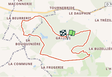
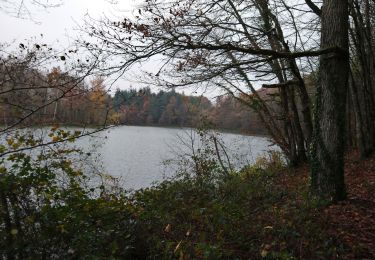
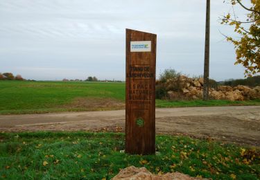
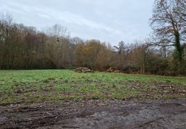
Beau circuit principalement dans le Bois de Gâtines et essentiellement sur des chemins et sentiers avec des franchissements de petits vallons.
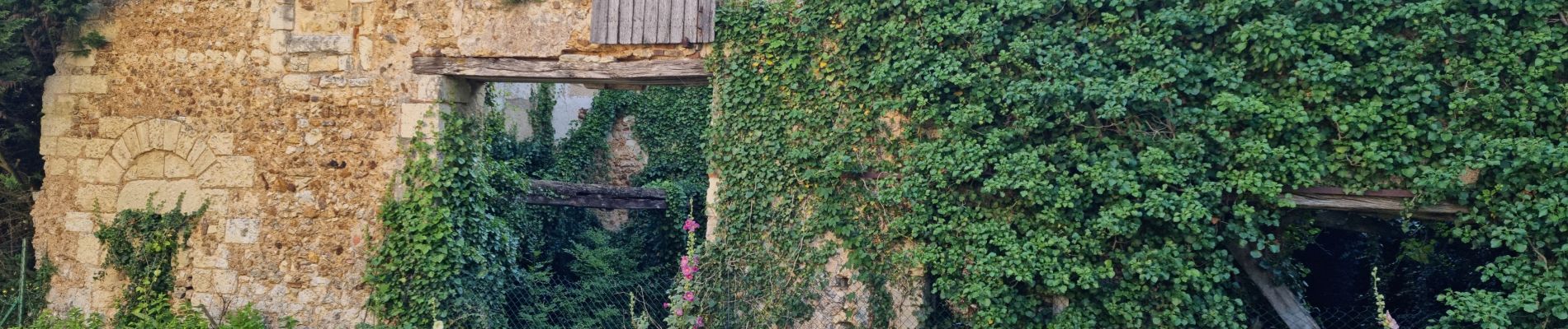
Le départ de ce parcours se fait à côté des ruines de l'abbaye de Gâtines et suit tantôt un balisage jaune et/ou bleu et/ou rouge.
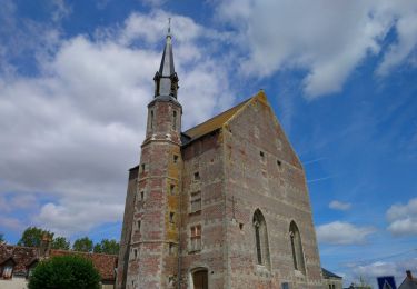
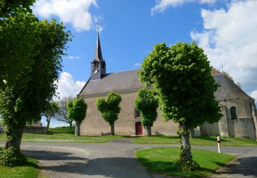
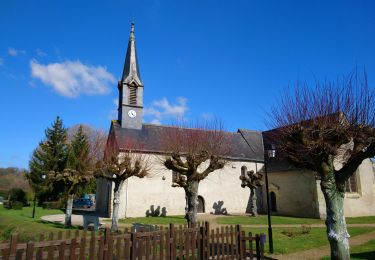
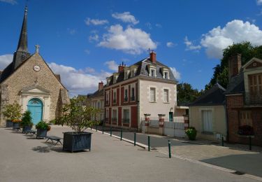
Localisation
Commentaires
Randonnées à proximité
![Randonnée Marche Saint-Laurent-en-Gâtines - Saint-Laurent-en-Gâtines - variante du PR Chemin de Chenusson - 10.2km 90m 2h25 - 2023 07 30 - Photo](https://media.geolcdn.com/t/375/260/9480277e-5582-454b-ba7d-ba1780556f7f.jpg&format=jpg&maxdim=2)
![Marche Marche](https://static1.geolcdn.com/sitytour/trail-icons/101.png)
Marche
![](/images/other/stat-length.png)
![](https://static1.geolcdn.com/siteimages/upload/files/16400158638029165_repeat_loop_refresh_sync_direction_icon.png)
![Randonnée Marche Villedômer - la Grand'Vallée - Saint-Laurent-en-Gâtines via PRs - 26.8km 225m 5h35 (35mn) - 2022 12 03 - Photo](https://media.geolcdn.com/t/375/260/8b7d114e-fe4f-44eb-8278-b583e99468bd.jpg&format=jpg&maxdim=2)
![Marche Marche](https://static1.geolcdn.com/sitytour/trail-icons/101.png)
Marche
![](/images/other/stat-length.png)
![](https://static1.geolcdn.com/siteimages/upload/files/16400158638029165_repeat_loop_refresh_sync_direction_icon.png)
![Randonnée Marche Villedômer - Étang de l'Archevêque - Crotelles la Grand' Vallée - 20.3km 215m 4h25 (35mn) - 2022 11 26 - Photo](https://media.geolcdn.com/t/375/260/8eae5aaa-0c3c-4826-a622-21410b89935e.jpg&format=jpg&maxdim=2)
![Marche Marche](https://static1.geolcdn.com/sitytour/trail-icons/101.png)
Marche
![](/images/other/stat-length.png)
![](https://static1.geolcdn.com/siteimages/upload/files/16400158638029165_repeat_loop_refresh_sync_direction_icon.png)
![Randonnée Marche Le Boulay - le Boulay - circuits Le pain sec et le Boulay avec variante le Sentier - 21.4km 180m 5h15 - 2022 05 05 - Photo](https://media.geolcdn.com/t/375/260/7bbdc975-98a0-4a8f-8bd9-b7c135231252.jpg&format=jpg&maxdim=2)
![Marche Marche](https://static1.geolcdn.com/sitytour/trail-icons/101.png)
Marche
![](/images/other/stat-length.png)
![](https://static1.geolcdn.com/siteimages/upload/files/16400158638029165_repeat_loop_refresh_sync_direction_icon.png)
![Randonnée Marche Château-Renault - Château-Renault - GR655ouest Villechauve - 21.9km 235m 4h55 (30mn) - 2021 10 23 - Photo](https://media.geolcdn.com/t/375/260/f56af21b-37d8-43a1-8e30-6f94c58a9a00.jpg&format=jpg&maxdim=2)
![Marche Marche](https://static1.geolcdn.com/sitytour/trail-icons/101.png)
Marche
![](/images/other/stat-length.png)
![](https://static1.geolcdn.com/siteimages/upload/files/16400158638029165_repeat_loop_refresh_sync_direction_icon.png)
![Randonnée Marche Crotelles - Crotelles - PR avec variante - 21.4km 285m 4h35 (30mn) - 2021 03 20 - Photo](https://media.geolcdn.com/t/375/260/bceaf6e3-80b3-4324-91c6-ae12af2bbf7f.jpg&format=jpg&maxdim=2)
![Marche Marche](https://static1.geolcdn.com/sitytour/trail-icons/101.png)
Marche
![](/images/other/stat-length.png)
![](https://static1.geolcdn.com/siteimages/upload/files/16400158638029165_repeat_loop_refresh_sync_direction_icon.png)
![Randonnée Marche Villedômer - Villedômer - Le sentier des Bois - 22.4km 265m 5h05 (25mn) - 2019 08 10 - Photo](https://media.geolcdn.com/t/375/260/bf722cc0-91b1-46aa-bfeb-b4446fdcac70.jpg&format=jpg&maxdim=2)
![Marche Marche](https://static1.geolcdn.com/sitytour/trail-icons/101.png)
Marche
![](/images/other/stat-length.png)
![](https://static1.geolcdn.com/siteimages/upload/files/16400158638029165_repeat_loop_refresh_sync_direction_icon.png)
![Randonnée Marche Villedômer - Villedomer - Étang de l'Arche - Photo](https://media.geolcdn.com/t/375/260/cc6a816a-f3f4-48e1-b54d-93d3dbb3b0cd.jpg&format=jpg&maxdim=2)
![Marche Marche](https://static1.geolcdn.com/sitytour/trail-icons/101.png)
Marche
![](/images/other/stat-length.png)
![](https://static1.geolcdn.com/siteimages/upload/files/16400158638029165_repeat_loop_refresh_sync_direction_icon.png)
![Randonnée Marche Crotelles - Crotelles-19-11 - Photo](https://media.geolcdn.com/t/375/260/ext.jpg?maxdim=2&url=https%3A%2F%2Fstatic1.geolcdn.com%2Fsiteimages%2Fupload%2Ffiles%2F1553511878bg_sport_marche.png)
![Marche Marche](https://static1.geolcdn.com/sitytour/trail-icons/101.png)
Marche
![](/images/other/stat-length.png)
![](https://static1.geolcdn.com/siteimages/upload/files/16400158638029165_repeat_loop_refresh_sync_direction_icon.png)