![](/images/other/stat-length.png)
![Randonnée Marche Bièvre - Balade à Bellefontaine - Bièvre - Photo](https://media.geolcdn.com/t/1900/400/479b792a-217f-4a9c-be19-91532b972e2a.jpeg&format=pjpeg&maxdim=2)
Balade à Bellefontaine - Bièvre
Desrumaux
Utilisateur GUIDE
![Longueur](/images/other/stat-length.png)
Longueur
10 km
![Altitude max](https://static1.geolcdn.com/siteimages/upload/files/1508320355ic_sort_altitude_max_24dp.png)
Altitude max
398 m
![Dénivelé positif](https://static1.geolcdn.com/siteimages/upload/files/1508320355ic_sort_den_pos_24dp.png)
Dénivelé positif
222 m
![Km-Effort](/images/other/stat-length.png)
Km-Effort
12,9 km
![Altitude min](https://static1.geolcdn.com/siteimages/upload/files/1508320355ic_sort_altitude_min_24dp.png)
Altitude min
287 m
![Dénivelé négatif](https://static1.geolcdn.com/siteimages/upload/files/1508320355ic_sort_den_neg_24dp.png)
Dénivelé négatif
221 m
![Boucle](https://static1.geolcdn.com/siteimages/upload/files/16400158638029165_repeat_loop_refresh_sync_direction_icon.png)
Boucle
Oui
Date de création :
2023-07-11 06:52:34.316
Dernière modification :
2023-07-17 08:57:49.728
![Marche](https://static1.geolcdn.com/sitytour/trail-icons/101.png)
2h56
Difficulté : Difficile
![Scannez ce code QR pour ouvrir la randonnée dans l'application SityTrail](https://capi.geolives.com/qq0zvz2zws4bq2lad0pu/sitytour/trails/3731538/qr.png?size=200)
Application GPS de randonnée GRATUITE
À propos
Randonnée Marche de 10 km à découvrir à Wallonie, Namur, Bièvre. Cette randonnée est proposée par Desrumaux.
Description
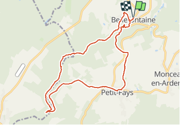
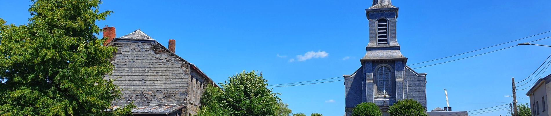
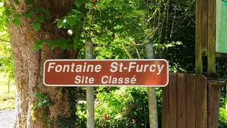
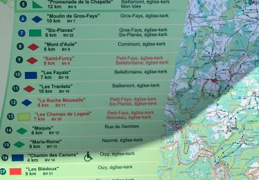
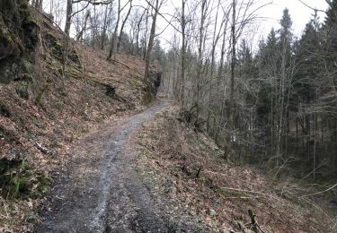
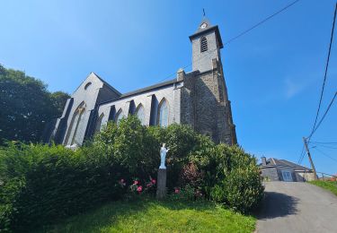
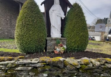
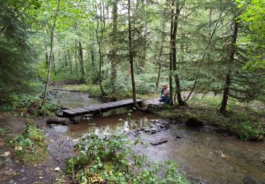
Très jolie balade au départ du village de Bellefontaine dans l'entité de Bièvre vers le village de Petit-Fays en passant par la fontaine Saint-Furcy.
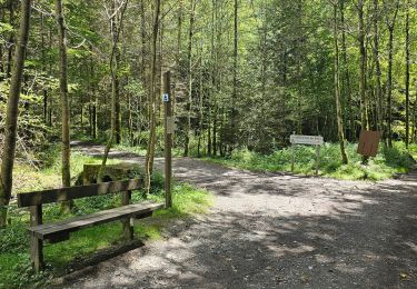
Balisage losange rouge
Localisation
Pays :
Belgique
Région :
Wallonie
Département/Province :
Namur
Commune :
Bièvre
Localité :
Unknown
Départ:(Dec)
Départ:(UTM)
641655 ; 5531409 (31U) N.
Commentaires
Randonnées à proximité
![Marche Marche](https://static1.geolcdn.com/sitytour/trail-icons/101.png)
RB-Na-31_Oisy
Marche
Très difficile
(5)
Bièvre,
Wallonie,
Namur,
Belgique
![](/images/other/stat-length.png)
21 km | 27 km-effort
6h 14min
![](https://static1.geolcdn.com/siteimages/upload/files/16400158638029165_repeat_loop_refresh_sync_direction_icon.png)
Oui
![Marche Marche](https://static1.geolcdn.com/sitytour/trail-icons/101.png)
RB-Na-31_Oisy_via-racc
Marche
Très difficile
(2)
Bièvre,
Wallonie,
Namur,
Belgique
![](/images/other/stat-length.png)
16,1 km | 21 km-effort
4h 49min
![](https://static1.geolcdn.com/siteimages/upload/files/16400158638029165_repeat_loop_refresh_sync_direction_icon.png)
Oui
![Randonnée Marche Bièvre - La roche mouselle bv11 - Photo](https://media.geolcdn.com/t/375/260/180021d9-3dfc-4c34-835a-76474bb7f028.jpg&format=jpg&maxdim=2)
![Marche Marche](https://static1.geolcdn.com/sitytour/trail-icons/101.png)
La roche mouselle bv11
Marche
Facile
(2)
Bièvre,
Wallonie,
Namur,
Belgique
![](/images/other/stat-length.png)
5,5 km | 7,2 km-effort
1h 27min
![](https://static1.geolcdn.com/siteimages/upload/files/16400158638029165_repeat_loop_refresh_sync_direction_icon.png)
Oui
![Randonnée Marche Vresse-sur-Semois - nafraiture 23 km - Photo](https://media.geolcdn.com/t/375/260/ext.jpg?maxdim=2&url=https%3A%2F%2Fservices.sitytrail.com%2FGeolivesWS%2FDownloadMedia.ashx%3FTrailID%3D935326%26Media%3D20180402164930.jpg)
![Marche Marche](https://static1.geolcdn.com/sitytour/trail-icons/101.png)
nafraiture 23 km
Marche
Moyen
(1)
Vresse-sur-Semois,
Wallonie,
Namur,
Belgique
![](/images/other/stat-length.png)
23 km | 33 km-effort
6h 59min
![](https://static1.geolcdn.com/siteimages/upload/files/16400158638029165_repeat_loop_refresh_sync_direction_icon.png)
Oui
![Randonnée Marche Vresse-sur-Semois - Balade à Orchimont - Les Moinils - Photo](https://media.geolcdn.com/t/375/260/1ad35554-1344-4378-ba81-c2000338e613.jpg&format=jpg&maxdim=2)
![Marche Marche](https://static1.geolcdn.com/sitytour/trail-icons/101.png)
Balade à Orchimont - Les Moinils
Marche
Moyen
Vresse-sur-Semois,
Wallonie,
Namur,
Belgique
![](/images/other/stat-length.png)
8,1 km | 10,5 km-effort
2h 23min
![](https://static1.geolcdn.com/siteimages/upload/files/16400158638029165_repeat_loop_refresh_sync_direction_icon.png)
Oui
![Randonnée Marche Bièvre - Promenade de la Roche Mouselle - Petit-Fays - Photo](https://media.geolcdn.com/t/375/260/501e45df-6a5c-4127-b2f5-d1b068aa8215.jpg&format=jpg&maxdim=2)
![Marche Marche](https://static1.geolcdn.com/sitytour/trail-icons/101.png)
Promenade de la Roche Mouselle - Petit-Fays
Marche
Moyen
Bièvre,
Wallonie,
Namur,
Belgique
![](/images/other/stat-length.png)
5,5 km | 7,2 km-effort
1h 38min
![](https://static1.geolcdn.com/siteimages/upload/files/16400158638029165_repeat_loop_refresh_sync_direction_icon.png)
Oui
![Randonnée Marche Vresse-sur-Semois - Promenade de la Roche à Campa - Orchimont - Photo](https://media.geolcdn.com/t/375/260/953f9ca0-4f07-4a11-b2cc-cb0e3d1e7de3.jpg&format=jpg&maxdim=2)
![Marche Marche](https://static1.geolcdn.com/sitytour/trail-icons/101.png)
Promenade de la Roche à Campa - Orchimont
Marche
Difficile
(1)
Vresse-sur-Semois,
Wallonie,
Namur,
Belgique
![](/images/other/stat-length.png)
11,5 km | 15,1 km-effort
3h 25min
![](https://static1.geolcdn.com/siteimages/upload/files/16400158638029165_repeat_loop_refresh_sync_direction_icon.png)
Oui
![Randonnée Marche Vresse-sur-Semois - Marche ADEPS à Nafraiture - Photo](https://media.geolcdn.com/t/375/260/a7dc78b2-25e3-46bd-a512-84cfaf450cd5.jpg&format=jpg&maxdim=2)
![Marche Marche](https://static1.geolcdn.com/sitytour/trail-icons/101.png)
Marche ADEPS à Nafraiture
Marche
Moyen
Vresse-sur-Semois,
Wallonie,
Namur,
Belgique
![](/images/other/stat-length.png)
9,3 km | 12,2 km-effort
2h 4min
![](https://static1.geolcdn.com/siteimages/upload/files/16400158638029165_repeat_loop_refresh_sync_direction_icon.png)
Oui
![Randonnée A pied Vresse-sur-Semois - La Roche aux Corbeaux - Photo](https://media.geolcdn.com/t/375/260/ext.jpg?maxdim=2&url=https%3A%2F%2Fpivotmedia.tourismewallonie.be%2FOTH-A0-006E-1IB1%2FOTH-A0-006E-1IB1.jpg)
![A pied A pied](https://static1.geolcdn.com/sitytour/trail-icons/100.png)
La Roche aux Corbeaux
A pied
Facile
(1)
Vresse-sur-Semois,
Wallonie,
Namur,
Belgique
![](/images/other/stat-length.png)
6 km | 7,1 km-effort
1h 37min
![](https://static1.geolcdn.com/siteimages/upload/files/16400158638029165_repeat_loop_refresh_sync_direction_icon.png)
Oui