![](/images/other/stat-length.png)
![Randonnée Marche Étaples - Baie de la Canche - Photo](https://media.geolcdn.com/t/1900/400/7b70c265-b387-4979-ae8b-4073d98297ee.jpg&format=pjpeg&maxdim=2)
Baie de la Canche
Greg813
Utilisateur
![Longueur](/images/other/stat-length.png)
Longueur
6,8 km
![Altitude max](https://static1.geolcdn.com/siteimages/upload/files/1508320355ic_sort_altitude_max_24dp.png)
Altitude max
9 m
![Dénivelé positif](https://static1.geolcdn.com/siteimages/upload/files/1508320355ic_sort_den_pos_24dp.png)
Dénivelé positif
25 m
![Km-Effort](/images/other/stat-length.png)
Km-Effort
7,2 km
![Altitude min](https://static1.geolcdn.com/siteimages/upload/files/1508320355ic_sort_altitude_min_24dp.png)
Altitude min
1 m
![Dénivelé négatif](https://static1.geolcdn.com/siteimages/upload/files/1508320355ic_sort_den_neg_24dp.png)
Dénivelé négatif
25 m
![Boucle](https://static1.geolcdn.com/siteimages/upload/files/16400158638029165_repeat_loop_refresh_sync_direction_icon.png)
Boucle
Non
Date de création :
2023-07-01 07:12:13.002
Dernière modification :
2023-10-01 15:13:49.706
![Marche](https://static1.geolcdn.com/sitytour/trail-icons/101.png)
1h37
Difficulté : Facile
![Scannez ce code QR pour ouvrir la randonnée dans l'application SityTrail](https://capi.geolives.com/qq0zvz2zws4bq2lad0pu/sitytour/trails/3723754/qr.png?size=200)
Application GPS de randonnée GRATUITE
À propos
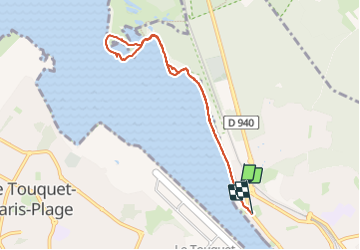
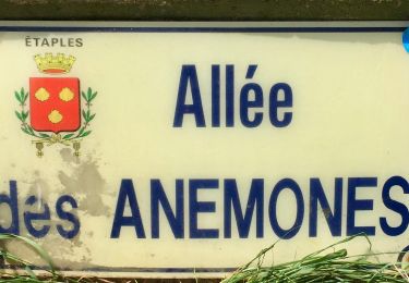
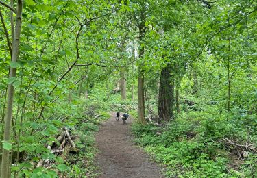
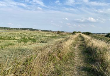
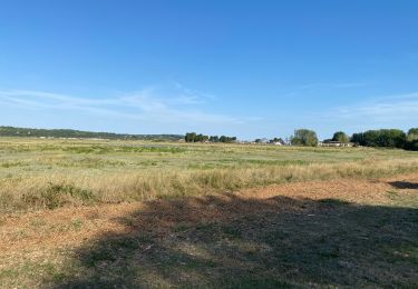
Randonnée Marche de 6,8 km à découvrir à Hauts-de-France, Pas-de-Calais, Étaples. Cette randonnée est proposée par Greg813.
Description
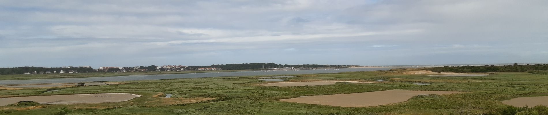
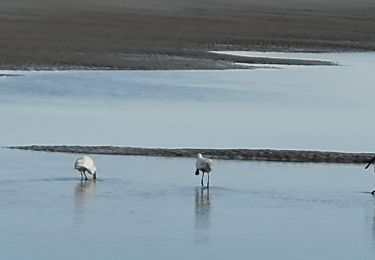
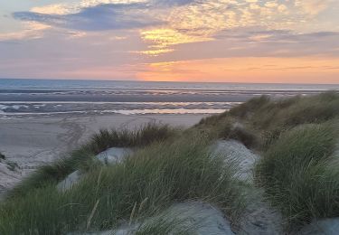
Petite ballade avec Mettons le Monde en Marche à la découverte de la faune et la flore dans la baie de Canche à marée basse.
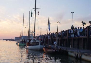
Pour d'autres photos, voir le site de l'association :
https://mmm-rando.org/initiation-au-longe-cote/
Localisation
Pays :
France
Région :
Hauts-de-France
Département/Province :
Pas-de-Calais
Commune :
Étaples
Localité :
Unknown
Départ:(Dec)
Départ:(UTM)
402656 ; 5597503 (31U) N.
Commentaires
Randonnées à proximité
![Randonnée Vélo Étaples - Les Garnoulles - Etaples - Photo](https://media.geolcdn.com/t/375/260/ext.jpg?maxdim=2&url=https%3A%2F%2Fservices.sitytrail.com%2FGeolivesWS%2FDownloadMedia.ashx%3FTrailID%3D110038%26Media%3D5140_6.jpg)
![Vélo Vélo](https://static1.geolcdn.com/sitytour/trail-icons/200.png)
Les Garnoulles - Etaples
Vélo
Moyen
(2)
Étaples,
Hauts-de-France,
Pas-de-Calais,
France
![](/images/other/stat-length.png)
34 km | 38 km-effort
2h 45min
![](https://static1.geolcdn.com/siteimages/upload/files/16400158638029165_repeat_loop_refresh_sync_direction_icon.png)
Oui
![Randonnée Marche Étaples - Le sentier du Rombly - Etaples - Photo](https://media.geolcdn.com/t/375/260/ext.jpg?maxdim=2&url=https%3A%2F%2Fservices.sitytrail.com%2FGeolivesWS%2FDownloadMedia.ashx%3FTrailID%3D110030%26Media%3D5135_5.jpg)
![Marche Marche](https://static1.geolcdn.com/sitytour/trail-icons/101.png)
Le sentier du Rombly - Etaples
Marche
Difficile
(3)
Étaples,
Hauts-de-France,
Pas-de-Calais,
France
![](/images/other/stat-length.png)
14,1 km | 17,3 km-effort
3h 30min
![](https://static1.geolcdn.com/siteimages/upload/files/16400158638029165_repeat_loop_refresh_sync_direction_icon.png)
Oui
![Randonnée A pied Étaples - Sentier de Rombly - Photo](https://media.geolcdn.com/t/375/260/91fe37b4-244e-4fc8-8ef4-3e25b2d6c241.jpeg&format=jpg&maxdim=2)
![A pied A pied](https://static1.geolcdn.com/sitytour/trail-icons/100.png)
Sentier de Rombly
A pied
Moyen
Étaples,
Hauts-de-France,
Pas-de-Calais,
France
![](/images/other/stat-length.png)
17,2 km | 21 km-effort
4h 48min
![](https://static1.geolcdn.com/siteimages/upload/files/16400158638029165_repeat_loop_refresh_sync_direction_icon.png)
Oui
![Randonnée Marche nordique Le Touquet-Paris-Plage - Marche nordique : Boucle 12 km Le Touquet - Merlimont - Photo](https://media.geolcdn.com/t/375/260/3f68287f-5493-43e5-98e0-b8e122cf61f9.jpg&format=jpg&maxdim=2)
![Marche nordique Marche nordique](https://static1.geolcdn.com/sitytour/trail-icons/102.png)
Marche nordique : Boucle 12 km Le Touquet - Merlimont
Marche nordique
Très facile
Le Touquet-Paris-Plage,
Hauts-de-France,
Pas-de-Calais,
France
![](/images/other/stat-length.png)
12,3 km | 12,5 km-effort
1h 59min
![](https://static1.geolcdn.com/siteimages/upload/files/16400158638029165_repeat_loop_refresh_sync_direction_icon.png)
Oui
![Randonnée Marche Le Touquet-Paris-Plage - Sur la route du musée - Photo](https://media.geolcdn.com/t/375/260/62c5aadb-0410-4785-8e61-ddcf957a5ea7.jpg&format=jpg&maxdim=2)
![Marche Marche](https://static1.geolcdn.com/sitytour/trail-icons/101.png)
Sur la route du musée
Marche
Le Touquet-Paris-Plage,
Hauts-de-France,
Pas-de-Calais,
France
![](/images/other/stat-length.png)
8,4 km | 9 km-effort
1h 55min
![](https://static1.geolcdn.com/siteimages/upload/files/16400158638029165_repeat_loop_refresh_sync_direction_icon.png)
Oui
![Randonnée Marche Le Touquet-Paris-Plage - Balade dans la baie de Canche - Photo](https://media.geolcdn.com/t/375/260/3dc28a84-57d0-46cf-b02e-bd5974f0e2ec.jpg&format=jpg&maxdim=2)
![Marche Marche](https://static1.geolcdn.com/sitytour/trail-icons/101.png)
Balade dans la baie de Canche
Marche
Très facile
Le Touquet-Paris-Plage,
Hauts-de-France,
Pas-de-Calais,
France
![](/images/other/stat-length.png)
7,3 km | 7,8 km-effort
1h 24min
![](https://static1.geolcdn.com/siteimages/upload/files/16400158638029165_repeat_loop_refresh_sync_direction_icon.png)
Non
![Randonnée Marche Étaples - Étaples - La forestière - Photo](https://media.geolcdn.com/t/375/260/ea83baf0-4684-4df5-9be2-2a2c1d93a866.jpg&format=jpg&maxdim=2)
![Marche Marche](https://static1.geolcdn.com/sitytour/trail-icons/101.png)
Étaples - La forestière
Marche
Facile
Étaples,
Hauts-de-France,
Pas-de-Calais,
France
![](/images/other/stat-length.png)
4,4 km | 5,5 km-effort
1h 26min
![](https://static1.geolcdn.com/siteimages/upload/files/16400158638029165_repeat_loop_refresh_sync_direction_icon.png)
Oui
![Randonnée Vélo de route Le Touquet-Paris-Plage - Le Touquet Vélo - Photo](https://media.geolcdn.com/t/375/260/d0d444ac-fb80-4612-9631-6d43cd426718.jpg&format=jpg&maxdim=2)
![Vélo de route Vélo de route](https://static1.geolcdn.com/sitytour/trail-icons/201.png)
Le Touquet Vélo
Vélo de route
Le Touquet-Paris-Plage,
Hauts-de-France,
Pas-de-Calais,
France
![](/images/other/stat-length.png)
23 km | 25 km-effort
2h 24min
![](https://static1.geolcdn.com/siteimages/upload/files/16400158638029165_repeat_loop_refresh_sync_direction_icon.png)
Oui
![Randonnée Marche Le Touquet-Paris-Plage - Le Touquet Paris Plage - Photo](https://media.geolcdn.com/t/375/260/58cf07f6-f257-4be4-a8f7-0f5714037a5d.jpg&format=jpg&maxdim=2)
![Marche Marche](https://static1.geolcdn.com/sitytour/trail-icons/101.png)
Le Touquet Paris Plage
Marche
Le Touquet-Paris-Plage,
Hauts-de-France,
Pas-de-Calais,
France
![](/images/other/stat-length.png)
9 km | 9,8 km-effort
2h 36min
![](https://static1.geolcdn.com/siteimages/upload/files/16400158638029165_repeat_loop_refresh_sync_direction_icon.png)
Non