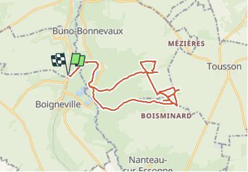
Randonnée V.T.T. Prunay-sur-Essonne - VTT 26 juin 2023 - Photo
 poozix
poozix

Utilisateur

© OpenStreetMap contributors
Longueur
Longueur
18,9 km
Altitude max
Altitude max
125 m
Dénivelé positif
Dénivelé positif
138 m
Km-Effort
Km-Effort  
21 km
Altitude min
Altitude min
65 m
Dénivelé négatif
Dénivelé négatif
139 m
Boucle
Boucle
Oui
Date de création :
2023-06-26 12:49:39.574
Dernière modification :
2023-06-26 18:54:42.423

(0 Avis)

V.T.T.
V.T.T.
2h10
Difficulté : Moyen

Scannez ce code QR pour ouvrir la randonnée dans l'application SityTrail

Application GPS de randonnée GRATUITE

Logo SityTrail SityTrail

IGN / Instituts géographiques

Télécharger SityTrail sur l'App Store Télécharger SityTrail sur Google Play

Logo SityTrail SityTrail World

Le monde est à vous

Télécharger SityTrail sur l'App Store Télécharger SityTrail sur Google Play Télécharger SityTrail sur Huawei AppGallery

À propos

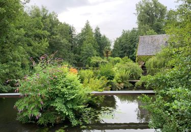
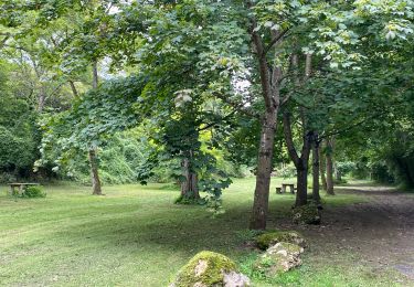
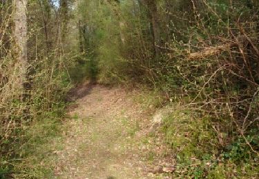
Randonnée V.T.T. de 18,9 km à découvrir à Île-de-France, Essonne, Prunay-sur-Essonne. Cette randonnée est proposée par poozix.

Profil altimétrique

Photos

Localisation

Pays :
France
Région :
Île-de-France
Département/Province :
Essonne
Commune :
Prunay-sur-Essonne
Localité :
Unknown
Départ:(UTM)
454019 ; 5354795 (31U) N.

Randonnées à proximité

Randonnée Marche Buno-Bonnevaux - Buno-Bonnevaux - Photo
Marche
guydu41

Marche

Moyen
Buno-Bonnevaux, Île-de-France, Essonne, France
7,7 km | 9,7 km-effort
2h 11min
Oui
Randonnée Marche Buno-Bonnevaux - Buneau-Bonnevaux Menhir de la pierre droite  - Photo
Marche
jll7513

Marche

Facile
Buno-Bonnevaux, Île-de-France, Essonne, France
12,2 km | 13,9 km-effort
3h 9min
Oui
Randonnée Marche Buno-Bonnevaux - buno bonneveau - Photo
Marche
BrassensJC

Marche

Très facile
Buno-Bonnevaux, Île-de-France, Essonne, France
3,4 km | 4,2 km-effort
58min
Oui
Randonnée V.T.T. Prunay-sur-Essonne - VTT 25 juin 2024 - Photo
V.T.T.
poozix

V.T.T.

Facile
Prunay-sur-Essonne, Île-de-France, Essonne, France
13 km | 14,3 km-effort
1h 32min
Oui
Randonnée Canoë - kayak Prunay-sur-Essonne - 16 jun 2024 - Photo
Canoë - kayak
poozix

Canoë - kayak

Très facile
Prunay-sur-Essonne, Île-de-France, Essonne, France
10,9 km | 12,1 km-effort
51min
Oui
Randonnée V.T.T. Prunay-sur-Essonne - 17 oct 2923  - Photo
V.T.T.
poozix

V.T.T.

Très facile
Prunay-sur-Essonne, Île-de-France, Essonne, France
13,4 km | 15 km-effort
1h 31min
Oui
Randonnée Marche Boigneville - Boigneville - Photo
Marche
JacquesMARQUET

Marche

Difficile
Boigneville, Île-de-France, Essonne, France
12,9 km | 14,8 km-effort
3h 17min
Oui
Randonnée Marche Buno-Bonnevaux - buno bonneveau - Photo
Marche
Christophe Jarry

Marche

Difficile
Buno-Bonnevaux, Île-de-France, Essonne, France
11,6 km | 12,9 km-effort
2h 51min
Oui
Randonnée Marche Nanteau-sur-Essonne - 2018-07-02 Rando Nanteau-sur-Essonne - Photo
Marche
jchezlemas

Marche

Facile
Nanteau-sur-Essonne, Île-de-France, Seine-et-Marne, France
18,9 km | 22 km-effort
4h 52min
Oui


Fermer
Mes abonnements