![](/images/other/stat-length.png)
![Randonnée Marche Durbuy - Le sentier botanique du mont des Pins - Photo](https://media.geolcdn.com/t/1900/400/d3be0114-1acd-4091-8fa3-bb8c70b376fa.jpeg&format=pjpeg&maxdim=2)
Le sentier botanique du mont des Pins
Desrumaux
Utilisateur GUIDE
![Longueur](/images/other/stat-length.png)
![Altitude max](https://static1.geolcdn.com/siteimages/upload/files/1508320355ic_sort_altitude_max_24dp.png)
![Dénivelé positif](https://static1.geolcdn.com/siteimages/upload/files/1508320355ic_sort_den_pos_24dp.png)
![Km-Effort](/images/other/stat-length.png)
![Altitude min](https://static1.geolcdn.com/siteimages/upload/files/1508320355ic_sort_altitude_min_24dp.png)
![Dénivelé négatif](https://static1.geolcdn.com/siteimages/upload/files/1508320355ic_sort_den_neg_24dp.png)
![Boucle](https://static1.geolcdn.com/siteimages/upload/files/16400158638029165_repeat_loop_refresh_sync_direction_icon.png)
![Marche](https://static1.geolcdn.com/sitytour/trail-icons/101.png)
1h18
Difficulté : Facile
![Scannez ce code QR pour ouvrir la randonnée dans l'application SityTrail](https://capi.geolives.com/qq0zvz2zws4bq2lad0pu/sitytour/trails/3705789/qr.png?size=200)
Application GPS de randonnée GRATUITE
À propos
Randonnée Marche de 3,6 km à découvrir à Wallonie, Luxembourg, Durbuy. Cette randonnée est proposée par Desrumaux.
Description
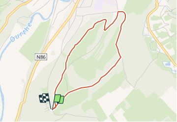
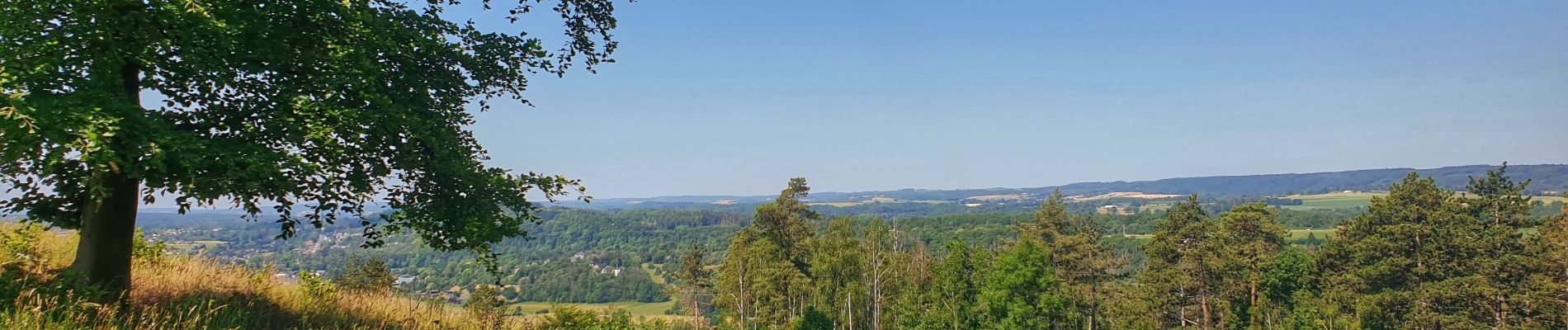
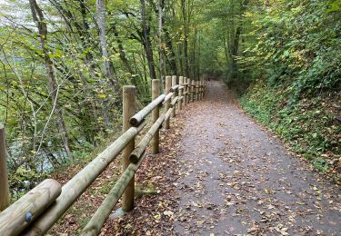
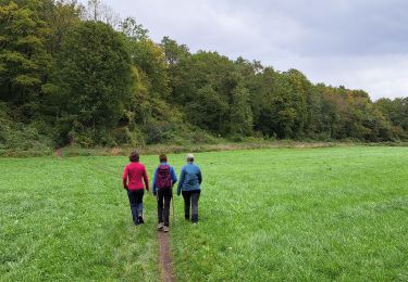
Ce petit circuit dans la réserve naturelle du Mont des pins permet de découvrir la flore typique des pelouses calcaires sèches. Tout au long de la promenade, vous découvrirez des plantes communes ou rares. Des panneaux présentent notamment le fusain, l’arabette hérissée, le bois joli, les cornouillers, l’érable champêtre, le genévrier commun…..Une balade de 3,7 km emmène le promeneur de panneau en panneau. Le départ est à l’entrée de la réserve naturelle rue Mont des Pins.
Attention de bonnes chaussures sont à prévoir et divers sentiers ne sont pas accessibles aux poussettes. Les pentes sont courtes mais raides !
La réalisation de ce sentier botanique est une collaboration entre NATAGORA, la Ville de Durbuy et l’office communal du tourisme.©
Départ du domaine de vacances ‘Mont-des-Pins’. Bomal-sur-Ourthe
https://randos.be/le-sentier-botanique-du-mont-des-pins/
Localisation
Commentaires
Randonnées à proximité
![Randonnée Marche Durbuy - RB-Lu-01_Tohogne - Photo](https://media.geolcdn.com/t/375/260/ext.jpg?maxdim=2&url=https%3A%2F%2Fservices.sitytrail.com%2FGeolivesWS%2FDownloadMedia.ashx%3FTrailID%3D179610%26Media%3Dbae66ec4-955f-4295-8f2d-e1b21fcea213.jpg)
![Marche Marche](https://static1.geolcdn.com/sitytour/trail-icons/101.png)
Marche
![](/images/other/stat-length.png)
![](https://static1.geolcdn.com/siteimages/upload/files/16400158638029165_repeat_loop_refresh_sync_direction_icon.png)
![Randonnée Marche Durbuy - Durbuy belle boucle depuis le centre - Photo](https://media.geolcdn.com/t/375/260/cfedd71b-4855-4bd5-865e-f677c4301a64.jpg&format=jpg&maxdim=2)
![Marche Marche](https://static1.geolcdn.com/sitytour/trail-icons/101.png)
Marche
![](/images/other/stat-length.png)
![](https://static1.geolcdn.com/siteimages/upload/files/16400158638029165_repeat_loop_refresh_sync_direction_icon.png)
![Randonnée Marche Durbuy - RF-Lu-02 - Variante Ravel - Au fils de l'Ourthe : Barvaux - Photo](https://media.geolcdn.com/t/375/260/ext.jpg?maxdim=2&url=https%3A%2F%2Fstatic1.geolcdn.com%2Fsiteimages%2Fupload%2Ffiles%2F1553511878bg_sport_marche.png)
![Marche Marche](https://static1.geolcdn.com/sitytour/trail-icons/101.png)
Marche
![](/images/other/stat-length.png)
![](https://static1.geolcdn.com/siteimages/upload/files/16400158638029165_repeat_loop_refresh_sync_direction_icon.png)
![Randonnée Marche Durbuy - RF-Lu-01 - De dolmens en menhirs autour de Wéris - Photo](https://media.geolcdn.com/t/375/260/ext.jpg?maxdim=2&url=https%3A%2F%2Fstatic1.geolcdn.com%2Fsiteimages%2Fupload%2Ffiles%2F1553511878bg_sport_marche.png)
![Marche Marche](https://static1.geolcdn.com/sitytour/trail-icons/101.png)
Marche
![](/images/other/stat-length.png)
![](https://static1.geolcdn.com/siteimages/upload/files/16400158638029165_repeat_loop_refresh_sync_direction_icon.png)
![Randonnée Marche Durbuy - Balade à Bomal sur Ourthe - Photo](https://media.geolcdn.com/t/375/260/5741dd62-7ff1-40d2-b9aa-0e0aed97da9a.jpg&format=jpg&maxdim=2)
![Marche Marche](https://static1.geolcdn.com/sitytour/trail-icons/101.png)
Marche
![](/images/other/stat-length.png)
![](https://static1.geolcdn.com/siteimages/upload/files/16400158638029165_repeat_loop_refresh_sync_direction_icon.png)
![Randonnée Vélo Durbuy - À vélo, autour de Durbuy - Photo](https://media.geolcdn.com/t/375/260/0cd5bc92-78b0-4b7d-8ab6-58af53446b64.jpg&format=jpg&maxdim=2)
![Vélo Vélo](https://static1.geolcdn.com/sitytour/trail-icons/200.png)
Vélo
![](/images/other/stat-length.png)
![](https://static1.geolcdn.com/siteimages/upload/files/16400158638029165_repeat_loop_refresh_sync_direction_icon.png)
![Randonnée Marche Durbuy - Durbuy - Photo](https://media.geolcdn.com/t/375/260/bb012fd3-a2b7-4b11-a73c-1b9130d29f16.jpg&format=jpg&maxdim=2)
![Marche Marche](https://static1.geolcdn.com/sitytour/trail-icons/101.png)
![Randonnée Marche Ferrières - RL-GG-15_Sy_Barvaux - Photo](https://media.geolcdn.com/t/375/260/4cf6fb9a-77d5-4c51-bb72-4b6ca6a27202.jpg&format=jpg&maxdim=2)
![Marche Marche](https://static1.geolcdn.com/sitytour/trail-icons/101.png)
Marche
![](/images/other/stat-length.png)
![](https://static1.geolcdn.com/siteimages/upload/files/16400158638029165_repeat_loop_refresh_sync_direction_icon.png)
![Randonnée Marche Durbuy - Autour de Tohogne (Durbuy) - Photo](https://media.geolcdn.com/t/375/260/2a8689fc-6e11-44ce-8f89-67705d1757ba.jpg&format=jpg&maxdim=2)
![Marche Marche](https://static1.geolcdn.com/sitytour/trail-icons/101.png)
Marche
![](/images/other/stat-length.png)
![](https://static1.geolcdn.com/siteimages/upload/files/16400158638029165_repeat_loop_refresh_sync_direction_icon.png)
Très belle randonnée ! Quelques petites côtes assez raides