![](/images/other/stat-length.png)
![Randonnée Marche Rumilly - Bois de la Salle - Photo](https://media.geolcdn.com/t/1900/400/6ea740c6-86db-49df-bf24-f638147656f0.png&format=pjpeg&maxdim=2)
Bois de la Salle
Ladyclairdelune74
Utilisateur
![Longueur](/images/other/stat-length.png)
![Altitude max](https://static1.geolcdn.com/siteimages/upload/files/1508320355ic_sort_altitude_max_24dp.png)
![Dénivelé positif](https://static1.geolcdn.com/siteimages/upload/files/1508320355ic_sort_den_pos_24dp.png)
![Km-Effort](/images/other/stat-length.png)
![Altitude min](https://static1.geolcdn.com/siteimages/upload/files/1508320355ic_sort_altitude_min_24dp.png)
![Dénivelé négatif](https://static1.geolcdn.com/siteimages/upload/files/1508320355ic_sort_den_neg_24dp.png)
![Boucle](https://static1.geolcdn.com/siteimages/upload/files/16400158638029165_repeat_loop_refresh_sync_direction_icon.png)
![Marche](https://static1.geolcdn.com/sitytour/trail-icons/101.png)
59m
Difficulté : Facile
![Scannez ce code QR pour ouvrir la randonnée dans l'application SityTrail](https://capi.geolives.com/qq0zvz2zws4bq2lad0pu/sitytour/trails/3691587/qr.png?size=200)
Application GPS de randonnée GRATUITE
À propos
Randonnée Marche de 2,8 km à découvrir à Auvergne-Rhône-Alpes, Haute-Savoie, Rumilly. Cette randonnée est proposée par Ladyclairdelune74.
Description
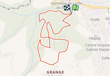
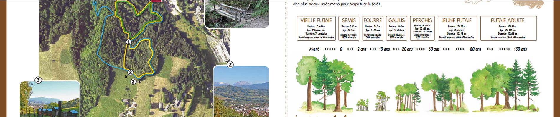
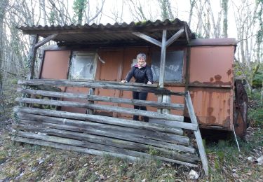
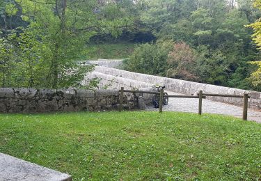
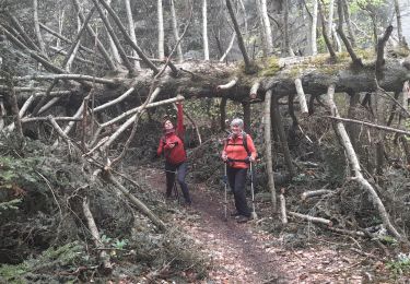
Le Bois de la Salle représente la partie la plus importante de la forêt communale de Rumilly avec une vingtaine d’hectares. Il est très apprécié par les promeneurs, les cueilleurs de champignons, les vététiste, et même les écoles qui y pratiquent la course d’orientation.
La forêt du Bois de la Salle est composée de plusieurs chemins et pour se repérer, un panneau situé à l’entrée du Bois de la Salle indique les temps de trajets pour parcourir 3 circuits.
Accès : depuis la rue du Bois de la Salle (après l’hôpital Gabriel Déplante).
Parking à proximité.
Localisation
Commentaires
Randonnées à proximité
![Randonnée Marche Sales - Pont Coppet - Photo](https://media.geolcdn.com/t/375/260/6c149bdc-b543-49af-8bcc-762f821120c9.jpeg&format=jpg&maxdim=2)
![Marche Marche](https://static1.geolcdn.com/sitytour/trail-icons/101.png)
Marche
![](/images/other/stat-length.png)
![](https://static1.geolcdn.com/siteimages/upload/files/16400158638029165_repeat_loop_refresh_sync_direction_icon.png)
![Randonnée Marche Massingy - CLERGEON - Photo](https://media.geolcdn.com/t/375/260/ext.jpg?maxdim=2&url=https%3A%2F%2Fservices.sitytrail.com%2FGeolivesWS%2FDownloadMedia.ashx%3FTrailID%3D474185%26Media%3Dc01eb5a7-bf72-4ffc-98fa-1e923f8f3f43.jpg)
![Marche Marche](https://static1.geolcdn.com/sitytour/trail-icons/101.png)
Marche
![](/images/other/stat-length.png)
![](https://static1.geolcdn.com/siteimages/upload/files/16400158638029165_repeat_loop_refresh_sync_direction_icon.png)
![Randonnée V.T.T. Moye - 74- Le Gros Foug - Photo](https://media.geolcdn.com/t/375/260/ext.jpg?maxdim=2&url=https%3A%2F%2Fstatic1.geolcdn.com%2Fsiteimages%2Fupload%2Ffiles%2F1524743154velo.jpg)
![V.T.T. V.T.T.](https://static1.geolcdn.com/sitytour/trail-icons/202.png)
V.T.T.
![](/images/other/stat-length.png)
![](https://static1.geolcdn.com/siteimages/upload/files/16400158638029165_repeat_loop_refresh_sync_direction_icon.png)
![Randonnée Marche Entrelacs - SAPENAY / CLERGEON: GRANDE CUVE - Photo](https://media.geolcdn.com/t/375/260/81ea709e-f7b9-477c-93c3-923ab4e12c63.jpg&format=jpg&maxdim=2)
![Marche Marche](https://static1.geolcdn.com/sitytour/trail-icons/101.png)
Marche
![](/images/other/stat-length.png)
![](https://static1.geolcdn.com/siteimages/upload/files/16400158638029165_repeat_loop_refresh_sync_direction_icon.png)
![Randonnée Marche Chindrieux - SAPENAY / CLERGEON: COL DU SAPENAY - MONTCLERGEON PAR LE SENTIER DES VACHES (en live) - Photo](https://media.geolcdn.com/t/375/260/3c03cb4b-fb8a-4c79-83a1-ad8f3ccbc05c.jpg&format=jpg&maxdim=2)
![Marche Marche](https://static1.geolcdn.com/sitytour/trail-icons/101.png)
Marche
![](/images/other/stat-length.png)
![](https://static1.geolcdn.com/siteimages/upload/files/16400158638029165_repeat_loop_refresh_sync_direction_icon.png)
![Randonnée Marche Entrelacs - SAPENAY / CLERGEON: COL DU SAPENAY - GRANDE CUVE directissime - Photo](https://media.geolcdn.com/t/375/260/410c440e-545c-4327-974f-255c4304a936.jpg&format=jpg&maxdim=2)
![Marche Marche](https://static1.geolcdn.com/sitytour/trail-icons/101.png)
Marche
![](/images/other/stat-length.png)
![](https://static1.geolcdn.com/siteimages/upload/files/16400158638029165_repeat_loop_refresh_sync_direction_icon.png)
![Randonnée V.T.T. Rumilly - rando rumilly - Photo](https://media.geolcdn.com/t/375/260/377074f7-9fe1-4bff-851d-c59900e7a990.jpg&format=jpg&maxdim=2)
![V.T.T. V.T.T.](https://static1.geolcdn.com/sitytour/trail-icons/202.png)
V.T.T.
![](/images/other/stat-length.png)
![](https://static1.geolcdn.com/siteimages/upload/files/16400158638029165_repeat_loop_refresh_sync_direction_icon.png)
![Randonnée Marche Rumilly - Plan d'eau de Rumilly à poussette - Photo](https://media.geolcdn.com/t/375/260/646ece07-042d-4627-b048-b38f12592477.jpg&format=jpg&maxdim=2)
![Marche Marche](https://static1.geolcdn.com/sitytour/trail-icons/101.png)
Marche
![](/images/other/stat-length.png)
![](https://static1.geolcdn.com/siteimages/upload/files/16400158638029165_repeat_loop_refresh_sync_direction_icon.png)
![Randonnée Marche Chindrieux - SAPENAY - CLERGEON - GRANDE CUVE - GROS FOUG : 22 km - Photo](https://media.geolcdn.com/t/375/260/c64dae54-babd-4a7d-a295-709ed3aa140e.jpg&format=jpg&maxdim=2)
![Marche Marche](https://static1.geolcdn.com/sitytour/trail-icons/101.png)
Marche
![](/images/other/stat-length.png)
![](https://static1.geolcdn.com/siteimages/upload/files/16400158638029165_repeat_loop_refresh_sync_direction_icon.png)