![](/images/other/stat-length.png)
![Randonnée Marche Unknown - Baden Baden - châteaux Hohenbaden et Eberstein - coliine Merkurberg - Photo](https://media.geolcdn.com/t/1900/400/3c513f58-b022-4004-aebd-44ed7ae57178.jpg&format=pjpeg&maxdim=2)
Baden Baden - châteaux Hohenbaden et Eberstein - coliine Merkurberg
Bart2015
Utilisateur
![Longueur](/images/other/stat-length.png)
![Altitude max](https://static1.geolcdn.com/siteimages/upload/files/1508320355ic_sort_altitude_max_24dp.png)
![Dénivelé positif](https://static1.geolcdn.com/siteimages/upload/files/1508320355ic_sort_den_pos_24dp.png)
![Km-Effort](/images/other/stat-length.png)
![Altitude min](https://static1.geolcdn.com/siteimages/upload/files/1508320355ic_sort_altitude_min_24dp.png)
![Dénivelé négatif](https://static1.geolcdn.com/siteimages/upload/files/1508320355ic_sort_den_neg_24dp.png)
![Boucle](https://static1.geolcdn.com/siteimages/upload/files/16400158638029165_repeat_loop_refresh_sync_direction_icon.png)
![Marche](https://static1.geolcdn.com/sitytour/trail-icons/101.png)
6h59
Difficulté : Très difficile
![Scannez ce code QR pour ouvrir la randonnée dans l'application SityTrail](https://capi.geolives.com/qq0zvz2zws4bq2lad0pu/sitytour/trails/3678230/qr.png?size=200)
Application GPS de randonnée GRATUITE
À propos
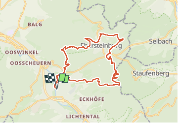
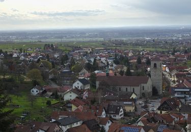
Randonnée Marche de 19,1 km à découvrir à Bade-Wurtemberg, Baden-Baden. Cette randonnée est proposée par Bart2015.
Description
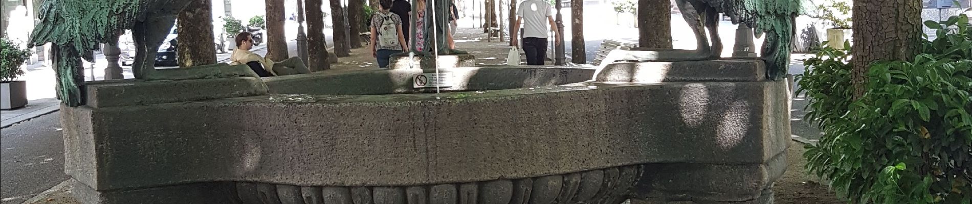
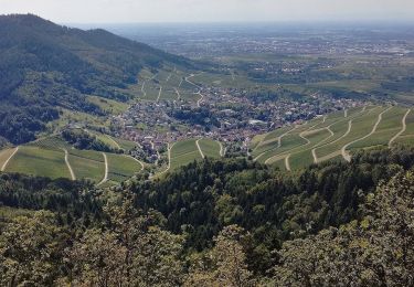
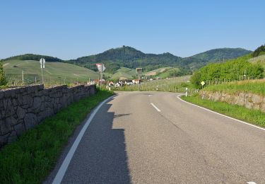
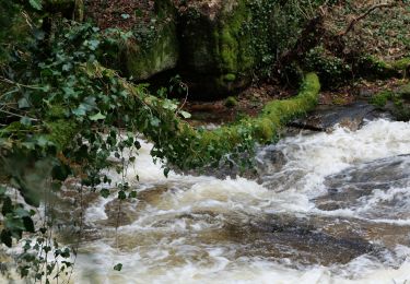
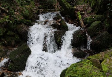
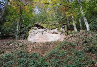
Randonnée physique pour découvrir la beauté des rues de Baden Baden, le château Hohenbaden et sa magnifique vue sur la ville. que l'on peut visiter, un peu plus loin l'impressionnant site d'escalade du Grafensprung, le château d'Eberstein non visitable (ce jour là ?), et la colline Merkurberg où il fera bon se désaltérer ... Au retour, une surprise en regagnat le centre de Baden Baden : de magnifiques fontaines ....
Bon randonnée, physique par endroit mais de toute beauté ...
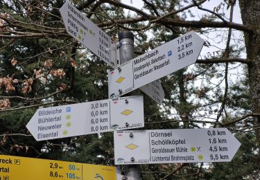
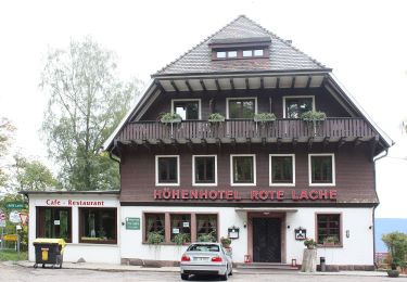
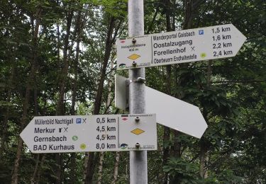
Localisation
Commentaires
Randonnées à proximité
![Randonnée A pied - Yburg Rundweg - Photo](https://media.geolcdn.com/t/375/260/9465470a-9321-4702-8d92-bf53a6692fd2.jpeg&format=jpg&maxdim=2)
![A pied A pied](https://static1.geolcdn.com/sitytour/trail-icons/100.png)
A pied
![](/images/other/stat-length.png)
![](https://static1.geolcdn.com/siteimages/upload/files/16400158638029165_repeat_loop_refresh_sync_direction_icon.png)
![Randonnée A pied - AugenBlickrunde Baden-Baden-Neuweier - Photo](https://media.geolcdn.com/t/375/260/d1172795-6511-4e52-b758-160061946c72.jpeg&format=jpg&maxdim=2)
![A pied A pied](https://static1.geolcdn.com/sitytour/trail-icons/100.png)
A pied
![](/images/other/stat-length.png)
![](https://static1.geolcdn.com/siteimages/upload/files/16400158638029165_repeat_loop_refresh_sync_direction_icon.png)
![Randonnée A pied - Schartenberg-Rundweg - Photo](https://media.geolcdn.com/t/375/260/ecc99695-d39c-4f25-835c-9ea6c2afc47b.jpeg&format=jpg&maxdim=2)
![A pied A pied](https://static1.geolcdn.com/sitytour/trail-icons/100.png)
A pied
![](/images/other/stat-length.png)
![](https://static1.geolcdn.com/siteimages/upload/files/16400158638029165_repeat_loop_refresh_sync_direction_icon.png)
![Randonnée A pied - Kreuzfelsen-Rundweg - Photo](https://media.geolcdn.com/t/375/260/f9dace17-edc3-438b-97fc-f5c4b4d7572a.jpeg&format=jpg&maxdim=2)
![A pied A pied](https://static1.geolcdn.com/sitytour/trail-icons/100.png)
A pied
![](/images/other/stat-length.png)
![](https://static1.geolcdn.com/siteimages/upload/files/16400158638029165_repeat_loop_refresh_sync_direction_icon.png)
![Randonnée A pied - Einmündung Littersbach - Bernickel - Photo](https://media.geolcdn.com/t/375/260/bea8d541-e7ea-450b-a556-e23b7df34437.jpeg&format=jpg&maxdim=2)
![A pied A pied](https://static1.geolcdn.com/sitytour/trail-icons/100.png)
A pied
![](/images/other/stat-length.png)
![](https://static1.geolcdn.com/siteimages/upload/files/16400158638029165_repeat_loop_refresh_sync_direction_icon.png)
![Randonnée A pied - Ebersteinburg-Rundweg - Photo](https://media.geolcdn.com/t/375/260/f643df66-7945-4966-9111-c1873db1eaf8.jpeg&format=jpg&maxdim=2)
![A pied A pied](https://static1.geolcdn.com/sitytour/trail-icons/100.png)
A pied
![](/images/other/stat-length.png)
![](https://static1.geolcdn.com/siteimages/upload/files/16400158638029165_repeat_loop_refresh_sync_direction_icon.png)
![Randonnée A pied - Zimmerplatz - Bildeiche - Photo](https://media.geolcdn.com/t/375/260/d36c0341-f6bb-4a42-a8d2-35e91d9bea23.jpeg&format=jpg&maxdim=2)
![A pied A pied](https://static1.geolcdn.com/sitytour/trail-icons/100.png)
A pied
![](/images/other/stat-length.png)
![](https://static1.geolcdn.com/siteimages/upload/files/16400158638029165_repeat_loop_refresh_sync_direction_icon.png)
![Randonnée A pied - Oostalzugang Ost - Rote Lache - Photo](https://media.geolcdn.com/t/375/260/a590b01a-ee10-4d9f-beb6-8980dc73ca0d.jpeg&format=jpg&maxdim=2)
![A pied A pied](https://static1.geolcdn.com/sitytour/trail-icons/100.png)
A pied
![](/images/other/stat-length.png)
![](https://static1.geolcdn.com/siteimages/upload/files/16400158638029165_repeat_loop_refresh_sync_direction_icon.png)
![Randonnée A pied - Oostal Rundweg - Photo](https://media.geolcdn.com/t/375/260/f6dc3586-d17b-471d-9820-7fdb503f90c7.jpeg&format=jpg&maxdim=2)
![A pied A pied](https://static1.geolcdn.com/sitytour/trail-icons/100.png)
A pied
![](/images/other/stat-length.png)
![](https://static1.geolcdn.com/siteimages/upload/files/16400158638029165_repeat_loop_refresh_sync_direction_icon.png)