![](/images/other/stat-length.png)
![Randonnée Marche Riez - 04_Riez_La Blache_J6_rea_corrigé - Photo](https://media.geolcdn.com/t/1900/400/ext.pjpeg?maxdim=2&url=https%3A%2F%2Fstatic1.geolcdn.com%2Fsiteimages%2Fupload%2Ffiles%2F1553511878bg_sport_marche.png)
04_Riez_La Blache_J6_rea_corrigé
jab31
Utilisateur
![Longueur](/images/other/stat-length.png)
Longueur
18,5 km
![Altitude max](https://static1.geolcdn.com/siteimages/upload/files/1508320355ic_sort_altitude_max_24dp.png)
Altitude max
850 m
![Dénivelé positif](https://static1.geolcdn.com/siteimages/upload/files/1508320355ic_sort_den_pos_24dp.png)
Dénivelé positif
439 m
![Km-Effort](/images/other/stat-length.png)
Km-Effort
24 km
![Altitude min](https://static1.geolcdn.com/siteimages/upload/files/1508320355ic_sort_altitude_min_24dp.png)
Altitude min
526 m
![Dénivelé négatif](https://static1.geolcdn.com/siteimages/upload/files/1508320355ic_sort_den_neg_24dp.png)
Dénivelé négatif
204 m
![Boucle](https://static1.geolcdn.com/siteimages/upload/files/16400158638029165_repeat_loop_refresh_sync_direction_icon.png)
Boucle
Non
Date de création :
2023-05-27 07:21:57.122
Dernière modification :
2023-06-11 14:31:52.152
![Marche](https://static1.geolcdn.com/sitytour/trail-icons/101.png)
5h05
Difficulté : Moyen
![Scannez ce code QR pour ouvrir la randonnée dans l'application SityTrail](https://capi.geolives.com/qq0zvz2zws4bq2lad0pu/sitytour/trails/3676685/qr.png?size=200)
Application GPS de randonnée GRATUITE
À propos
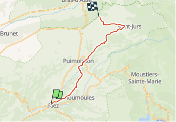
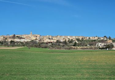
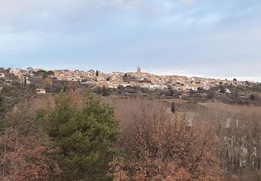
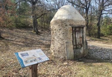
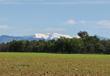
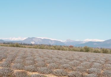
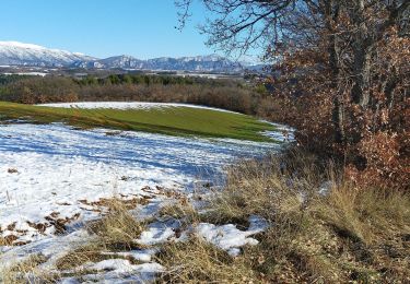
Randonnée Marche de 18,5 km à découvrir à Provence-Alpes-Côte d'Azur, Alpes-de-Haute-Provence, Riez. Cette randonnée est proposée par jab31.
Description
45 minutes sans enregistrement au départ : corrigé
plusieurs variantes raccourcis: 2
un aller retour à Saint Jurs
Localisation
Pays :
France
Région :
Provence-Alpes-Côte d'Azur
Département/Province :
Alpes-de-Haute-Provence
Commune :
Riez
Localité :
Unknown
Départ:(Dec)
Départ:(UTM)
265995 ; 4855822 (32T) N.
Commentaires
Randonnées à proximité
![Randonnée Marche Puimoisson - 2024-03-12 Puimoisson Aventure - Photo](https://media.geolcdn.com/t/375/260/f144eb6a-0f73-4c6d-9440-c27eff387270.jpg&format=jpg&maxdim=2)
![Marche Marche](https://static1.geolcdn.com/sitytour/trail-icons/101.png)
2024-03-12 Puimoisson Aventure
Marche
Difficile
Puimoisson,
Provence-Alpes-Côte d'Azur,
Alpes-de-Haute-Provence,
France
![](/images/other/stat-length.png)
19,3 km | 25 km-effort
5h 35min
![](https://static1.geolcdn.com/siteimages/upload/files/16400158638029165_repeat_loop_refresh_sync_direction_icon.png)
Oui
![Randonnée V.T.T. Riez - Rlez et ses environ - Photo](https://media.geolcdn.com/t/375/260/2d996a7a-dcf9-4ee3-a100-4d4d8a8ce9ee.jpg&format=jpg&maxdim=2)
![V.T.T. V.T.T.](https://static1.geolcdn.com/sitytour/trail-icons/202.png)
Rlez et ses environ
V.T.T.
Moyen
Riez,
Provence-Alpes-Côte d'Azur,
Alpes-de-Haute-Provence,
France
![](/images/other/stat-length.png)
21 km | 26 km-effort
3h 2min
![](https://static1.geolcdn.com/siteimages/upload/files/16400158638029165_repeat_loop_refresh_sync_direction_icon.png)
Oui
![Randonnée Marche Puimoisson - puimasson. la chapelle notre Dame, la plaine de réme - Photo](https://media.geolcdn.com/t/375/260/3d33cd4d-8d7b-4a6d-a79d-daeca46648cc.jpg&format=jpg&maxdim=2)
![Marche Marche](https://static1.geolcdn.com/sitytour/trail-icons/101.png)
puimasson. la chapelle notre Dame, la plaine de réme
Marche
Moyen
Puimoisson,
Provence-Alpes-Côte d'Azur,
Alpes-de-Haute-Provence,
France
![](/images/other/stat-length.png)
13,6 km | 18,3 km-effort
4h 19min
![](https://static1.geolcdn.com/siteimages/upload/files/16400158638029165_repeat_loop_refresh_sync_direction_icon.png)
Oui
![Randonnée Marche Puimoisson - PUIMOISSON RIEZ o n - Photo](https://media.geolcdn.com/t/375/260/b05f58fe-860d-4383-a3b4-30de10450299.jpg&format=jpg&maxdim=2)
![Marche Marche](https://static1.geolcdn.com/sitytour/trail-icons/101.png)
PUIMOISSON RIEZ o n
Marche
Moyen
Puimoisson,
Provence-Alpes-Côte d'Azur,
Alpes-de-Haute-Provence,
France
![](/images/other/stat-length.png)
15,7 km | 19,8 km-effort
3h 34min
![](https://static1.geolcdn.com/siteimages/upload/files/16400158638029165_repeat_loop_refresh_sync_direction_icon.png)
Oui
![Randonnée Marche Riez - 2024-03-22 Riez - Valvachères - Photo](https://media.geolcdn.com/t/375/260/f714c7fa-03b6-4d16-9a29-8154beef1683.jpg&format=jpg&maxdim=2)
![Marche Marche](https://static1.geolcdn.com/sitytour/trail-icons/101.png)
2024-03-22 Riez - Valvachères
Marche
Facile
Riez,
Provence-Alpes-Côte d'Azur,
Alpes-de-Haute-Provence,
France
![](/images/other/stat-length.png)
13,5 km | 16,3 km-effort
3h 42min
![](https://static1.geolcdn.com/siteimages/upload/files/16400158638029165_repeat_loop_refresh_sync_direction_icon.png)
Oui
![Randonnée Marche Riez - GR4 Jour 2 Riez - Saint Martin de Brôme 18-05-2021 - Photo](https://media.geolcdn.com/t/375/260/a4d994e4-b8e7-463f-b916-e24ed4ee83eb.jpg&format=jpg&maxdim=2)
![Marche Marche](https://static1.geolcdn.com/sitytour/trail-icons/101.png)
GR4 Jour 2 Riez - Saint Martin de Brôme 18-05-2021
Marche
Moyen
Riez,
Provence-Alpes-Côte d'Azur,
Alpes-de-Haute-Provence,
France
![](/images/other/stat-length.png)
16,3 km | 19,9 km-effort
3h 51min
![](https://static1.geolcdn.com/siteimages/upload/files/16400158638029165_repeat_loop_refresh_sync_direction_icon.png)
Non
![Randonnée Marche Valensole - valensole. Le tour du.bois d arlane - Photo](https://media.geolcdn.com/t/375/260/aa1605a1-9a5a-4266-940c-d5349281a323.jpg&format=jpg&maxdim=2)
![Marche Marche](https://static1.geolcdn.com/sitytour/trail-icons/101.png)
valensole. Le tour du.bois d arlane
Marche
Très facile
Valensole,
Provence-Alpes-Côte d'Azur,
Alpes-de-Haute-Provence,
France
![](/images/other/stat-length.png)
7,7 km | 9,1 km-effort
2h 26min
![](https://static1.geolcdn.com/siteimages/upload/files/16400158638029165_repeat_loop_refresh_sync_direction_icon.png)
Oui
![Randonnée Marche Riez - riez puimoison - Photo](https://media.geolcdn.com/t/375/260/ext.jpg?maxdim=2&url=https%3A%2F%2Fstatic1.geolcdn.com%2Fsiteimages%2Fupload%2Ffiles%2F1553511878bg_sport_marche.png)
![Marche Marche](https://static1.geolcdn.com/sitytour/trail-icons/101.png)
riez puimoison
Marche
Difficile
Riez,
Provence-Alpes-Côte d'Azur,
Alpes-de-Haute-Provence,
France
![](/images/other/stat-length.png)
12,3 km | 14,7 km-effort
3h 3min
![](https://static1.geolcdn.com/siteimages/upload/files/16400158638029165_repeat_loop_refresh_sync_direction_icon.png)
Non
![Randonnée Marche Riez - balade Riez - Photo](https://media.geolcdn.com/t/375/260/a0b74fda-9c05-401f-bf88-d161fa083d91.jpg&format=jpg&maxdim=2)
![Marche Marche](https://static1.geolcdn.com/sitytour/trail-icons/101.png)
balade Riez
Marche
Facile
Riez,
Provence-Alpes-Côte d'Azur,
Alpes-de-Haute-Provence,
France
![](/images/other/stat-length.png)
8,7 km | 10,7 km-effort
2h 12min
![](https://static1.geolcdn.com/siteimages/upload/files/16400158638029165_repeat_loop_refresh_sync_direction_icon.png)
Oui