![](/images/other/stat-length.png)
![Randonnée Marche Boutigny-sur-Essonne - Boutigny-sur-Essonne - Photo](https://media.geolcdn.com/t/1900/400/35e7e1a4-0e81-4101-ba61-582eb9cd50f0.jpg&format=pjpeg&maxdim=2)
Boutigny-sur-Essonne
guydu41
Utilisateur
![Longueur](/images/other/stat-length.png)
![Altitude max](https://static1.geolcdn.com/siteimages/upload/files/1508320355ic_sort_altitude_max_24dp.png)
![Dénivelé positif](https://static1.geolcdn.com/siteimages/upload/files/1508320355ic_sort_den_pos_24dp.png)
![Km-Effort](/images/other/stat-length.png)
![Altitude min](https://static1.geolcdn.com/siteimages/upload/files/1508320355ic_sort_altitude_min_24dp.png)
![Dénivelé négatif](https://static1.geolcdn.com/siteimages/upload/files/1508320355ic_sort_den_neg_24dp.png)
![Boucle](https://static1.geolcdn.com/siteimages/upload/files/16400158638029165_repeat_loop_refresh_sync_direction_icon.png)
![Marche](https://static1.geolcdn.com/sitytour/trail-icons/101.png)
1h56
Difficulté : Moyen
![Scannez ce code QR pour ouvrir la randonnée dans l'application SityTrail](https://capi.geolives.com/qq0zvz2zws4bq2lad0pu/sitytour/trails/3673797/qr.png?size=200)
Application GPS de randonnée GRATUITE
À propos
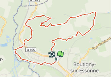
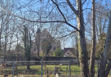
Randonnée Marche de 6,4 km à découvrir à Île-de-France, Essonne, Boutigny-sur-Essonne. Cette randonnée est proposée par guydu41.
Description
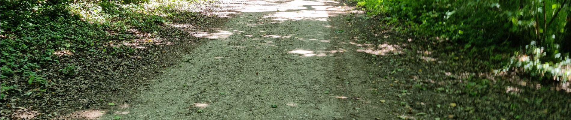
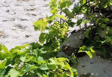
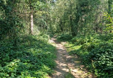
Très belle petite randonnée sur des chemins et des sentiers tortueux dans le massif boisé au Nord de Boutigny-sur-Essonne.
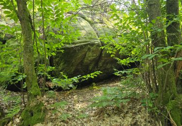
Le circuit longe et domine plusieurs vallées encaissées et carrières de grès.
Un petit crochet permet de voir la base d'un ancien bloc gréseux exploité par les carriers.
Localisation
Commentaires
Randonnées à proximité
![Randonnée Marche Vayres-sur-Essonne - Boucle 22 km Boutigny Vayres Courdimanche - Photo](https://media.geolcdn.com/t/375/260/4b667bc1-98a4-484c-a9ef-d48797f8b1d6.jpg&format=jpg&maxdim=2)
![Marche Marche](https://static1.geolcdn.com/sitytour/trail-icons/101.png)
Marche
![](/images/other/stat-length.png)
![](https://static1.geolcdn.com/siteimages/upload/files/16400158638029165_repeat_loop_refresh_sync_direction_icon.png)
![Randonnée Marche Vayres-sur-Essonne - Boucle 30 km à partir de Vayres / Essonne - Photo](https://media.geolcdn.com/t/375/260/99723d7b-eef1-42c9-a80a-6ef415a50d61.jpg&format=jpg&maxdim=2)
![Marche Marche](https://static1.geolcdn.com/sitytour/trail-icons/101.png)
Marche
![](/images/other/stat-length.png)
![](https://static1.geolcdn.com/siteimages/upload/files/16400158638029165_repeat_loop_refresh_sync_direction_icon.png)
![Randonnée Marche La Ferté-Alais - Boucle Cerny - Photo](https://media.geolcdn.com/t/375/260/562ec7de-aba0-410b-b341-a4b4bf98c65c.jpg&format=jpg&maxdim=2)
![Marche Marche](https://static1.geolcdn.com/sitytour/trail-icons/101.png)
Marche
![](/images/other/stat-length.png)
![](https://static1.geolcdn.com/siteimages/upload/files/16400158638029165_repeat_loop_refresh_sync_direction_icon.png)
![Randonnée Marche Boutigny-sur-Essonne - Le tour du Grand Paris via le GR1 Etape 16 Boutigny /essonne - Lardy - Photo](https://media.geolcdn.com/t/375/260/120031b3-84d9-4df8-a3d3-f842b8d2e855.jpg&format=jpg&maxdim=2)
![Marche Marche](https://static1.geolcdn.com/sitytour/trail-icons/101.png)
Marche
![](/images/other/stat-length.png)
![](https://static1.geolcdn.com/siteimages/upload/files/16400158638029165_repeat_loop_refresh_sync_direction_icon.png)
![Randonnée A pied La Ferté-Alais - Boucle Orveau - Ferté Alais 27 km - Photo](https://media.geolcdn.com/t/375/260/7e0587a3-b381-4c51-bb59-08cb2434ad69.jpg&format=jpg&maxdim=2)
![A pied A pied](https://static1.geolcdn.com/sitytour/trail-icons/100.png)
A pied
![](/images/other/stat-length.png)
![](https://static1.geolcdn.com/siteimages/upload/files/16400158638029165_repeat_loop_refresh_sync_direction_icon.png)
![Randonnée Marche La Ferté-Alais - la ferté alais la sablière - Photo](https://media.geolcdn.com/t/375/260/ext.jpg?maxdim=2&url=https%3A%2F%2Fstatic1.geolcdn.com%2Fsiteimages%2Fupload%2Ffiles%2F1553511878bg_sport_marche.png)
![Marche Marche](https://static1.geolcdn.com/sitytour/trail-icons/101.png)
Marche
![](/images/other/stat-length.png)
![](https://static1.geolcdn.com/siteimages/upload/files/16400158638029165_repeat_loop_refresh_sync_direction_icon.png)
![Randonnée Marche Maisse - Maisse - Forêt communale de Milly-la-Forêt - Photo](https://media.geolcdn.com/t/375/260/ac13d570-05a3-405f-b57f-b7a0251ed338.jpg&format=jpg&maxdim=2)
![Marche Marche](https://static1.geolcdn.com/sitytour/trail-icons/101.png)
Marche
![](/images/other/stat-length.png)
![](https://static1.geolcdn.com/siteimages/upload/files/16400158638029165_repeat_loop_refresh_sync_direction_icon.png)
![Randonnée Marche Videlles - Videlles - Exploration d'un chaos rocheux au hameau](https://media.geolcdn.com/t/375/260/28cf3a42-58a0-4885-b69e-366feb563ae7.jpg&format=jpg&maxdim=2)
![Marche Marche](https://static1.geolcdn.com/sitytour/trail-icons/101.png)
Marche
![](/images/other/stat-length.png)
![](https://static1.geolcdn.com/siteimages/upload/files/16400158638029165_repeat_loop_refresh_sync_direction_icon.png)
![Randonnée Marche Moigny-sur-École - Moigny-sur-École - Photo](https://media.geolcdn.com/t/375/260/e39b79dd-0698-47d1-a993-eeec2e342c98.jpg&format=jpg&maxdim=2)
![Marche Marche](https://static1.geolcdn.com/sitytour/trail-icons/101.png)
Marche
![](/images/other/stat-length.png)
![](https://static1.geolcdn.com/siteimages/upload/files/16400158638029165_repeat_loop_refresh_sync_direction_icon.png)