![](/images/other/stat-length.png)
![Randonnée V.T.T. Simiane-Collongue - Simiane l'etoile - Photo](https://media.geolcdn.com/t/1900/400/ext.pjpeg?maxdim=2&url=https%3A%2F%2Fstatic1.geolcdn.com%2Fsiteimages%2Fupload%2Ffiles%2F1524743154velo.jpg)
Simiane l'etoile
j13120
Utilisateur
![Longueur](/images/other/stat-length.png)
Longueur
21 km
![Altitude max](https://static1.geolcdn.com/siteimages/upload/files/1508320355ic_sort_altitude_max_24dp.png)
Altitude max
534 m
![Dénivelé positif](https://static1.geolcdn.com/siteimages/upload/files/1508320355ic_sort_den_pos_24dp.png)
Dénivelé positif
541 m
![Km-Effort](/images/other/stat-length.png)
Km-Effort
28 km
![Altitude min](https://static1.geolcdn.com/siteimages/upload/files/1508320355ic_sort_altitude_min_24dp.png)
Altitude min
278 m
![Dénivelé négatif](https://static1.geolcdn.com/siteimages/upload/files/1508320355ic_sort_den_neg_24dp.png)
Dénivelé négatif
541 m
![Boucle](https://static1.geolcdn.com/siteimages/upload/files/16400158638029165_repeat_loop_refresh_sync_direction_icon.png)
Boucle
Oui
Date de création :
2014-12-10 00:00:00.0
Dernière modification :
2014-12-10 00:00:00.0
![V.T.T.](https://static1.geolcdn.com/sitytour/trail-icons/202.png)
2h15
Difficulté : Facile
![Scannez ce code QR pour ouvrir la randonnée dans l'application SityTrail](https://capi.geolives.com/qq0zvz2zws4bq2lad0pu/sitytour/trails/366322/qr.png?size=200)
Application GPS de randonnée GRATUITE
À propos
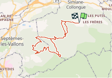
Randonnée V.T.T. de 21 km à découvrir à Provence-Alpes-Côte d'Azur, Bouches-du-Rhône, Simiane-Collongue. Cette randonnée est proposée par j13120.
Description
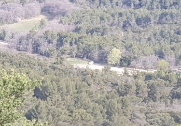
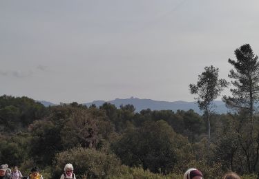
Parcours sur DFCI et grands chemins, à l'abri du vent d'est.
Vue magnifique sur Marseille et les iles ainsi que sur l'étang de Berre
Localisation
Pays :
France
Région :
Provence-Alpes-Côte d'Azur
Département/Province :
Bouches-du-Rhône
Commune :
Simiane-Collongue
Localité :
Unknown
Départ:(Dec)
Départ:(UTM)
697627 ; 4809636 (31T) N.
Commentaires
Randonnées à proximité
![Randonnée Marche Allauch - Le Pilon du Roy - Photo](https://media.geolcdn.com/t/375/260/f70c47ce-637e-4170-ac86-2a2a395feaa2.jpg&format=jpg&maxdim=2)
![Marche Marche](https://static1.geolcdn.com/sitytour/trail-icons/101.png)
Le Pilon du Roy
Marche
Moyen
(1)
Allauch,
Provence-Alpes-Côte d'Azur,
Bouches-du-Rhône,
France
![](/images/other/stat-length.png)
13,7 km | 20 km-effort
6h 0min
![](https://static1.geolcdn.com/siteimages/upload/files/16400158638029165_repeat_loop_refresh_sync_direction_icon.png)
Oui
![Randonnée Marche Simiane-Collongue - chemin de gui - Photo](https://media.geolcdn.com/t/375/260/ext.jpg?maxdim=2&url=https%3A%2F%2Fservices.sitytrail.com%2FGeolivesWS%2FDownloadMedia.ashx%3FTrailID%3D902615%26Media%3D20180210121457.jpg)
![Marche Marche](https://static1.geolcdn.com/sitytour/trail-icons/101.png)
chemin de gui
Marche
Facile
(1)
Simiane-Collongue,
Provence-Alpes-Côte d'Azur,
Bouches-du-Rhône,
France
![](/images/other/stat-length.png)
5,9 km | 8,1 km-effort
1h 45min
![](https://static1.geolcdn.com/siteimages/upload/files/16400158638029165_repeat_loop_refresh_sync_direction_icon.png)
Oui
![Randonnée Course à pied Bouc-Bel-Air - Balade à Bouc Bel Air - Photo](https://media.geolcdn.com/t/375/260/ext.jpg?maxdim=2&url=https%3A%2F%2Fservices.sitytrail.com%2FGeolivesWS%2FDownloadMedia.ashx%3FTrailID%3D106593%26Media%3D11177_1.jpg)
![Course à pied Course à pied](https://static1.geolcdn.com/sitytour/trail-icons/103.png)
Balade à Bouc Bel Air
Course à pied
Moyen
(1)
Bouc-Bel-Air,
Provence-Alpes-Côte d'Azur,
Bouches-du-Rhône,
France
![](/images/other/stat-length.png)
6,6 km | 8,7 km-effort
34min
![](https://static1.geolcdn.com/siteimages/upload/files/16400158638029165_repeat_loop_refresh_sync_direction_icon.png)
Oui
![Randonnée Marche Simiane-Collongue - PF-Simiane-Collongue - La Grande Etoile et le Petit Sanguin - ST - Photo](https://media.geolcdn.com/t/375/260/82a74cf5-866f-40df-bc18-cb0499817c37.jpg&format=jpg&maxdim=2)
![Marche Marche](https://static1.geolcdn.com/sitytour/trail-icons/101.png)
PF-Simiane-Collongue - La Grande Etoile et le Petit Sanguin - ST
Marche
Simiane-Collongue,
Provence-Alpes-Côte d'Azur,
Bouches-du-Rhône,
France
![](/images/other/stat-length.png)
14,8 km | 21 km-effort
4h 43min
![](https://static1.geolcdn.com/siteimages/upload/files/16400158638029165_repeat_loop_refresh_sync_direction_icon.png)
Oui
![Randonnée V.T.T. Bouc-Bel-Air - MOUNINE - Photo](https://media.geolcdn.com/t/375/260/ext.jpg?maxdim=2&url=https%3A%2F%2Fstatic1.geolcdn.com%2Fsiteimages%2Fupload%2Ffiles%2F1524743154velo.jpg)
![V.T.T. V.T.T.](https://static1.geolcdn.com/sitytour/trail-icons/202.png)
MOUNINE
V.T.T.
Difficile
(2)
Bouc-Bel-Air,
Provence-Alpes-Côte d'Azur,
Bouches-du-Rhône,
France
![](/images/other/stat-length.png)
20 km | 28 km-effort
3h 0min
![](https://static1.geolcdn.com/siteimages/upload/files/16400158638029165_repeat_loop_refresh_sync_direction_icon.png)
Oui
![Randonnée Marche Allauch - N D des Anges massif de l'étoile - Photo](https://media.geolcdn.com/t/375/260/6a0032d7-e92c-4350-b286-01fec953b30e.jpg&format=jpg&maxdim=2)
![Marche Marche](https://static1.geolcdn.com/sitytour/trail-icons/101.png)
N D des Anges massif de l'étoile
Marche
Moyen
Allauch,
Provence-Alpes-Côte d'Azur,
Bouches-du-Rhône,
France
![](/images/other/stat-length.png)
13,1 km | 19,5 km-effort
6h 51min
![](https://static1.geolcdn.com/siteimages/upload/files/16400158638029165_repeat_loop_refresh_sync_direction_icon.png)
Oui
![Randonnée Vélo électrique Simiane-Collongue - LES MARRES PILON DU ROI - Photo](https://media.geolcdn.com/t/375/260/c4b78727-69dd-44a9-a9a1-4c1c067165d9.jpg&format=jpg&maxdim=2)
![Vélo électrique Vélo électrique](https://static1.geolcdn.com/sitytour/trail-icons/205.png)
LES MARRES PILON DU ROI
Vélo électrique
Facile
Simiane-Collongue,
Provence-Alpes-Côte d'Azur,
Bouches-du-Rhône,
France
![](/images/other/stat-length.png)
26 km | 36 km-effort
2h 18min
![](https://static1.geolcdn.com/siteimages/upload/files/16400158638029165_repeat_loop_refresh_sync_direction_icon.png)
Oui
![Randonnée Marche Bouc-Bel-Air - Bouc bel air - Photo](https://media.geolcdn.com/t/375/260/cf1c774b-45b4-4326-be41-ff721cfc3693.jpg&format=jpg&maxdim=2)
![Marche Marche](https://static1.geolcdn.com/sitytour/trail-icons/101.png)
Bouc bel air
Marche
Moyen
Bouc-Bel-Air,
Provence-Alpes-Côte d'Azur,
Bouches-du-Rhône,
France
![](/images/other/stat-length.png)
8,9 km | 11,7 km-effort
2h 44min
![](https://static1.geolcdn.com/siteimages/upload/files/16400158638029165_repeat_loop_refresh_sync_direction_icon.png)
Oui
![Randonnée Marche Mimet - Massif de l'Etoile: Col Ste Anne, Pilon, Col des Ouides - Photo](https://media.geolcdn.com/t/375/260/ext.jpg?maxdim=2&url=https%3A%2F%2Fstatic1.geolcdn.com%2Fsiteimages%2Fupload%2Ffiles%2F1553511878bg_sport_marche.png)
![Marche Marche](https://static1.geolcdn.com/sitytour/trail-icons/101.png)
Massif de l'Etoile: Col Ste Anne, Pilon, Col des Ouides
Marche
Très difficile
(1)
Mimet,
Provence-Alpes-Côte d'Azur,
Bouches-du-Rhône,
France
![](/images/other/stat-length.png)
12,3 km | 19,4 km-effort
4h 49min
![](https://static1.geolcdn.com/siteimages/upload/files/16400158638029165_repeat_loop_refresh_sync_direction_icon.png)
Oui