![](/images/other/stat-length.png)
![Randonnée Marche Serans - Chemin de Serans - Photo](https://media.geolcdn.com/t/1900/400/5f5dd226-f9bf-44d0-a351-ea63ac5a0f5f.jpg&format=pjpeg&maxdim=2)
Chemin de Serans
Fky78
Utilisateur
![Longueur](/images/other/stat-length.png)
Longueur
8,2 km
![Altitude max](https://static1.geolcdn.com/siteimages/upload/files/1508320355ic_sort_altitude_max_24dp.png)
Altitude max
218 m
![Dénivelé positif](https://static1.geolcdn.com/siteimages/upload/files/1508320355ic_sort_den_pos_24dp.png)
Dénivelé positif
129 m
![Km-Effort](/images/other/stat-length.png)
Km-Effort
9,9 km
![Altitude min](https://static1.geolcdn.com/siteimages/upload/files/1508320355ic_sort_altitude_min_24dp.png)
Altitude min
120 m
![Dénivelé négatif](https://static1.geolcdn.com/siteimages/upload/files/1508320355ic_sort_den_neg_24dp.png)
Dénivelé négatif
133 m
![Boucle](https://static1.geolcdn.com/siteimages/upload/files/16400158638029165_repeat_loop_refresh_sync_direction_icon.png)
Boucle
Oui
Date de création :
2023-05-16 12:15:44.56
Dernière modification :
2023-05-16 16:41:44.432
![Marche](https://static1.geolcdn.com/sitytour/trail-icons/101.png)
2h14
Difficulté : Moyen
![Scannez ce code QR pour ouvrir la randonnée dans l'application SityTrail](https://capi.geolives.com/qq0zvz2zws4bq2lad0pu/sitytour/trails/3661892/qr.png?size=200)
Application GPS de randonnée GRATUITE
À propos
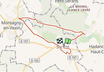
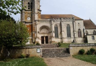
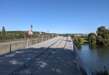
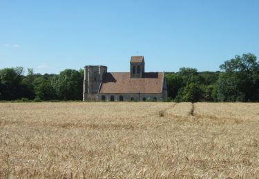
Randonnée Marche de 8,2 km à découvrir à Hauts-de-France, Oise, Serans. Cette randonnée est proposée par Fky78.
Description
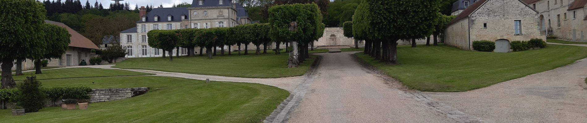
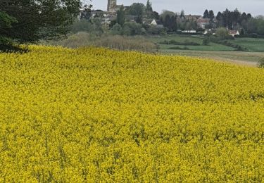
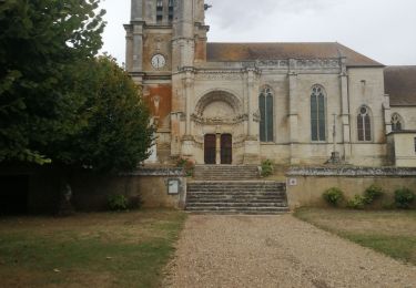
Parcours entre forêt et vue sur grandes plaines , on peut voir la tour Eiffel au loin par temps clair , passage dans la forêt humide et boueux ce printemps et haute herbe dans la fin du chemin avant retour sur Serans
Localisation
Pays :
France
Région :
Hauts-de-France
Département/Province :
Oise
Commune :
Serans
Localité :
Unknown
Départ:(Dec)
Départ:(UTM)
414889 ; 5448834 (31U) N.
Commentaires
Randonnées à proximité
![Randonnée Marche Montjavoult - Montjavoult - Vaudancourt - Photo](https://media.geolcdn.com/t/375/260/ext.jpg?maxdim=2&url=https%3A%2F%2Fstatic1.geolcdn.com%2Fsiteimages%2Fupload%2Ffiles%2F1553511878bg_sport_marche.png)
![Marche Marche](https://static1.geolcdn.com/sitytour/trail-icons/101.png)
Montjavoult - Vaudancourt
Marche
Facile
(1)
Montjavoult,
Hauts-de-France,
Oise,
France
![](/images/other/stat-length.png)
10,2 km | 12,2 km-effort
2h 39min
![](https://static1.geolcdn.com/siteimages/upload/files/16400158638029165_repeat_loop_refresh_sync_direction_icon.png)
Oui
![Randonnée Cheval Magny-en-Vexin - Magny - Le Bouleaume - Chars - Photo](https://media.geolcdn.com/t/375/260/ext.jpg?maxdim=2&url=https%3A%2F%2Fstatic1.geolcdn.com%2Fsiteimages%2Fupload%2Ffiles%2F1524743154cheval.jpg)
![Cheval Cheval](https://static1.geolcdn.com/sitytour/trail-icons/300.png)
Magny - Le Bouleaume - Chars
Cheval
Moyen
(1)
Magny-en-Vexin,
Île-de-France,
Val-d'Oise,
France
![](/images/other/stat-length.png)
28 km | 32 km-effort
3h 38min
![](https://static1.geolcdn.com/siteimages/upload/files/16400158638029165_repeat_loop_refresh_sync_direction_icon.png)
Non
![Randonnée Marche Serans - Montagny en vexin - Photo](https://media.geolcdn.com/t/375/260/44b3a3d2-e302-4394-94ad-04fcc7b5e9a8.jpg&format=jpg&maxdim=2)
![Marche Marche](https://static1.geolcdn.com/sitytour/trail-icons/101.png)
Montagny en vexin
Marche
Moyen
Serans,
Hauts-de-France,
Oise,
France
![](/images/other/stat-length.png)
7,7 km | 9,5 km-effort
2h 3min
![](https://static1.geolcdn.com/siteimages/upload/files/16400158638029165_repeat_loop_refresh_sync_direction_icon.png)
Non
![Randonnée Marche Montjavoult - Montjavoult le gibet Valécourt - Photo](https://media.geolcdn.com/t/375/260/2cb6e3f0-fdc2-4bbc-af55-043b8b032a0d.jpg&format=jpg&maxdim=2)
![Marche Marche](https://static1.geolcdn.com/sitytour/trail-icons/101.png)
Montjavoult le gibet Valécourt
Marche
Difficile
Montjavoult,
Hauts-de-France,
Oise,
France
![](/images/other/stat-length.png)
12,8 km | 15,4 km-effort
2h 19min
![](https://static1.geolcdn.com/siteimages/upload/files/16400158638029165_repeat_loop_refresh_sync_direction_icon.png)
Oui
![Randonnée Marche Montjavoult - Montjavoult- l'Ecce Homo- la vallée Grand Jacques - Photo](https://media.geolcdn.com/t/375/260/d9ada8f6-8228-4f48-81bc-713d96c4d024.jpg&format=jpg&maxdim=2)
![Marche Marche](https://static1.geolcdn.com/sitytour/trail-icons/101.png)
Montjavoult- l'Ecce Homo- la vallée Grand Jacques
Marche
Difficile
Montjavoult,
Hauts-de-France,
Oise,
France
![](/images/other/stat-length.png)
12,9 km | 15,5 km-effort
2h 44min
![](https://static1.geolcdn.com/siteimages/upload/files/16400158638029165_repeat_loop_refresh_sync_direction_icon.png)
Oui
![Randonnée A pied Magny-en-Vexin - De Magny-en-Vexin à Mantes-la-Jolie - Photo](https://media.geolcdn.com/t/375/260/0c893c42-6322-43e8-9672-2bcd0d3680e5.jpeg&format=jpg&maxdim=2)
![A pied A pied](https://static1.geolcdn.com/sitytour/trail-icons/100.png)
De Magny-en-Vexin à Mantes-la-Jolie
A pied
Difficile
Magny-en-Vexin,
Île-de-France,
Val-d'Oise,
France
![](/images/other/stat-length.png)
30 km | 37 km-effort
8h 20min
![](https://static1.geolcdn.com/siteimages/upload/files/16400158638029165_repeat_loop_refresh_sync_direction_icon.png)
Non
![Randonnée A pied Magny-en-Vexin - L’église de Nucourt par le bois de l’Île - Photo](https://media.geolcdn.com/t/375/260/855ba59d-1237-4a95-92b0-ab078704df0b.jpeg&format=jpg&maxdim=2)
![A pied A pied](https://static1.geolcdn.com/sitytour/trail-icons/100.png)
L’église de Nucourt par le bois de l’Île
A pied
Facile
Magny-en-Vexin,
Île-de-France,
Val-d'Oise,
France
![](/images/other/stat-length.png)
8,9 km | 10,2 km-effort
2h 19min
![](https://static1.geolcdn.com/siteimages/upload/files/16400158638029165_repeat_loop_refresh_sync_direction_icon.png)
Non
![Randonnée Marche Magny-en-Vexin - Magny en vexin - Photo](https://media.geolcdn.com/t/375/260/4ee88479-c15d-4d95-8c5c-7d7a567b3d3e.jpg&format=jpg&maxdim=2)
![Marche Marche](https://static1.geolcdn.com/sitytour/trail-icons/101.png)
Magny en vexin
Marche
Très facile
Magny-en-Vexin,
Île-de-France,
Val-d'Oise,
France
![](/images/other/stat-length.png)
12,1 km | 13,8 km-effort
2h 49min
![](https://static1.geolcdn.com/siteimages/upload/files/16400158638029165_repeat_loop_refresh_sync_direction_icon.png)
Oui
![Randonnée Marche Magny-en-Vexin - Source de l Aubette - Photo](https://media.geolcdn.com/t/375/260/ext.jpg?maxdim=2&url=https%3A%2F%2Fstatic1.geolcdn.com%2Fsiteimages%2Fupload%2Ffiles%2F1553511878bg_sport_marche.png)
![Marche Marche](https://static1.geolcdn.com/sitytour/trail-icons/101.png)
Source de l Aubette
Marche
Très facile
(1)
Magny-en-Vexin,
Île-de-France,
Val-d'Oise,
France
![](/images/other/stat-length.png)
6 km | 6,9 km-effort
1h 29min
![](https://static1.geolcdn.com/siteimages/upload/files/16400158638029165_repeat_loop_refresh_sync_direction_icon.png)
Oui