![](/images/other/stat-length.png)
![Randonnée Marche Unknown - Ballade le long de la voie ferrée du train touristique de Caernarfon - Photo](https://media.geolcdn.com/t/1900/400/0b69132b-64e8-46fa-8547-c6751813d1ed.jpg&format=pjpeg&maxdim=2)
Ballade le long de la voie ferrée du train touristique de Caernarfon
dudu42
Utilisateur GUIDE
![Longueur](/images/other/stat-length.png)
![Altitude max](https://static1.geolcdn.com/siteimages/upload/files/1508320355ic_sort_altitude_max_24dp.png)
![Dénivelé positif](https://static1.geolcdn.com/siteimages/upload/files/1508320355ic_sort_den_pos_24dp.png)
![Km-Effort](/images/other/stat-length.png)
![Altitude min](https://static1.geolcdn.com/siteimages/upload/files/1508320355ic_sort_altitude_min_24dp.png)
![Dénivelé négatif](https://static1.geolcdn.com/siteimages/upload/files/1508320355ic_sort_den_neg_24dp.png)
![Boucle](https://static1.geolcdn.com/siteimages/upload/files/16400158638029165_repeat_loop_refresh_sync_direction_icon.png)
![Marche](https://static1.geolcdn.com/sitytour/trail-icons/101.png)
2h23
Difficulté : Facile
![Scannez ce code QR pour ouvrir la randonnée dans l'application SityTrail](https://capi.geolives.com/qq0zvz2zws4bq2lad0pu/sitytour/trails/3660696/qr.png?size=200)
Application GPS de randonnée GRATUITE
À propos
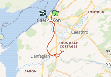
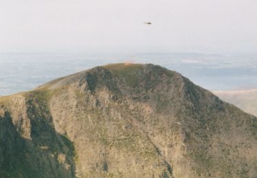
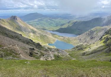
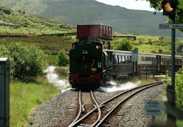
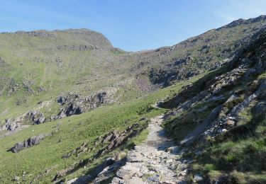
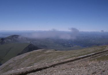
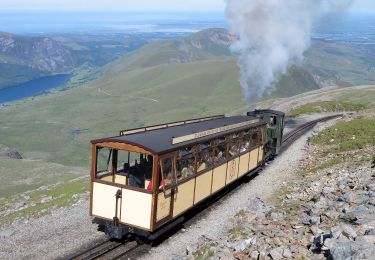
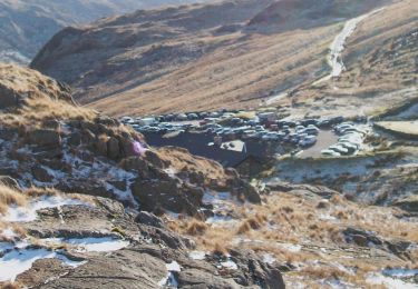
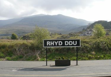
Randonnée Marche de 10 km à découvrir à Pays de Galles, Gwynedd. Cette randonnée est proposée par dudu42.
Description
Promenade sur piste cyclable donc attention.Parcours très agréable le long de la voie du train touristique. Végétation avec fougères et fleurs de sous bois. Attention , vers la fin de la moitié du parcours ,si vous n aller pas dans le parc ( payant avec résa en ligne) faire demi-tour dans le hameau car les chemins et routes sont privées.
Localisation
Commentaires
Randonnées à proximité
![Randonnée A pied - Welsh Three Thousands - Photo](https://media.geolcdn.com/t/375/260/5ab8a0aa-99ee-4595-9df2-2d73ae24b2ac.jpeg&format=jpg&maxdim=2)
![A pied A pied](https://static1.geolcdn.com/sitytour/trail-icons/100.png)
A pied
![](/images/other/stat-length.png)
![](https://static1.geolcdn.com/siteimages/upload/files/16400158638029165_repeat_loop_refresh_sync_direction_icon.png)
![Randonnée A pied - Snowdon Ranger Path - Photo](https://media.geolcdn.com/t/375/260/faa58f12-38d5-4b1e-960c-3efae5abce00.jpeg&format=jpg&maxdim=2)
![A pied A pied](https://static1.geolcdn.com/sitytour/trail-icons/100.png)
A pied
![](/images/other/stat-length.png)
![](https://static1.geolcdn.com/siteimages/upload/files/16400158638029165_repeat_loop_refresh_sync_direction_icon.png)
![Randonnée A pied - Rhyd Ddu Path - Photo](https://media.geolcdn.com/t/375/260/48131255-60b4-495f-ae0b-0d9605dc65fa.jpeg&format=jpg&maxdim=2)
![A pied A pied](https://static1.geolcdn.com/sitytour/trail-icons/100.png)
A pied
![](/images/other/stat-length.png)
![](https://static1.geolcdn.com/siteimages/upload/files/16400158638029165_repeat_loop_refresh_sync_direction_icon.png)
![Randonnée A pied - Watkin Path - Photo](https://media.geolcdn.com/t/375/260/c6a48fa0-6308-465e-8d71-d7620c3f9fb4.jpeg&format=jpg&maxdim=2)
![A pied A pied](https://static1.geolcdn.com/sitytour/trail-icons/100.png)
![Randonnée A pied - Pyg Track - Photo](https://media.geolcdn.com/t/375/260/e6c4d3cb-2f7d-4836-aef6-035ad12e948d.jpeg&format=jpg&maxdim=2)
![A pied A pied](https://static1.geolcdn.com/sitytour/trail-icons/100.png)
![Randonnée A pied - Llanberis Path - Photo](https://media.geolcdn.com/t/375/260/5412c483-5e3d-4c06-9307-04cd80856ea2.jpeg&format=jpg&maxdim=2)
![A pied A pied](https://static1.geolcdn.com/sitytour/trail-icons/100.png)
A pied
![](/images/other/stat-length.png)
![](https://static1.geolcdn.com/siteimages/upload/files/16400158638029165_repeat_loop_refresh_sync_direction_icon.png)
![Randonnée A pied - Miners' Track - Photo](https://media.geolcdn.com/t/375/260/585d4134-e4aa-421b-b710-2084706a950f.jpeg&format=jpg&maxdim=2)
![A pied A pied](https://static1.geolcdn.com/sitytour/trail-icons/100.png)
A pied
![](/images/other/stat-length.png)
![](https://static1.geolcdn.com/siteimages/upload/files/16400158638029165_repeat_loop_refresh_sync_direction_icon.png)
![Randonnée A pied - Lôn Gwyrfai - Photo](https://media.geolcdn.com/t/375/260/3e9fc225-b0d6-4154-a17e-6406d8f46b95.jpeg&format=jpg&maxdim=2)
![A pied A pied](https://static1.geolcdn.com/sitytour/trail-icons/100.png)
A pied
![](/images/other/stat-length.png)
![](https://static1.geolcdn.com/siteimages/upload/files/16400158638029165_repeat_loop_refresh_sync_direction_icon.png)
![Randonnée Marche - Aber falls - Photo](https://media.geolcdn.com/t/375/260/ext.jpg?maxdim=2&url=https%3A%2F%2Fstatic1.geolcdn.com%2Fsiteimages%2Fupload%2Ffiles%2F1553511878bg_sport_marche.png)
![Marche Marche](https://static1.geolcdn.com/sitytour/trail-icons/101.png)
Marche
![](/images/other/stat-length.png)
![](https://static1.geolcdn.com/siteimages/upload/files/16400158638029165_repeat_loop_refresh_sync_direction_icon.png)