


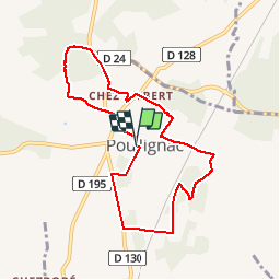

8,5 km | 10,4 km-effort


Utilisateur


Application GPS de randonnée GRATUITE
 SityTrail
IGN / Instituts géographiques
SityTrail World
Le monde est à vous
Randonnée Marche de 8,4 km à découvrir à Nouvelle-Aquitaine, Charente, Poullignac. Cette randonnée est proposée par dorcier.
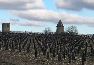
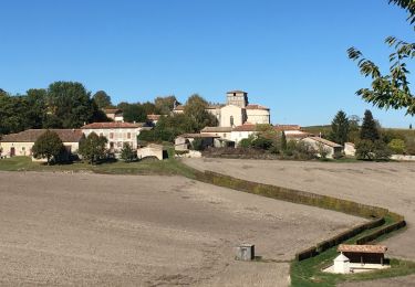
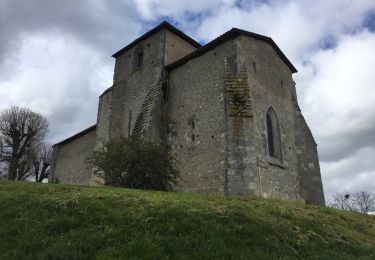
Senyier du bois de la Caillère. Poullignac est un petit village niché au creux d'un vallon boisé ou coule le Lamoury affluent du Né.Eglise romane du 12ème siècle avec de magnifiques fresques également du 12ème.
Marche
Marche
Marche

Marche
Marche

A pied
A pied
Marche
Marche