


8,5 km | 10,5 km-effort
![Randonnée Marche Montfort-l'Amaury - Yvelines_[Rando_Journée]_Montfort=>Les Mesnuls=>Autour_de_Montfort - Photo](https://media.geolcdn.com/t/1900/400/87104e12-16e9-47e9-9422-03ff8e98753c.jpg&format=pjpeg&maxdim=2)

Utilisateur


Application GPS de randonnée GRATUITE
 SityTrail
IGN / Instituts géographiques
SityTrail World
Le monde est à vous
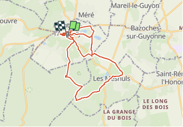
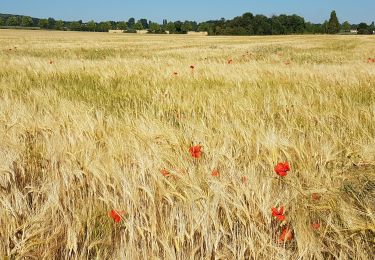
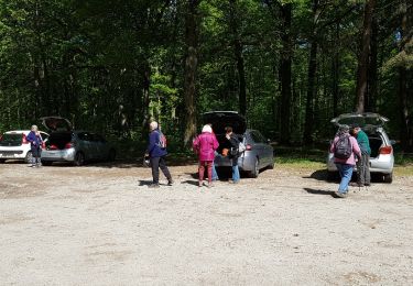
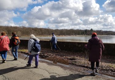
Randonnée Marche de 18,7 km à découvrir à Île-de-France, Yvelines, Montfort-l'Amaury. Cette randonnée est proposée par BMorin91470.
Randonnée sur une journée à partir de Montfort-L'Amaury :
- Matin : circuit de 12 km qui mène par la forêt jusqu'a Les Mesnuls et retour
Pique-nique au point de départ.
- Après-midi : circuit de 7 km permettant de visiter ou longer les principales richesses du patrimoine montfortois (l’Église Saint-Pierre, les Tours, la Maison de Maurice Ravel, le Cloître, le château de Groussay, les Remparts) et de faire ainsi le tour de la commune.
Rando journée réalisée le 21/05/2023
![Randonnée Marche Montfort-l'Amaury - Yvelines_[Rando_Journée]_Montfort=>Les Mesnuls=>Autour_de_Montfort - Photo 1](https://media.geolcdn.com/t/2048/auto/87104e12-16e9-47e9-9422-03ff8e98753c.jpg&format=jpg&maxdim=0 "Randonnée Marche Montfort-l'Amaury - Yvelines_[Rando_Journée]_Montfort=>Les Mesnuls=>Autour_de_Montfort - Photo 1")
![Randonnée Marche Montfort-l'Amaury - Yvelines_[Rando_Journée]_Montfort=>Les Mesnuls=>Autour_de_Montfort - Photo 2](https://media.geolcdn.com/t/2048/auto/7a469e32-08b0-4b79-be6d-88c414fcb169.jpg&format=jpg&maxdim=0 "Randonnée Marche Montfort-l'Amaury - Yvelines_[Rando_Journée]_Montfort=>Les Mesnuls=>Autour_de_Montfort - Photo 2")
![Randonnée Marche Montfort-l'Amaury - Yvelines_[Rando_Journée]_Montfort=>Les Mesnuls=>Autour_de_Montfort - Photo 3](https://media.geolcdn.com/t/2048/auto/52040b76-5a55-43e1-b88a-8e05db5df2c9.jpg&format=jpg&maxdim=0 "Randonnée Marche Montfort-l'Amaury - Yvelines_[Rando_Journée]_Montfort=>Les Mesnuls=>Autour_de_Montfort - Photo 3")
![Randonnée Marche Montfort-l'Amaury - Yvelines_[Rando_Journée]_Montfort=>Les Mesnuls=>Autour_de_Montfort - Photo 4](https://media.geolcdn.com/t/2048/auto/a28dc38f-337e-4568-a4a5-a7fad7e07d8a.jpg&format=jpg&maxdim=0 "Randonnée Marche Montfort-l'Amaury - Yvelines_[Rando_Journée]_Montfort=>Les Mesnuls=>Autour_de_Montfort - Photo 4")
![Randonnée Marche Montfort-l'Amaury - Yvelines_[Rando_Journée]_Montfort=>Les Mesnuls=>Autour_de_Montfort - Photo 5](https://media.geolcdn.com/t/2048/auto/633c7a87-06d7-4a53-8fc2-a2e00a2bec43.jpg&format=jpg&maxdim=0 "Randonnée Marche Montfort-l'Amaury - Yvelines_[Rando_Journée]_Montfort=>Les Mesnuls=>Autour_de_Montfort - Photo 5")
![Randonnée Marche Montfort-l'Amaury - Yvelines_[Rando_Journée]_Montfort=>Les Mesnuls=>Autour_de_Montfort - Photo 6](https://media.geolcdn.com/t/2048/auto/9b2d3d87-3602-4e61-af25-56a3274780fd.jpg&format=jpg&maxdim=0 "Randonnée Marche Montfort-l'Amaury - Yvelines_[Rando_Journée]_Montfort=>Les Mesnuls=>Autour_de_Montfort - Photo 6")
![Randonnée Marche Montfort-l'Amaury - Yvelines_[Rando_Journée]_Montfort=>Les Mesnuls=>Autour_de_Montfort - Photo 7](https://media.geolcdn.com/t/2048/auto/c57ad9e6-3e02-458f-92d5-dfb722eeffbc.jpg&format=jpg&maxdim=0 "Randonnée Marche Montfort-l'Amaury - Yvelines_[Rando_Journée]_Montfort=>Les Mesnuls=>Autour_de_Montfort - Photo 7")
![Randonnée Marche Montfort-l'Amaury - Yvelines_[Rando_Journée]_Montfort=>Les Mesnuls=>Autour_de_Montfort - Photo 8](https://media.geolcdn.com/t/2048/auto/8abe4a3e-45a4-416a-9728-8bf436815323.jpg&format=jpg&maxdim=0 "Randonnée Marche Montfort-l'Amaury - Yvelines_[Rando_Journée]_Montfort=>Les Mesnuls=>Autour_de_Montfort - Photo 8")

Marche
Marche
![Randonnée Marche Montfort-l'Amaury - Yvelines_[Rando_Journée]_Montfort=>Les Mesnuls=>Autour_de_Montfort - Tronçon 1 - Photo](https://media.geolcdn.com/t/375/260/9a77b4d0-afa4-42cb-beea-4a17fa8cb8c3.jpg&format=jpg&maxdim=2)
Marche
![Randonnée Marche Montfort-l'Amaury - Yvelines_[Rando_Journée]_Montfort=>Les Mesnuls=>Autour_de_Montfort - Tronçon 2 - Photo](https://media.geolcdn.com/t/375/260/3a031c20-1fc4-4232-b97e-93470db48f02.jpg&format=jpg&maxdim=2)
Marche
Marche
Avion
Marche
Marche
Autre activité