![](/images/other/stat-length.png)
![Randonnée Marche Cornimont - En balcon au-dessus de La Bresse - Photo](https://media.geolcdn.com/t/1900/400/ext.pjpeg?maxdim=2&url=https%3A%2F%2Fservices.sitytrail.com%2FGeolivesWS%2FDownloadMedia.ashx%3FTrailID%3D365437%26Media%3Dfix__20141125162756.jpg)
En balcon au-dessus de La Bresse
jeanclaude12
Utilisateur
![Longueur](/images/other/stat-length.png)
Longueur
9,6 km
![Altitude max](https://static1.geolcdn.com/siteimages/upload/files/1508320355ic_sort_altitude_max_24dp.png)
Altitude max
1062 m
![Dénivelé positif](https://static1.geolcdn.com/siteimages/upload/files/1508320355ic_sort_den_pos_24dp.png)
Dénivelé positif
368 m
![Km-Effort](/images/other/stat-length.png)
Km-Effort
14,5 km
![Altitude min](https://static1.geolcdn.com/siteimages/upload/files/1508320355ic_sort_altitude_min_24dp.png)
Altitude min
860 m
![Dénivelé négatif](https://static1.geolcdn.com/siteimages/upload/files/1508320355ic_sort_den_neg_24dp.png)
Dénivelé négatif
364 m
![Boucle](https://static1.geolcdn.com/siteimages/upload/files/16400158638029165_repeat_loop_refresh_sync_direction_icon.png)
Boucle
Oui
Date de création :
2014-12-10 00:00:00.0
Dernière modification :
2014-12-10 00:00:00.0
![Marche](https://static1.geolcdn.com/sitytour/trail-icons/101.png)
2h33
Difficulté : Moyen
![Scannez ce code QR pour ouvrir la randonnée dans l'application SityTrail](https://capi.geolives.com/qq0zvz2zws4bq2lad0pu/sitytour/trails/365437/qr.png?size=200)
Application GPS de randonnée GRATUITE
À propos
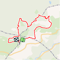
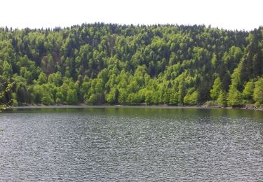
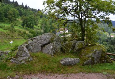
Randonnée Marche de 9,6 km à découvrir à Grand Est, Vosges, Cornimont. Cette randonnée est proposée par jeanclaude12.
Description
Agréable randonnée en balcon au départ de La Roche des Chats vers le Raindé, la Basse des Faignes, l'Etang de Jemnaufaing et le Rondfaing.
Localisation
Pays :
France
Région :
Grand Est
Département/Province :
Vosges
Commune :
Cornimont
Localité :
Unknown
Départ:(Dec)
Départ:(UTM)
337704 ; 5317750 (32T) N.
Commentaires
Randonnées à proximité
![Randonnée Marche La Bresse - la bresse - le moutier des fées - Photo](https://media.geolcdn.com/t/375/260/8b05ded1-af8a-4cd0-8ffd-c8efb092f1de.jpg&format=jpg&maxdim=2)
![Marche Marche](https://static1.geolcdn.com/sitytour/trail-icons/101.png)
la bresse - le moutier des fées
Marche
Très facile
(1)
La Bresse,
Grand Est,
Vosges,
France
![](/images/other/stat-length.png)
26 km | 36 km-effort
3h 26min
![](https://static1.geolcdn.com/siteimages/upload/files/16400158638029165_repeat_loop_refresh_sync_direction_icon.png)
Non
![Randonnée Marche La Bresse - Le Couchetat - Photo](https://media.geolcdn.com/t/375/260/ext.jpg?maxdim=2&url=https%3A%2F%2Fservices.sitytrail.com%2FGeolivesWS%2FDownloadMedia.ashx%3FTrailID%3D441671%26Media%3D20150706110250.jpg)
![Marche Marche](https://static1.geolcdn.com/sitytour/trail-icons/101.png)
Le Couchetat
Marche
Très facile
(2)
La Bresse,
Grand Est,
Vosges,
France
![](/images/other/stat-length.png)
4,8 km | 7,4 km-effort
1h 50min
![](https://static1.geolcdn.com/siteimages/upload/files/16400158638029165_repeat_loop_refresh_sync_direction_icon.png)
Oui
![Randonnée Marche Cornimont - Xoulces _ Grand Ventron _ Vieille Montagne - Photo](https://media.geolcdn.com/t/375/260/ext.jpg?maxdim=2&url=https%3A%2F%2Fservices.sitytrail.com%2FGeolivesWS%2FDownloadMedia.ashx%3FTrailID%3D439822%26Media%3Dfix__20150630145857.jpg)
![Marche Marche](https://static1.geolcdn.com/sitytour/trail-icons/101.png)
Xoulces _ Grand Ventron _ Vieille Montagne
Marche
Moyen
(1)
Cornimont,
Grand Est,
Vosges,
France
![](/images/other/stat-length.png)
15,6 km | 25 km-effort
5h 6min
![](https://static1.geolcdn.com/siteimages/upload/files/16400158638029165_repeat_loop_refresh_sync_direction_icon.png)
Non
![Randonnée Marche La Bresse - Le col du Brabant et le lac des Corbeaux - Photo](https://media.geolcdn.com/t/375/260/ext.jpg?maxdim=2&url=https%3A%2F%2Fservices.sitytrail.com%2FGeolivesWS%2FDownloadMedia.ashx%3FTrailID%3D418054%26Media%3Dfix__20150508123923.jpg)
![Marche Marche](https://static1.geolcdn.com/sitytour/trail-icons/101.png)
Le col du Brabant et le lac des Corbeaux
Marche
Moyen
(2)
La Bresse,
Grand Est,
Vosges,
France
![](/images/other/stat-length.png)
10,3 km | 16,4 km-effort
3h 51min
![](https://static1.geolcdn.com/siteimages/upload/files/16400158638029165_repeat_loop_refresh_sync_direction_icon.png)
Oui
![Randonnée Marche La Bresse - Le Moutier des Fées_backup_backup - Photo](https://media.geolcdn.com/t/375/260/ext.jpg?maxdim=2&url=https%3A%2F%2Fstatic1.geolcdn.com%2Fsiteimages%2Fupload%2Ffiles%2F1553511878bg_sport_marche.png)
![Marche Marche](https://static1.geolcdn.com/sitytour/trail-icons/101.png)
Le Moutier des Fées_backup_backup
Marche
Facile
(1)
La Bresse,
Grand Est,
Vosges,
France
![](/images/other/stat-length.png)
9,1 km | 15,4 km-effort
3h 11min
![](https://static1.geolcdn.com/siteimages/upload/files/16400158638029165_repeat_loop_refresh_sync_direction_icon.png)
Oui
![Randonnée Randonnée équestre Gerbamont - 2022-06-05 Rando CVA Gerbamont Dommartin les Remiremont - Photo](https://media.geolcdn.com/t/375/260/fd6e9bbc-68c7-4aa5-ac35-74c2c082f858.jpg&format=jpg&maxdim=2)
![Randonnée équestre Randonnée équestre](https://static1.geolcdn.com/sitytour/trail-icons/301.png)
2022-06-05 Rando CVA Gerbamont Dommartin les Remiremont
Randonnée équestre
Difficile
Gerbamont,
Grand Est,
Vosges,
France
![](/images/other/stat-length.png)
24 km | 34 km-effort
5h 10min
![](https://static1.geolcdn.com/siteimages/upload/files/16400158638029165_repeat_loop_refresh_sync_direction_icon.png)
Non
![Randonnée Randonnée équestre Gerbamont - 2022-06-04 Rando CVA Gerbamont Boucle Foret de Noire Goutte - Photo](https://media.geolcdn.com/t/375/260/44bce39b-ceb9-4dae-b553-730e48ff9ece.jpg&format=jpg&maxdim=2)
![Randonnée équestre Randonnée équestre](https://static1.geolcdn.com/sitytour/trail-icons/301.png)
2022-06-04 Rando CVA Gerbamont Boucle Foret de Noire Goutte
Randonnée équestre
Très difficile
Gerbamont,
Grand Est,
Vosges,
France
![](/images/other/stat-length.png)
31 km | 43 km-effort
6h 2min
![](https://static1.geolcdn.com/siteimages/upload/files/16400158638029165_repeat_loop_refresh_sync_direction_icon.png)
Oui
![Randonnée Marche Saulxures-sur-Moselotte - France Vosges saulxure sur Moselotte Etang des fées coteau du bambois 3,6km 22072019 - Photo](https://media.geolcdn.com/t/375/260/ext.jpg?maxdim=2&url=https%3A%2F%2Fstatic1.geolcdn.com%2Fsiteimages%2Fupload%2Ffiles%2F1553511878bg_sport_marche.png)
![Marche Marche](https://static1.geolcdn.com/sitytour/trail-icons/101.png)
France Vosges saulxure sur Moselotte Etang des fées coteau du bambois 3,6km...
Marche
Facile
(2)
Saulxures-sur-Moselotte,
Grand Est,
Vosges,
France
![](/images/other/stat-length.png)
3,6 km | 4,7 km-effort
1h 22min
![](https://static1.geolcdn.com/siteimages/upload/files/16400158638029165_repeat_loop_refresh_sync_direction_icon.png)
Oui
![V.T.T. V.T.T.](https://static1.geolcdn.com/sitytour/trail-icons/202.png)
La Bresse : CIRCUIT VTT N°1 - LES BALCONS DE LA BRESSE
V.T.T.
Facile
La Bresse,
Grand Est,
Vosges,
France
![](/images/other/stat-length.png)
12,5 km | 16,7 km-effort
1h 0min
![](https://static1.geolcdn.com/siteimages/upload/files/16400158638029165_repeat_loop_refresh_sync_direction_icon.png)
Oui