


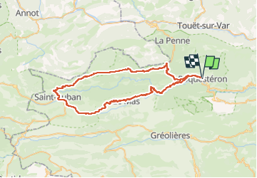

24 km | 46 km-effort


Utilisateur


Application GPS de randonnée GRATUITE
 SityTrail
IGN / Instituts géographiques
SityTrail World
Le monde est à vous
Randonnée Vélo électrique de 68 km à découvrir à Provence-Alpes-Côte d'Azur, Alpes-Maritimes, Roquestéron. Cette randonnée est proposée par franquen.
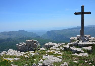
Très beau circuit permettant d'admirer la clue d'Aiglun, la clue de St Auban et la clue de Riolan. Il est conseillé de faire la boucle comme indiqué car dans l'autre sens la montée Coullongues est interminable
A pied

A pied

Marche

Marche
Marche
Marche
Marche
Marche
Marche