![](/images/other/stat-length.png)
![Randonnée Marche Bernissart - De Bernissart à Roisin - Photo](https://media.geolcdn.com/t/1900/400/acdb2308-648c-4f98-97ef-3be26321cf3b.jpg&format=pjpeg&maxdim=2)
De Bernissart à Roisin
jeff2
Utilisateur
![Longueur](/images/other/stat-length.png)
Longueur
30 km
![Altitude max](https://static1.geolcdn.com/siteimages/upload/files/1508320355ic_sort_altitude_max_24dp.png)
Altitude max
97 m
![Dénivelé positif](https://static1.geolcdn.com/siteimages/upload/files/1508320355ic_sort_den_pos_24dp.png)
Dénivelé positif
204 m
![Km-Effort](/images/other/stat-length.png)
Km-Effort
32 km
![Altitude min](https://static1.geolcdn.com/siteimages/upload/files/1508320355ic_sort_altitude_min_24dp.png)
Altitude min
13 m
![Dénivelé négatif](https://static1.geolcdn.com/siteimages/upload/files/1508320355ic_sort_den_neg_24dp.png)
Dénivelé négatif
127 m
![Boucle](https://static1.geolcdn.com/siteimages/upload/files/16400158638029165_repeat_loop_refresh_sync_direction_icon.png)
Boucle
Non
Date de création :
2023-05-07 05:23:06.118
Dernière modification :
2023-05-08 07:39:08.65
![Marche](https://static1.geolcdn.com/sitytour/trail-icons/101.png)
9h10
Difficulté : Moyen
![Scannez ce code QR pour ouvrir la randonnée dans l'application SityTrail](https://capi.geolives.com/qq0zvz2zws4bq2lad0pu/sitytour/trails/3651224/qr.png?size=200)
Application GPS de randonnée GRATUITE
À propos
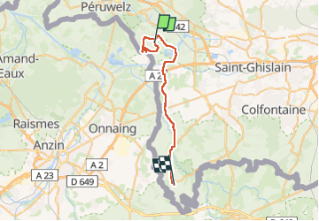
Randonnée Marche de 30 km à découvrir à Wallonie, Hainaut, Bernissart. Cette randonnée est proposée par jeff2.
Description
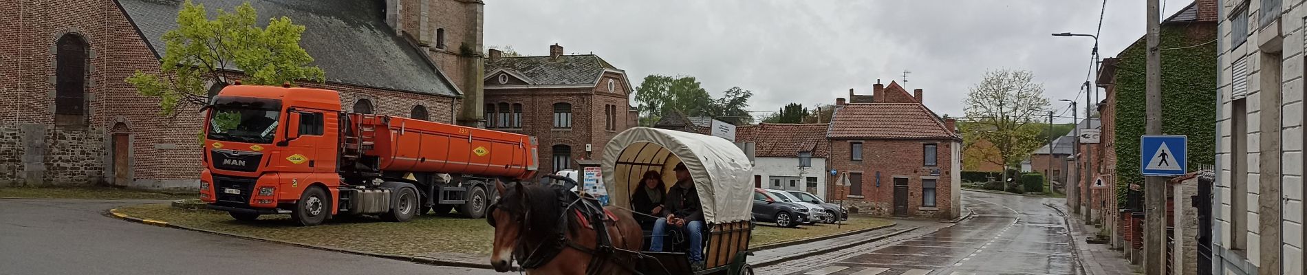
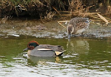
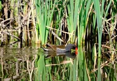
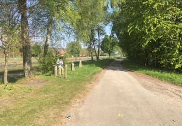
Départ du camping du Préau, sympa parce que bengalow au prix d'une tente de camping, puis 8,2 kms en boucle retour au départ, chemin fermée, impossible de passer, réserve Ornitho.
Passage à Quievrain, puis arrivée à Roisin en Belgique. Camping des Tourelles.
Localisation
Pays :
Belgique
Région :
Wallonie
Département/Province :
Hainaut
Commune :
Bernissart
Localité :
Unknown
Départ:(Dec)
Départ:(UTM)
547295 ; 5591278 (31U) N.
Commentaires
Randonnées à proximité
![Randonnée Marche Bernissart - Harchies. Natura 2000, des sites qui valent le détour. HT1 - Photo](https://media.geolcdn.com/t/375/260/ext.jpg?maxdim=2&url=https%3A%2F%2Fservices.sitytrail.com%2FGeolivesWS%2FDownloadMedia.ashx%3FTrailID%3D108047%26Media%3D55525e45-0980-46a8-a8cb-1f1bf9a7f502.jpg)
![Marche Marche](https://static1.geolcdn.com/sitytour/trail-icons/101.png)
Harchies. Natura 2000, des sites qui valent le détour. HT1
Marche
Très facile
(8)
Bernissart,
Wallonie,
Hainaut,
Belgique
![](/images/other/stat-length.png)
6,7 km | 7,2 km-effort
Inconnu
![](https://static1.geolcdn.com/siteimages/upload/files/16400158638029165_repeat_loop_refresh_sync_direction_icon.png)
Oui
![Randonnée Marche Bernissart - RL-GG-08_Blaton_Erbisoeul - Photo](https://media.geolcdn.com/t/375/260/b5d305e0-4ee4-456e-bfc5-3d0771f79506.jpg&format=jpg&maxdim=2)
![Marche Marche](https://static1.geolcdn.com/sitytour/trail-icons/101.png)
RL-GG-08_Blaton_Erbisoeul
Marche
Très difficile
(2)
Bernissart,
Wallonie,
Hainaut,
Belgique
![](/images/other/stat-length.png)
26 km | 29 km-effort
6h 30min
![](https://static1.geolcdn.com/siteimages/upload/files/16400158638029165_repeat_loop_refresh_sync_direction_icon.png)
Non
![Randonnée Marche Bernissart - Bon-Secours - Circuit Natura 2000, des sites qui valent le détour - Ht07 - Photo](https://media.geolcdn.com/t/375/260/ext.jpg?maxdim=2&url=https%3A%2F%2Fservices.sitytrail.com%2FGeolivesWS%2FDownloadMedia.ashx%3FTrailID%3D451783%26Media%3D0e2cd755-8e66-4a9b-9a8f-f1f08c8ab555.jpg)
![Marche Marche](https://static1.geolcdn.com/sitytour/trail-icons/101.png)
Bon-Secours - Circuit Natura 2000, des sites qui valent le détour - Ht07
Marche
Facile
(3)
Bernissart,
Wallonie,
Hainaut,
Belgique
![](/images/other/stat-length.png)
6 km | 7,1 km-effort
1h 37min
![](https://static1.geolcdn.com/siteimages/upload/files/16400158638029165_repeat_loop_refresh_sync_direction_icon.png)
Oui
![Randonnée Marche Péruwelz - Bon Secours à Condé sur Escaut - Photo](https://media.geolcdn.com/t/375/260/ext.jpg?maxdim=2&url=https%3A%2F%2Fservices.sitytrail.com%2FGeolivesWS%2FDownloadMedia.ashx%3FTrailID%3D1057846%26Media%3Dfix__20181010103956.jpg)
![Marche Marche](https://static1.geolcdn.com/sitytour/trail-icons/101.png)
Bon Secours à Condé sur Escaut
Marche
Moyen
(1)
Péruwelz,
Wallonie,
Hainaut,
Belgique
![](/images/other/stat-length.png)
25 km | 27 km-effort
4h 11min
![](https://static1.geolcdn.com/siteimages/upload/files/16400158638029165_repeat_loop_refresh_sync_direction_icon.png)
Oui
![Randonnée Marche Bernissart - BE-Bernissart - Les Marais d'Harchies - Nat - Photo](https://media.geolcdn.com/t/375/260/ext.jpg?maxdim=2&url=https%3A%2F%2Fstatic1.geolcdn.com%2Fsiteimages%2Fupload%2Ffiles%2F1553511878bg_sport_marche.png)
![Marche Marche](https://static1.geolcdn.com/sitytour/trail-icons/101.png)
BE-Bernissart - Les Marais d'Harchies - Nat
Marche
Moyen
(1)
Bernissart,
Wallonie,
Hainaut,
Belgique
![](/images/other/stat-length.png)
6,4 km | 7 km-effort
1h 33min
![](https://static1.geolcdn.com/siteimages/upload/files/16400158638029165_repeat_loop_refresh_sync_direction_icon.png)
Oui
![Randonnée Marche Belœil - Stambruges - Photo](https://media.geolcdn.com/t/375/260/845671f2-de57-446d-a443-835d16757d31.jpg&format=jpg&maxdim=2)
![Marche Marche](https://static1.geolcdn.com/sitytour/trail-icons/101.png)
Stambruges
Marche
Très facile
(1)
Belœil,
Wallonie,
Hainaut,
Belgique
![](/images/other/stat-length.png)
3 km | 3,3 km-effort
38min
![](https://static1.geolcdn.com/siteimages/upload/files/16400158638029165_repeat_loop_refresh_sync_direction_icon.png)
Non
![Randonnée Marche Péruwelz - bois Bonsecours - Photo](https://media.geolcdn.com/t/375/260/ext.jpg?maxdim=2&url=https%3A%2F%2Fservices.sitytrail.com%2FGeolivesWS%2FDownloadMedia.ashx%3FTrailID%3D736604%26Media%3D20170420165139.jpg)
![Marche Marche](https://static1.geolcdn.com/sitytour/trail-icons/101.png)
bois Bonsecours
Marche
Facile
(1)
Péruwelz,
Wallonie,
Hainaut,
Belgique
![](/images/other/stat-length.png)
7,8 km | 8,9 km-effort
2h 17min
![](https://static1.geolcdn.com/siteimages/upload/files/16400158638029165_repeat_loop_refresh_sync_direction_icon.png)
Oui
![Randonnée Marche Bernissart - Balade aux marais d'Harchies - Photo](https://media.geolcdn.com/t/375/260/5fc5916f-f494-42b6-8f32-e20d9eabcbcf.jpg&format=jpg&maxdim=2)
![Marche Marche](https://static1.geolcdn.com/sitytour/trail-icons/101.png)
Balade aux marais d'Harchies
Marche
Moyen
Bernissart,
Wallonie,
Hainaut,
Belgique
![](/images/other/stat-length.png)
7,3 km | 7,9 km-effort
1h 48min
![](https://static1.geolcdn.com/siteimages/upload/files/16400158638029165_repeat_loop_refresh_sync_direction_icon.png)
Oui
![Randonnée Marche nordique Belœil - Mielikki marche nordique - Stambruges - Voeux 2024 - Photo](https://media.geolcdn.com/t/375/260/ext.jpg?maxdim=2&url=https%3A%2F%2Fstatic1.geolcdn.com%2Fsiteimages%2Fupload%2Ffiles%2F1545311037marcheuse_200dpi.jpg)
![Marche nordique Marche nordique](https://static1.geolcdn.com/sitytour/trail-icons/102.png)
Mielikki marche nordique - Stambruges - Voeux 2024
Marche nordique
Moyen
(1)
Belœil,
Wallonie,
Hainaut,
Belgique
![](/images/other/stat-length.png)
7,5 km | 8,3 km-effort
1h 45min
![](https://static1.geolcdn.com/siteimages/upload/files/16400158638029165_repeat_loop_refresh_sync_direction_icon.png)
Oui