6,6 km | 7,6 km-effort
Château du Seuil
counoise
Utilisateur
Longueur
9,7 km
Altitude max
471 m
Dénivelé positif
197 m
Km-Effort
12,3 km
Altitude min
314 m
Dénivelé négatif
197 m
Boucle
Oui
Date de création :
2023-04-30 13:52:42.975
Dernière modification :
2023-04-30 16:55:29.345
2h04
Difficulté : Facile
Application GPS de randonnée GRATUITE
À propos
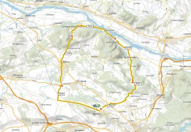
Randonnée Marche de 9,7 km à découvrir à Provence-Alpes-Côte d'Azur, Bouches-du-Rhône, Aix-en-Provence. Cette randonnée est proposée par counoise.
Localisation
Pays :
France
Région :
Provence-Alpes-Côte d'Azur
Département/Province :
Bouches-du-Rhône
Commune :
Aix-en-Provence
Localité :
Unknown
Départ:(Dec)
Départ:(UTM)
691535 ; 4830816 (31T) N.
Commentaires
Randonnées à proximité
eguilles les bories
Marche
Facile
Éguilles,
Provence-Alpes-Côte d'Azur,
Bouches-du-Rhône,
France
1h 17min
Oui
GB le grand st Jean
Marche
Moyen
Aix-en-Provence,
Provence-Alpes-Côte d'Azur,
Bouches-du-Rhône,
France
6,2 km | 6,9 km-effort
1h 56min
Oui
Camaïsse-Eguilles-Bories
Marche
Difficile
(1)
Éguilles,
Provence-Alpes-Côte d'Azur,
Bouches-du-Rhône,
France
11,6 km | 14,7 km-effort
3h 9min
Oui
l étape. cricri....
Marche
Très facile
Saint-Cannat,
Provence-Alpes-Côte d'Azur,
Bouches-du-Rhône,
France
8,6 km | 10,2 km-effort
2h 12min
Oui
Camaisse Nouveau
A pied
Facile
Éguilles,
Provence-Alpes-Côte d'Azur,
Bouches-du-Rhône,
France
11,6 km | 14,1 km-effort
3h 12min
Oui
de
Marche
Moyen
Le Puy-Sainte-Réparade,
Provence-Alpes-Côte d'Azur,
Bouches-du-Rhône,
France
4,9 km | 6,3 km-effort
2h 40min
Non
GB LA DOUDONNE NEW VERSION
Marche
Moyen
Saint-Cannat,
Provence-Alpes-Côte d'Azur,
Bouches-du-Rhône,
France
5,2 km | 6,6 km-effort
1h 43min
Oui
GB la plaine de Richard moins rapide
Marche
Moyen
Éguilles,
Provence-Alpes-Côte d'Azur,
Bouches-du-Rhône,
France
5,7 km | 7,3 km-effort
2h 14min
Oui
Eguilles La Roque D+840m
Vélo de route
Très difficile
Éguilles,
Provence-Alpes-Côte d'Azur,
Bouches-du-Rhône,
France
55 km | 66 km-effort
4h 0min
Oui