![](/images/other/stat-length.png)
![Randonnée Marche Commune de Zaros - Lac de Votomos à la chapelle d'Agios Loannis (rother n°44) - Photo](https://media.geolcdn.com/t/1900/400/2b9a2087-d635-47b7-bf21-ff3dc192c808.jpg&format=pjpeg&maxdim=2)
Lac de Votomos à la chapelle d'Agios Loannis (rother n°44)
Bart2015
Utilisateur
![Longueur](/images/other/stat-length.png)
![Altitude max](https://static1.geolcdn.com/siteimages/upload/files/1508320355ic_sort_altitude_max_24dp.png)
![Dénivelé positif](https://static1.geolcdn.com/siteimages/upload/files/1508320355ic_sort_den_pos_24dp.png)
![Km-Effort](/images/other/stat-length.png)
![Altitude min](https://static1.geolcdn.com/siteimages/upload/files/1508320355ic_sort_altitude_min_24dp.png)
![Dénivelé négatif](https://static1.geolcdn.com/siteimages/upload/files/1508320355ic_sort_den_neg_24dp.png)
![Boucle](https://static1.geolcdn.com/siteimages/upload/files/16400158638029165_repeat_loop_refresh_sync_direction_icon.png)
![Marche](https://static1.geolcdn.com/sitytour/trail-icons/101.png)
3h57
Difficulté : Difficile
![Scannez ce code QR pour ouvrir la randonnée dans l'application SityTrail](https://capi.geolives.com/qq0zvz2zws4bq2lad0pu/sitytour/trails/3638916/qr.png?size=200)
Application GPS de randonnée GRATUITE
À propos
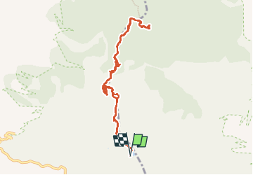
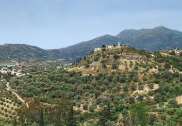
Randonnée Marche de 11,3 km à découvrir à Région Crète, Περιφερειακή Ενότητα Ηρακλείου, Commune de Zaros. Cette randonnée est proposée par Bart2015.
Description
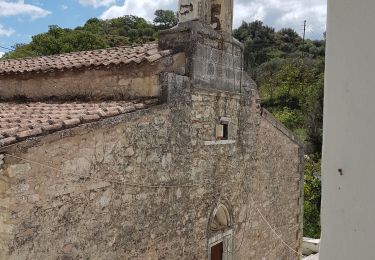
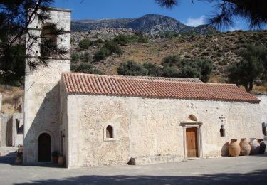
Au pied du Psiloritis, le lac de Votomos est gorgé de truites. La randonnée démarre à la taverne Limni qui le borde. Elle passe au travers des gorges de Rouwas où de nombreux aménagements en bois ont été nécessaires pour franchir certains passages. L'arrivée est dans une immense clairière idéale pour les pique-nique à proximité de la chapelle d'Agios Loannis.
Bonne rando ...
Localisation
Commentaires
Randonnées à proximité
![Randonnée Marche Commune de Moronion - Balade à Panagia (Rother n°45) - Photo](https://media.geolcdn.com/t/375/260/c636e735-bfd3-4b38-91f9-36fca775a293.jpg&format=jpg&maxdim=2)
![Marche Marche](https://static1.geolcdn.com/sitytour/trail-icons/101.png)
Marche
![](/images/other/stat-length.png)
![](https://static1.geolcdn.com/siteimages/upload/files/16400158638029165_repeat_loop_refresh_sync_direction_icon.png)
![Randonnée A pied Commune de Zaros - 1a Monasty Vrondisi - Photo](https://media.geolcdn.com/t/375/260/4ab48c6e-6ffc-4e24-aa44-12281c1de869.jpeg&format=jpg&maxdim=2)
![A pied A pied](https://static1.geolcdn.com/sitytour/trail-icons/100.png)
A pied
![](/images/other/stat-length.png)
![](https://static1.geolcdn.com/siteimages/upload/files/16400158638029165_repeat_loop_refresh_sync_direction_icon.png)
![Randonnée A pied Commune de Zaros - Agios Efthimios - Photo](https://media.geolcdn.com/t/375/260/342b1031-b9e4-469c-bb6f-23fff2e9965b.jpeg&format=jpg&maxdim=2)
![A pied A pied](https://static1.geolcdn.com/sitytour/trail-icons/100.png)
A pied
![](/images/other/stat-length.png)
![](https://static1.geolcdn.com/siteimages/upload/files/16400158638029165_repeat_loop_refresh_sync_direction_icon.png)
![Randonnée Marche Commune de Zaros - Crète-Gorge de Rouwas 09-04-2018 - Photo](https://media.geolcdn.com/t/375/260/ext.jpg?maxdim=2&url=https%3A%2F%2Fstatic1.geolcdn.com%2Fsiteimages%2Fupload%2Ffiles%2F1553511878bg_sport_marche.png)
![Marche Marche](https://static1.geolcdn.com/sitytour/trail-icons/101.png)
Marche
![](/images/other/stat-length.png)
![](https://static1.geolcdn.com/siteimages/upload/files/16400158638029165_repeat_loop_refresh_sync_direction_icon.png)