Randonnée  Reuilly - Reuilly 27/04/23 - Photo
 avit46
avit46

Utilisateur

© OpenStreetMap contributors
Longueur
Longueur
16,8 km
Altitude max
Altitude max
155 m
Dénivelé positif
Dénivelé positif
157 m
Km-Effort
Km-Effort  
18,9 km
Altitude min
Altitude min
104 m
Dénivelé négatif
Dénivelé négatif
157 m
Boucle
Boucle
Oui
Date de création :
2023-04-27 10:00:04.0
Dernière modification :
2023-04-27 10:00:05.167

(1 Avis)


Scannez ce code QR pour ouvrir la randonnée dans l'application SityTrail

Application GPS de randonnée GRATUITE

Logo SityTrail SityTrail

IGN / Instituts géographiques

Télécharger SityTrail sur l'App Store Télécharger SityTrail sur Google Play

Logo SityTrail SityTrail World

Le monde est à vous

Télécharger SityTrail sur l'App Store Télécharger SityTrail sur Google Play Télécharger SityTrail sur Huawei AppGallery

À propos

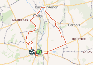
Randonnée de 16,8 km à découvrir à Centre-Val de Loire, Indre, Reuilly. Cette randonnée est proposée par avit46.

Description

Ça va être lourd

Profil altimétrique

Localisation

Pays :
France
Région :
Centre-Val de Loire
Département/Province :
Indre
Commune :
Reuilly
Localité :
Unknown
Départ:(Dec)
Départ:(UTM)
427471 ; 5214669 (31T) N.

Commentaires

Veuillez vous connecter pour laisser un commentaire ou une note


Randonnées à proximité

Randonnée sport Reuilly -  - Photo
sport
avit46

sport

Très facile
Reuilly, Centre-Val de Loire, Indre, France
16,2 km | 18,3 km-effort
Inconnu
Oui
Randonnée V.T.T. Reuilly - Reuilly20220501 - Photo
V.T.T.
didier20

V.T.T.

Moyen
Reuilly, Centre-Val de Loire, Indre, France
23 km | 26 km-effort
1h 31min
Oui
Randonnée Marche Reuilly - Reuilly - Photo
Marche
fouetillou

Marche

Moyen
Reuilly, Centre-Val de Loire, Indre, France
8,7 km | 10 km-effort
1h 33min
Oui


Fermer
Mes abonnements