![](/images/other/stat-length.png)
![Randonnée A pied Le Morne-Rouge - Le Morne-Rouge - Fonds-St-Denis - Photo](https://media.geolcdn.com/t/1900/400/ext.pjpeg?maxdim=2&url=https%3A%2F%2Fstatic1.geolcdn.com%2Fsiteimages%2Fupload%2Ffiles%2F1545311037marcheuse_200dpi.jpg)
Le Morne-Rouge - Fonds-St-Denis
Lamartiniere
Utilisateur GUIDE
![Longueur](/images/other/stat-length.png)
Longueur
8 km
![Altitude max](https://static1.geolcdn.com/siteimages/upload/files/1508320355ic_sort_altitude_max_24dp.png)
Altitude max
514 m
![Dénivelé positif](https://static1.geolcdn.com/siteimages/upload/files/1508320355ic_sort_den_pos_24dp.png)
Dénivelé positif
238 m
![Km-Effort](/images/other/stat-length.png)
Km-Effort
11,1 km
![Altitude min](https://static1.geolcdn.com/siteimages/upload/files/1508320355ic_sort_altitude_min_24dp.png)
Altitude min
346 m
![Dénivelé négatif](https://static1.geolcdn.com/siteimages/upload/files/1508320355ic_sort_den_neg_24dp.png)
Dénivelé négatif
224 m
![Boucle](https://static1.geolcdn.com/siteimages/upload/files/16400158638029165_repeat_loop_refresh_sync_direction_icon.png)
Boucle
Non
Date de création :
2023-04-26 22:30:52.932
Dernière modification :
2023-04-26 22:35:23.555
![A pied](https://static1.geolcdn.com/sitytour/trail-icons/100.png)
2h31
Difficulté : Facile
![Scannez ce code QR pour ouvrir la randonnée dans l'application SityTrail](https://capi.geolives.com/qq0zvz2zws4bq2lad0pu/sitytour/trails/3636830/qr.png?size=200)
Application GPS de randonnée GRATUITE
À propos
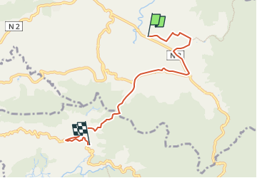
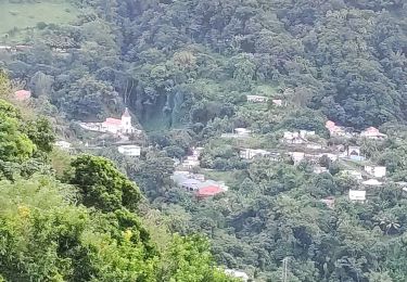
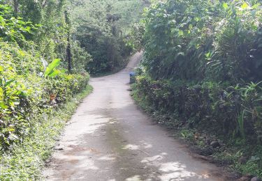
Randonnée A pied de 8 km à découvrir à Martinique, Inconnu, Le Morne-Rouge. Cette randonnée est proposée par Lamartiniere.
Description
Départ du Groupe Etoile prés de Socomor, direction Usine eau minérale Champflore, Etablissement Souds et Muets, direction Fonds-St Denis via le Col Yang jusqu'à La Tranchée puis direction l'Eglise pour une arrivée Place Jules Pain.
Localisation
Pays :
France
Région :
Martinique
Département/Province :
Inconnu
Commune :
Le Morne-Rouge
Localité :
Unknown
Départ:(Dec)
Départ:(UTM)
702620 ; 1632942 (20P) N.
Commentaires
Randonnées à proximité
![Randonnée Marche Le Morne-Rouge - Sainte Cécile/crête du Cournan/Beauvallon - Photo](https://media.geolcdn.com/t/375/260/0cdc997b-416c-4503-a132-9262284ca457.jpg&format=jpg&maxdim=2)
![Marche Marche](https://static1.geolcdn.com/sitytour/trail-icons/101.png)
Sainte Cécile/crête du Cournan/Beauvallon
Marche
Moyen
(1)
Le Morne-Rouge,
Martinique,
Inconnu,
France
![](/images/other/stat-length.png)
7,2 km | 11 km-effort
2h 29min
![](https://static1.geolcdn.com/siteimages/upload/files/16400158638029165_repeat_loop_refresh_sync_direction_icon.png)
Oui
![Randonnée Marche Le Morne-Rouge - Mac Intoch - Morne Capot - Photo](https://media.geolcdn.com/t/375/260/ext.jpg?maxdim=2&url=https%3A%2F%2Fstatic1.geolcdn.com%2Fsiteimages%2Fupload%2Ffiles%2F1553511878bg_sport_marche.png)
![Marche Marche](https://static1.geolcdn.com/sitytour/trail-icons/101.png)
Mac Intoch - Morne Capot
Marche
Moyen
(1)
Le Morne-Rouge,
Martinique,
Inconnu,
France
![](/images/other/stat-length.png)
9,4 km | 14,9 km-effort
4h 53min
![](https://static1.geolcdn.com/siteimages/upload/files/16400158638029165_repeat_loop_refresh_sync_direction_icon.png)
Non
![Randonnée Marche Fonds-Saint-Denis - Fonds saint Denis (Martinique) - Photo](https://media.geolcdn.com/t/375/260/ext.jpg?maxdim=2&url=https%3A%2F%2Fservices.sitytrail.com%2FGeolivesWS%2FDownloadMedia.ashx%3FTrailID%3D897741%26Media%3D20180130144253.jpg)
![Marche Marche](https://static1.geolcdn.com/sitytour/trail-icons/101.png)
Fonds saint Denis (Martinique)
Marche
Facile
(1)
Fonds-Saint-Denis,
Martinique,
Inconnu,
France
![](/images/other/stat-length.png)
8,2 km | 13,7 km-effort
3h 28min
![](https://static1.geolcdn.com/siteimages/upload/files/16400158638029165_repeat_loop_refresh_sync_direction_icon.png)
Oui
![Randonnée Marche Le Morne-Rouge - Morne la Caillerie, Trace des Jésuites - Photo](https://media.geolcdn.com/t/375/260/abb38c99-0268-4a50-8168-7a2f566fbedf.jpg&format=jpg&maxdim=2)
![Marche Marche](https://static1.geolcdn.com/sitytour/trail-icons/101.png)
Morne la Caillerie, Trace des Jésuites
Marche
Facile
Le Morne-Rouge,
Martinique,
Inconnu,
France
![](/images/other/stat-length.png)
11,2 km | 18,2 km-effort
3h 55min
![](https://static1.geolcdn.com/siteimages/upload/files/16400158638029165_repeat_loop_refresh_sync_direction_icon.png)
Oui
![Randonnée Marche Fonds-Saint-Denis - Fonds st Denis - Photo](https://media.geolcdn.com/t/375/260/36793758-779d-4b0a-9402-46d88c044d08.jpg&format=jpg&maxdim=2)
![Marche Marche](https://static1.geolcdn.com/sitytour/trail-icons/101.png)
Fonds st Denis
Marche
Difficile
Fonds-Saint-Denis,
Martinique,
Inconnu,
France
![](/images/other/stat-length.png)
10 km | 15,2 km-effort
3h 11min
![](https://static1.geolcdn.com/siteimages/upload/files/16400158638029165_repeat_loop_refresh_sync_direction_icon.png)
Oui
![Randonnée Marche L'Ajoupa-Bouillon - Montagne pelée - Photo](https://media.geolcdn.com/t/375/260/4661306f-959d-4727-8469-834deb4937e3.jpg&format=jpg&maxdim=2)
![Marche Marche](https://static1.geolcdn.com/sitytour/trail-icons/101.png)
Montagne pelée
Marche
Difficile
L'Ajoupa-Bouillon,
Martinique,
Inconnu,
France
![](/images/other/stat-length.png)
7,5 km | 16,5 km-effort
6h 2min
![](https://static1.geolcdn.com/siteimages/upload/files/16400158638029165_repeat_loop_refresh_sync_direction_icon.png)
Oui
![Randonnée Marche Le Morne-Rouge - Crête du Cournan boucle - Photo](https://media.geolcdn.com/t/375/260/0c296f5b-819e-48af-b83c-d8f8f993e809.jpg&format=jpg&maxdim=2)
![Marche Marche](https://static1.geolcdn.com/sitytour/trail-icons/101.png)
Crête du Cournan boucle
Marche
Moyen
Le Morne-Rouge,
Martinique,
Inconnu,
France
![](/images/other/stat-length.png)
4,2 km | 8,2 km-effort
2h 15min
![](https://static1.geolcdn.com/siteimages/upload/files/16400158638029165_repeat_loop_refresh_sync_direction_icon.png)
Oui
![Randonnée Marche Le Morne-Rouge - Trace des Jésuites - Photo](https://media.geolcdn.com/t/375/260/20a7cdb5-63b7-4fc2-90a5-e7ffe952a822.jpg&format=jpg&maxdim=2)
![Marche Marche](https://static1.geolcdn.com/sitytour/trail-icons/101.png)
Trace des Jésuites
Marche
Moyen
Le Morne-Rouge,
Martinique,
Inconnu,
France
![](/images/other/stat-length.png)
5,2 km | 8,8 km-effort
2h 5min
![](https://static1.geolcdn.com/siteimages/upload/files/16400158638029165_repeat_loop_refresh_sync_direction_icon.png)
Oui
![Randonnée Marche Le Lorrain - Fonds Labour - Fonds Duclos 2 - Photo](https://media.geolcdn.com/t/375/260/2299e64d-0012-4ef4-aee6-9138e1061912.jpg&format=jpg&maxdim=2)
![Marche Marche](https://static1.geolcdn.com/sitytour/trail-icons/101.png)
Fonds Labour - Fonds Duclos 2
Marche
Très facile
Le Lorrain,
Martinique,
Inconnu,
France
![](/images/other/stat-length.png)
7,7 km | 10,9 km-effort
2h 20min
![](https://static1.geolcdn.com/siteimages/upload/files/16400158638029165_repeat_loop_refresh_sync_direction_icon.png)
Oui