![](/images/other/stat-length.png)
![Randonnée Marche Sainte-Colombe - 100423 Plan de Cuques - Photo](https://media.geolcdn.com/t/1900/400/81f5bad3-8982-4a8b-b73b-e72d77fc0e67.jpg&format=pjpeg&maxdim=2)
100423 Plan de Cuques
mzonzon05
Utilisateur
![Longueur](/images/other/stat-length.png)
Longueur
11,7 km
![Altitude max](https://static1.geolcdn.com/siteimages/upload/files/1508320355ic_sort_altitude_max_24dp.png)
Altitude max
1141 m
![Dénivelé positif](https://static1.geolcdn.com/siteimages/upload/files/1508320355ic_sort_den_pos_24dp.png)
Dénivelé positif
412 m
![Km-Effort](/images/other/stat-length.png)
Km-Effort
17,4 km
![Altitude min](https://static1.geolcdn.com/siteimages/upload/files/1508320355ic_sort_altitude_min_24dp.png)
Altitude min
700 m
![Dénivelé négatif](https://static1.geolcdn.com/siteimages/upload/files/1508320355ic_sort_den_neg_24dp.png)
Dénivelé négatif
476 m
![Boucle](https://static1.geolcdn.com/siteimages/upload/files/16400158638029165_repeat_loop_refresh_sync_direction_icon.png)
Boucle
Non
Date de création :
2023-04-10 14:26:43.575
Dernière modification :
2023-04-19 09:46:02.375
![Marche](https://static1.geolcdn.com/sitytour/trail-icons/101.png)
3h12
Difficulté : Difficile
![Scannez ce code QR pour ouvrir la randonnée dans l'application SityTrail](https://capi.geolives.com/qq0zvz2zws4bq2lad0pu/sitytour/trails/3627201/qr.png?size=200)
Application GPS de randonnée GRATUITE
À propos
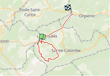
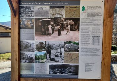
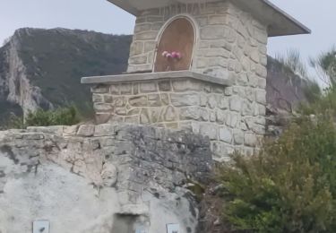
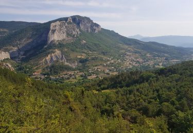
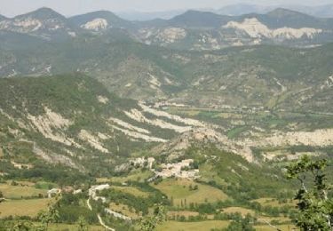
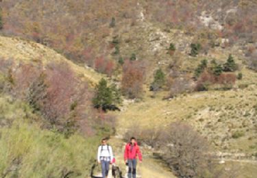
Randonnée Marche de 11,7 km à découvrir à Provence-Alpes-Côte d'Azur, Hautes-Alpes, Sainte-Colombe. Cette randonnée est proposée par mzonzon05.
Description
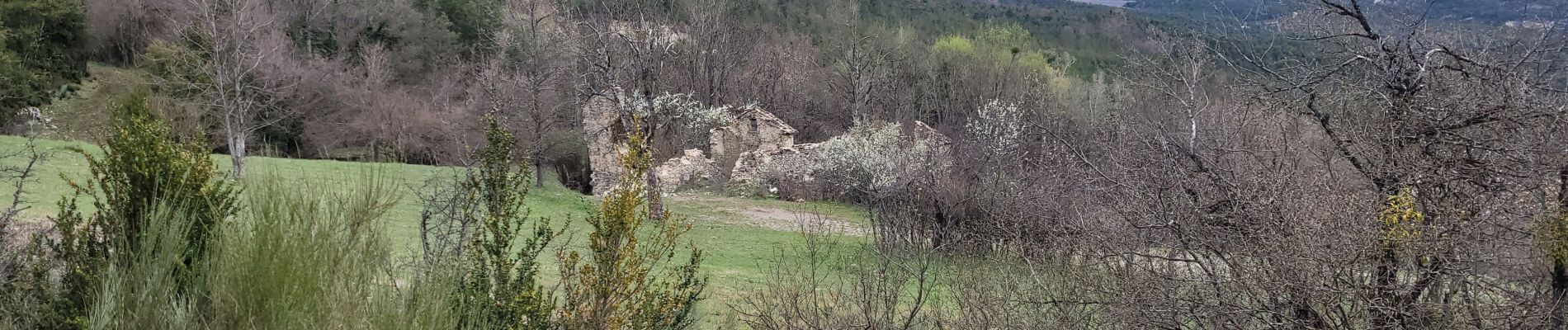
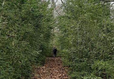
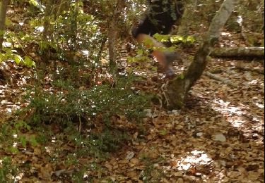
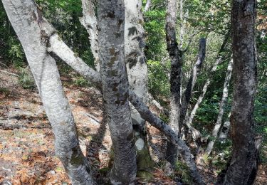
Très jolie balade variée au dessus de Ste Colombe et Plan de Cuques. Sentiers muletiers routes forestières et routes abandonnées alternent.
A faire en toute saison.
Localisation
Pays :
France
Région :
Provence-Alpes-Côte d'Azur
Département/Province :
Hautes-Alpes
Commune :
Sainte-Colombe
Localité :
Unknown
Départ:(Dec)
Départ:(UTM)
710420 ; 4907542 (31T) N.
Commentaires
Randonnées à proximité
![Randonnée Marche Sainte-Colombe - SAINTE COLOMBE , les Bègues, autour des versants du Céans o l - Photo](https://media.geolcdn.com/t/375/260/32ebd511-d9af-4e86-9fe3-3ac4fc66c4b2.jpg&format=jpg&maxdim=2)
![Marche Marche](https://static1.geolcdn.com/sitytour/trail-icons/101.png)
SAINTE COLOMBE , les Bègues, autour des versants du Céans o l
Marche
Moyen
Sainte-Colombe,
Provence-Alpes-Côte d'Azur,
Hautes-Alpes,
France
![](/images/other/stat-length.png)
11,3 km | 17,3 km-effort
3h 9min
![](https://static1.geolcdn.com/siteimages/upload/files/16400158638029165_repeat_loop_refresh_sync_direction_icon.png)
Oui
![Randonnée Marche Sainte-Colombe - SAINTE COLOMBE . 05 . Pas de Sainte Colombe o m s - Photo](https://media.geolcdn.com/t/375/260/81962515-6c25-41a2-9c57-59c34af424da.jpg&format=jpg&maxdim=2)
![Marche Marche](https://static1.geolcdn.com/sitytour/trail-icons/101.png)
SAINTE COLOMBE . 05 . Pas de Sainte Colombe o m s
Marche
Moyen
Sainte-Colombe,
Provence-Alpes-Côte d'Azur,
Hautes-Alpes,
France
![](/images/other/stat-length.png)
8 km | 13,3 km-effort
2h 56min
![](https://static1.geolcdn.com/siteimages/upload/files/16400158638029165_repeat_loop_refresh_sync_direction_icon.png)
Oui
![Randonnée Marche Sainte-Colombe - st colombe la](https://media.geolcdn.com/t/375/260/ext.jpg?maxdim=2&url=https%3A%2F%2Fservices.sitytrail.com%2FGeolivesWS%2FDownloadMedia.ashx%3FTrailID%3D791502%26Media%3Dfix__20160430095733.jpg)
![Marche Marche](https://static1.geolcdn.com/sitytour/trail-icons/101.png)
st colombe la "magnifique"
Marche
Moyen
Sainte-Colombe,
Provence-Alpes-Côte d'Azur,
Hautes-Alpes,
France
![](/images/other/stat-length.png)
11,6 km | 17,9 km-effort
3h 4min
![](https://static1.geolcdn.com/siteimages/upload/files/16400158638029165_repeat_loop_refresh_sync_direction_icon.png)
Oui
![Randonnée Marche Orpierre - rocher st Michel - Photo](https://media.geolcdn.com/t/375/260/ext.jpg?maxdim=2&url=https%3A%2F%2Fservices.sitytrail.com%2FGeolivesWS%2FDownloadMedia.ashx%3FTrailID%3D569402%26Media%3Dfix__20160425114304.jpg)
![Marche Marche](https://static1.geolcdn.com/sitytour/trail-icons/101.png)
rocher st Michel
Marche
Moyen
Orpierre,
Provence-Alpes-Côte d'Azur,
Hautes-Alpes,
France
![](/images/other/stat-length.png)
9 km | 16 km-effort
3h 41min
![](https://static1.geolcdn.com/siteimages/upload/files/16400158638029165_repeat_loop_refresh_sync_direction_icon.png)
Oui
![Randonnée Marche Sainte-Colombe - catoyes - Photo](https://media.geolcdn.com/t/375/260/ac87557a-0021-44d7-a91c-c330dd7837f6.jpg&format=jpg&maxdim=2)
![Marche Marche](https://static1.geolcdn.com/sitytour/trail-icons/101.png)
catoyes
Marche
Très difficile
Sainte-Colombe,
Provence-Alpes-Côte d'Azur,
Hautes-Alpes,
France
![](/images/other/stat-length.png)
17 km | 27 km-effort
6h 26min
![](https://static1.geolcdn.com/siteimages/upload/files/16400158638029165_repeat_loop_refresh_sync_direction_icon.png)
Oui
![Randonnée Marche Orpierre - 220822 La Louze - Photo](https://media.geolcdn.com/t/375/260/43335d2e-db02-450a-80e5-5e97f05e36ca.jpg&format=jpg&maxdim=2)
![Marche Marche](https://static1.geolcdn.com/sitytour/trail-icons/101.png)
220822 La Louze
Marche
Très difficile
Orpierre,
Provence-Alpes-Côte d'Azur,
Hautes-Alpes,
France
![](/images/other/stat-length.png)
12,5 km | 19,4 km-effort
2h 42min
![](https://static1.geolcdn.com/siteimages/upload/files/16400158638029165_repeat_loop_refresh_sync_direction_icon.png)
Oui
![Randonnée Marche Orpierre - st Michel - Photo](https://media.geolcdn.com/t/375/260/0978b7aa-47a5-4f12-859e-5d5d8fde4b1b.jpg&format=jpg&maxdim=2)
![Marche Marche](https://static1.geolcdn.com/sitytour/trail-icons/101.png)
st Michel
Marche
Difficile
Orpierre,
Provence-Alpes-Côte d'Azur,
Hautes-Alpes,
France
![](/images/other/stat-length.png)
8,4 km | 15,1 km-effort
3h 2min
![](https://static1.geolcdn.com/siteimages/upload/files/16400158638029165_repeat_loop_refresh_sync_direction_icon.png)
Oui
![Randonnée Marche Sainte-Colombe - La crête de la Montagne de Chabre - Ste Colombe - Photo](https://media.geolcdn.com/t/375/260/ext.jpg?maxdim=2&url=https%3A%2F%2Fservices.sitytrail.com%2FGeolivesWS%2FDownloadMedia.ashx%3FTrailID%3D173181%26Media%3D14763_2.jpg)
![Marche Marche](https://static1.geolcdn.com/sitytour/trail-icons/101.png)
La crête de la Montagne de Chabre - Ste Colombe
Marche
Très difficile
Sainte-Colombe,
Provence-Alpes-Côte d'Azur,
Hautes-Alpes,
France
![](/images/other/stat-length.png)
23 km | 37 km-effort
7h 0min
![](https://static1.geolcdn.com/siteimages/upload/files/16400158638029165_repeat_loop_refresh_sync_direction_icon.png)
Oui
![Randonnée Marche Orpierre - Tour des Baronnies du Buëch - Orpierre - Trescléoux - Photo](https://media.geolcdn.com/t/375/260/ext.jpg?maxdim=2&url=https%3A%2F%2Fservices.sitytrail.com%2FGeolivesWS%2FDownloadMedia.ashx%3FTrailID%3D108461%26Media%3D1173_1.jpg)
![Marche Marche](https://static1.geolcdn.com/sitytour/trail-icons/101.png)
Tour des Baronnies du Buëch - Orpierre - Trescléoux
Marche
Difficile
Orpierre,
Provence-Alpes-Côte d'Azur,
Hautes-Alpes,
France
![](/images/other/stat-length.png)
11,9 km | 21 km-effort
4h 30min
![](https://static1.geolcdn.com/siteimages/upload/files/16400158638029165_repeat_loop_refresh_sync_direction_icon.png)
Non