Randonnée Marche Peyre en Aubrac - Fau de Peyre- les moulins (long)Bis  - mardi - Photo

Fau de Peyre- les moulins (long)Bis - mardi

 ganinette
ganinette

Utilisateur

© OpenStreetMap contributors
Longueur
Longueur
14,8 km
Altitude max
Altitude max
1158 m
Dénivelé positif
Dénivelé positif
357 m
Km-Effort
Km-Effort  
19,5 km
Altitude min
Altitude min
1007 m
Dénivelé négatif
Dénivelé négatif
356 m
Boucle
Boucle
Oui
Date de création :
2023-04-13 05:17:19.033
Dernière modification :
2023-05-25 06:56:21.281

(0 Avis)

Marche
Marche
4h26
Difficulté : Très difficile

Scannez ce code QR pour ouvrir la randonnée dans l'application SityTrail

Application GPS de randonnée GRATUITE

Logo SityTrail SityTrail

IGN / Instituts géographiques

Télécharger SityTrail sur l'App Store Télécharger SityTrail sur Google Play

Logo SityTrail SityTrail World

Le monde est à vous

Télécharger SityTrail sur l'App Store Télécharger SityTrail sur Google Play Télécharger SityTrail sur Huawei AppGallery

À propos

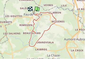
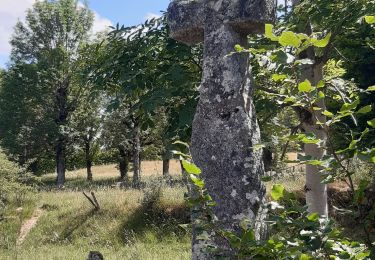
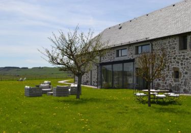
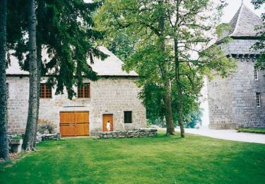
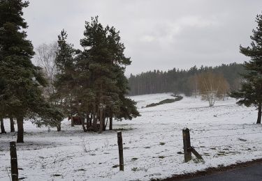
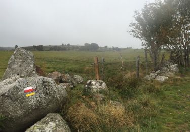
Randonnée Marche de 14,8 km à découvrir à Occitanie, Lozère, Peyre en Aubrac. Cette randonnée est proposée par ganinette.

Description

grp_trc:

Profil altimétrique

Points d'intérêt

Point d'intérêt Peyre en Aubrac - hotel restaurant Del FAU de Peyre - Photo
ganinette

Localisation

Pays :
France
Région :
Occitanie
Département/Province :
Lozère
Commune :
Peyre en Aubrac
Localité :
Unknown
Départ:(Dec)
Départ:(UTM)
517731 ; 4955027 (31T) N.

Randonnées à proximité

Randonnée Marche Peyre en Aubrac - Étape 1 Saint Gilhem - Photo
Marche
GUIDE
Roger Philippe Wallez

Marche

Très difficile
Peyre en Aubrac, Occitanie, Lozère, France
17,1 km | 21 km-effort
4h 48min
Non
Randonnée Marche Peyre en Aubrac - Mon chemin de St Guilhem étape 1 - Photo
Marche
GUIDE
nadinebondoux

Marche

Moyen
Peyre en Aubrac, Occitanie, Lozère, France
17,2 km | 21 km-effort
4h 12min
Non
Randonnée Marche Peyre en Aubrac - les moulins? - Photo
Marche
GILOU440

Marche

Difficile
Peyre en Aubrac, Occitanie, Lozère, France
12,4 km | 16,3 km-effort
3h 30min
Oui
Randonnée A pied Peyre en Aubrac - Etape05_1 - Aumont - Lasbros  par le chemin - Photo
A pied
ghislainem

A pied

Très facile
(1)
Peyre en Aubrac, Occitanie, Lozère, France
6,8 km | 8,2 km-effort
Inconnu
Non
Randonnée Randonnée équestre Peyre en Aubrac - grandtourAubrac sans waypoints - Photo
Randonnée équestre
Lozère Cheval

Randonnée équestre

Très difficile
Peyre en Aubrac, Occitanie, Lozère, France
138 km | 179 km-effort
22h 12min
Oui
Randonnée Randonnée équestre Peyre en Aubrac - GrandTourDaubrac - Photo
Randonnée équestre
Lozère Cheval

Randonnée équestre

Très facile
Peyre en Aubrac, Occitanie, Lozère, France
139 km | 180 km-effort
Inconnu
Oui
Randonnée Marche Peyre en Aubrac - Aumont Aubrac / Le Py auberge les gentianes  - Photo
Marche
guariso

Marche

Facile
Peyre en Aubrac, Occitanie, Lozère, France
15,6 km | 19,3 km-effort
4h 9min
Non
Randonnée Marche Peyre en Aubrac - Aumont Aubrac - Nasbinal - Photo
Marche
jib971

Marche

Facile
Peyre en Aubrac, Occitanie, Lozère, France
29 km | 35 km-effort
7h 17min
Non
Randonnée Marche Peyre en Aubrac - aumont aubrac - gilbertes - Photo
Marche
prv

Marche

Très facile
Peyre en Aubrac, Occitanie, Lozère, France
25 km | 32 km-effort
6h 14min
Non


Fermer
Mes abonnements